Sheridan Canyon Topo Map New Mexico
To zoom in, hover over the map of Sheridan Canyon
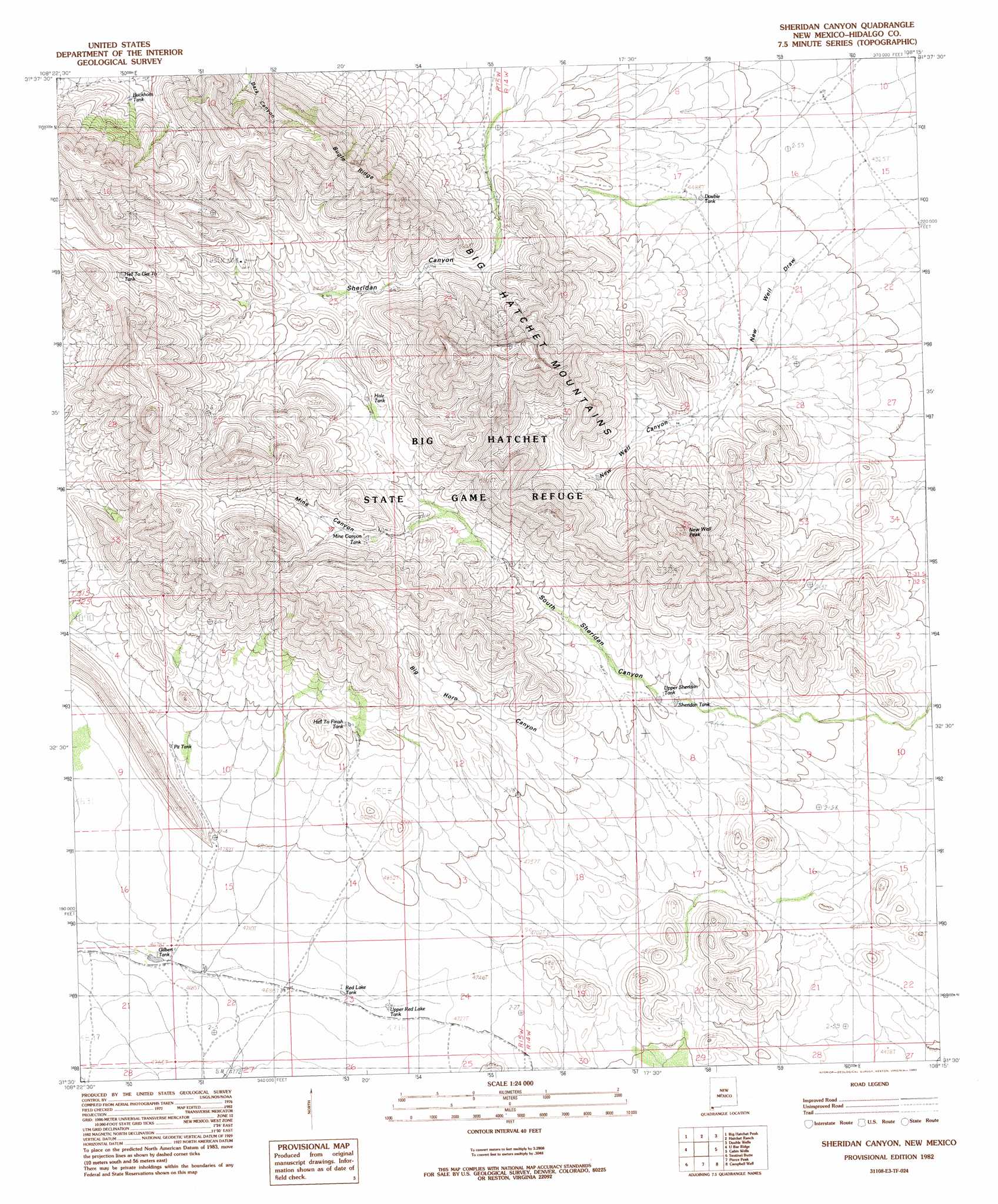
USGS Topo Quad 31108e3 - 1:24,000 scale
| Topo Map Name: | Sheridan Canyon |
| USGS Topo Quad ID: | 31108e3 |
| Print Size: | ca. 21 1/4" wide x 27" high |
| Southeast Coordinates: | 31.5° N latitude / 108.25° W longitude |
| Map Center Coordinates: | 31.5625° N latitude / 108.3125° W longitude |
| U.S. State: | NM |
| Filename: | o31108e3.jpg |
| Download Map JPG Image: | Sheridan Canyon topo map 1:24,000 scale |
| Map Type: | Topographic |
| Topo Series: | 7.5´ |
| Map Scale: | 1:24,000 |
| Source of Map Images: | United States Geological Survey (USGS) |
| Alternate Map Versions: |
Sheridan Canyon NM 1982, updated 1982 Download PDF Buy paper map Sheridan Canyon NM 2010 Download PDF Buy paper map Sheridan Canyon NM 2013 Download PDF Buy paper map Sheridan Canyon NM 2017 Download PDF Buy paper map |
1:24,000 Topo Quads surrounding Sheridan Canyon
Playas Lake South |
Hachita Peak |
Doyle Peak |
Victorio Ranch |
Victorio Ranch Se |
Walnut Wells Ne |
Big Hatchet Peak |
Hatchet Ranch |
Double Wells |
|
Horse Mountain |
U Bar Ridge |
Sheridan Canyon |
Cabin Wells |
|
Hilo Peak |
Sentinel Butte |
Pierce Peak |
Campbells Well |
|
Whitewater Mountains |
Eagle Mountain |
Dog Mountains |
Corner Well |
> Back to 31108e1 at 1:100,000 scale
> Back to 31108a1 at 1:250,000 scale
> Back to U.S. Topo Maps home
Sheridan Canyon topo map: Gazetteer
Sheridan Canyon: Arroyos
New Well Draw elevation 1339m 4393′Sheridan Canyon: Mines
Carbonate Group elevation 1538m 5045′Lead Queen elevation 1587m 5206′
Sheridan Canyon: Ranges
Big Hatchet Mountains elevation 1856m 6089′Sheridan Canyon: Reservoirs
Buckhorn Tank elevation 1668m 5472′Double Tank elevation 1362m 4468′
Gilbert Tank elevation 1417m 4648′
Hale Tank elevation 1580m 5183′
Hell to Finish Tank elevation 1529m 5016′
Hell to Get to Tank elevation 1701m 5580′
Mine Canyon Tank elevation 1598m 5242′
Pit Tank elevation 1493m 4898′
Red Lake Tank elevation 1442m 4730′
Sheridan Tank elevation 1445m 4740′
Upper Red Lake Tank elevation 1439m 4721′
Upper Sheridan Tank elevation 1459m 4786′
Sheridan Canyon: Ridges
Bugle Ridge elevation 1917m 6289′Sheridan Canyon: Summits
New Well Peak elevation 1910m 6266′Sheridan Canyon: Valleys
Big Horn Canyon elevation 1475m 4839′Mine Canyon elevation 1553m 5095′
New Well Canyon elevation 1405m 4609′
Sheridan Canyon digital topo map on disk
Buy this Sheridan Canyon topo map showing relief, roads, GPS coordinates and other geographical features, as a high-resolution digital map file on DVD: