Walnut Wells Ne Topo Map New Mexico
To zoom in, hover over the map of Walnut Wells Ne
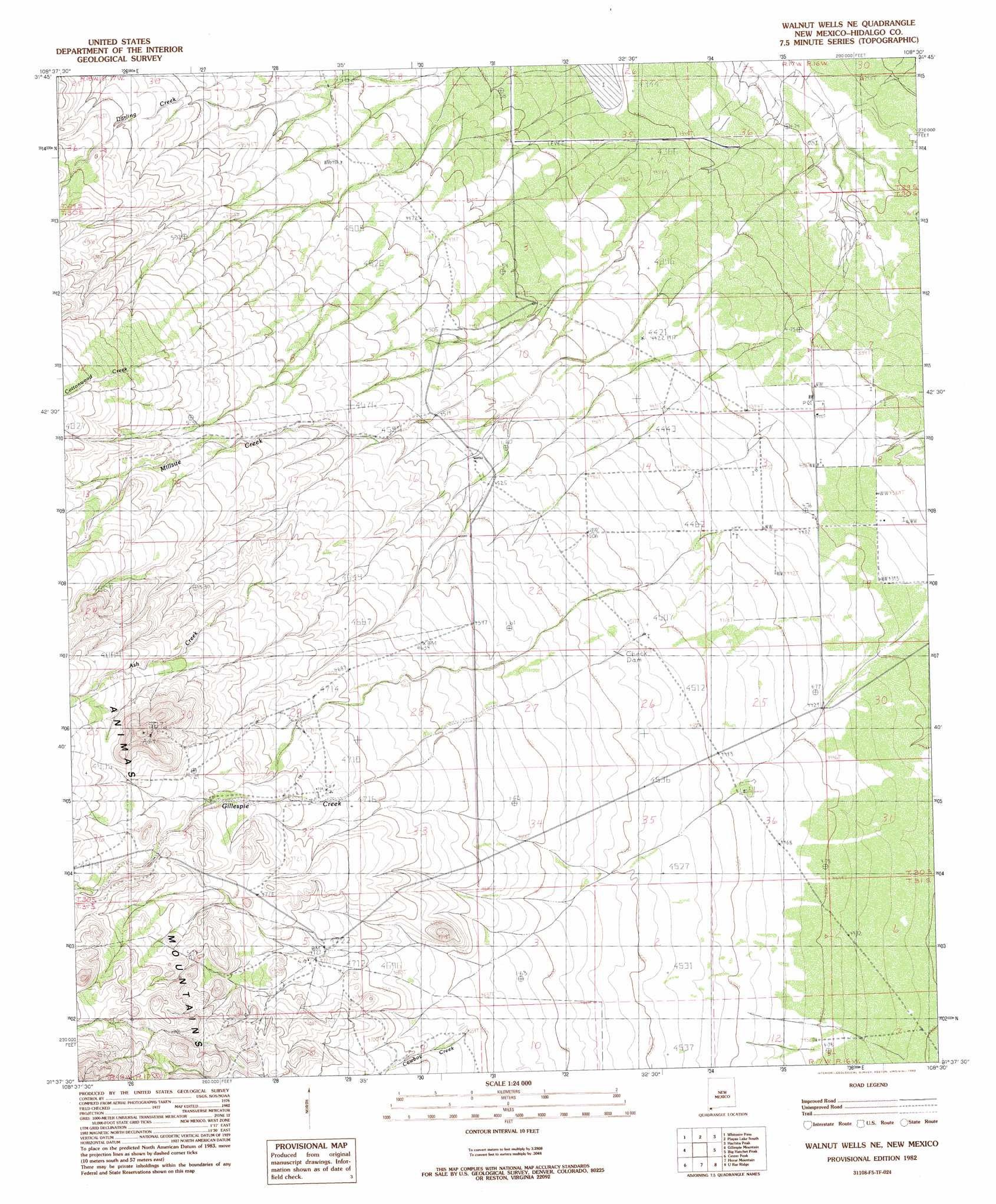
USGS Topo Quad 31108f5 - 1:24,000 scale
| Topo Map Name: | Walnut Wells Ne |
| USGS Topo Quad ID: | 31108f5 |
| Print Size: | ca. 21 1/4" wide x 27" high |
| Southeast Coordinates: | 31.625° N latitude / 108.5° W longitude |
| Map Center Coordinates: | 31.6875° N latitude / 108.5625° W longitude |
| U.S. State: | NM |
| Filename: | o31108f5.jpg |
| Download Map JPG Image: | Walnut Wells Ne topo map 1:24,000 scale |
| Map Type: | Topographic |
| Topo Series: | 7.5´ |
| Map Scale: | 1:24,000 |
| Source of Map Images: | United States Geological Survey (USGS) |
| Alternate Map Versions: |
Walnut Wells NE NM 1982, updated 1982 Download PDF Buy paper map Walnut Wells NE NM 2010 Download PDF Buy paper map Walnut Wells NE NM 2013 Download PDF Buy paper map Walnut Wells NE NM 2017 Download PDF Buy paper map |
1:24,000 Topo Quads surrounding Walnut Wells Ne
Animas |
Beacon Hill |
Playas Lake North |
Playas Peak |
Hachita |
Tank Mountain |
Whitmire Pass |
Playas Lake South |
Hachita Peak |
Doyle Peak |
Animas Peak Ne |
Gillespie Mountain |
Walnut Wells Ne |
Big Hatchet Peak |
Hatchet Ranch |
Animas Peak |
Center Peak |
Horse Mountain |
U Bar Ridge |
Sheridan Canyon |
Fitzpatricks |
San Luis Pass |
Hilo Peak |
Sentinel Butte |
Pierce Peak |
> Back to 31108e1 at 1:100,000 scale
> Back to 31108a1 at 1:250,000 scale
> Back to U.S. Topo Maps home
Walnut Wells Ne topo map: Gazetteer
Walnut Wells Ne: Mines
Red Hill Mine elevation 1545m 5068′Walnut Wells Ne: Streams
Ash Creek elevation 1374m 4507′Bennett Creek elevation 1494m 4901′
Cottonwood Creek elevation 1404m 4606′
Cowboy Creek elevation 1418m 4652′
Darling Creek elevation 1390m 4560′
Gillespie Creek elevation 1398m 4586′
Millsite Creek elevation 1344m 4409′
Walnut Wells Ne: Wells
10350 Water Well elevation 1310m 4297′Walnut Wells Ne digital topo map on disk
Buy this Walnut Wells Ne topo map showing relief, roads, GPS coordinates and other geographical features, as a high-resolution digital map file on DVD: