Mount Fagan Topo Map Arizona
To zoom in, hover over the map of Mount Fagan
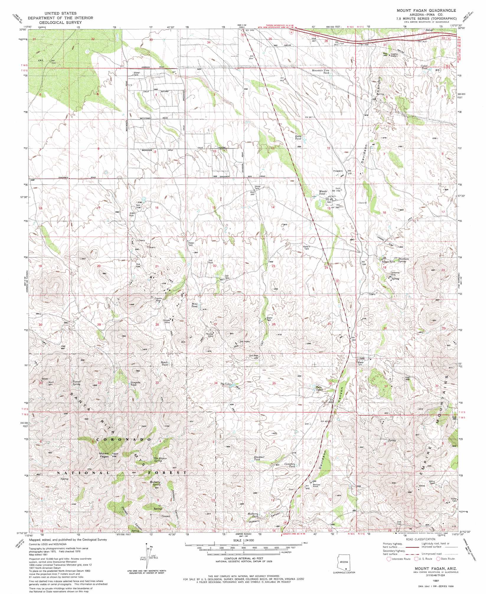
USGS Topo Quad 31110h6 - 1:24,000 scale
| Topo Map Name: | Mount Fagan |
| USGS Topo Quad ID: | 31110h6 |
| Print Size: | ca. 21 1/4" wide x 27" high |
| Southeast Coordinates: | 31.875° N latitude / 110.625° W longitude |
| Map Center Coordinates: | 31.9375° N latitude / 110.6875° W longitude |
| U.S. State: | AZ |
| Filename: | o31110h6.jpg |
| Download Map JPG Image: | Mount Fagan topo map 1:24,000 scale |
| Map Type: | Topographic |
| Topo Series: | 7.5´ |
| Map Scale: | 1:24,000 |
| Source of Map Images: | United States Geological Survey (USGS) |
| Alternate Map Versions: |
Mount Fagan AZ 1981, updated 1981 Download PDF Buy paper map Mount Fagan AZ 1981, updated 1988 Download PDF Buy paper map Mount Fagan AZ 1981, updated 1988 Download PDF Buy paper map Mount Fagan AZ 1996, updated 2002 Download PDF Buy paper map Mount Fagan AZ 2012 Download PDF Buy paper map Mount Fagan AZ 2014 Download PDF Buy paper map |
| FStopo: | US Forest Service topo Mount Fagan is available: Download FStopo PDF Download FStopo TIF |
1:24,000 Topo Quads surrounding Mount Fagan
Tucson |
Tucson East |
Tanque Verde Peak |
Mica Mountain |
Happy Valley |
Tucson Sw |
Tucson Se |
Vail |
Rincon Peak |
Galleta Flat West |
Sahuarita |
Corona De Tucson |
Mount Fagan |
The Narrows |
Mescal |
Green Valley |
Helvetia |
Empire Ranch |
Spring Water Canyon |
Apache Peak |
Mount Hopkins |
Mount Wrightson |
Sonoita |
Elgin |
Mustang Mountains |
> Back to 31110e1 at 1:100,000 scale
> Back to 31110a1 at 1:250,000 scale
> Back to U.S. Topo Maps home
Mount Fagan topo map: Gazetteer
Mount Fagan: Mines
California Mine elevation 1155m 3789′Cuprite Mine elevation 1251m 4104′
Dimple Mine elevation 1269m 4163′
Pauline Mine elevation 1280m 4199′
Mount Fagan: Populated Places
New Tucson elevation 1077m 3533′Mount Fagan: Reservoirs
Beach Tank elevation 1292m 4238′Blacktail Tank elevation 1301m 4268′
Cedar Tank elevation 1076m 3530′
Cemetery Tank elevation 1262m 4140′
Duck Tank elevation 1100m 3608′
Mine Tank elevation 1232m 4041′
Missile Tank elevation 1123m 3684′
Mountain View Tank elevation 1084m 3556′
Mulberry Tank elevation 1285m 4215′
Simpson Tank elevation 1376m 4514′
The Lake elevation 1279m 4196′
Twin Tanks elevation 1227m 4025′
Mount Fagan: Springs
Davidson Spring elevation 1182m 3877′Mulberry Spring elevation 1483m 4865′
Ojo Blanco Spring elevation 1531m 5022′
Ojo Blanco Spring elevation 1450m 4757′
Tunnel Spring elevation 1357m 4452′
Mount Fagan: Summits
Empire Mountains elevation 1525m 5003′Mount Fagan elevation 1882m 6174′
Mount Fagan: Valleys
Mulberry Canyon elevation 1266m 4153′Mount Fagan digital topo map on disk
Buy this Mount Fagan topo map showing relief, roads, GPS coordinates and other geographical features, as a high-resolution digital map file on DVD: