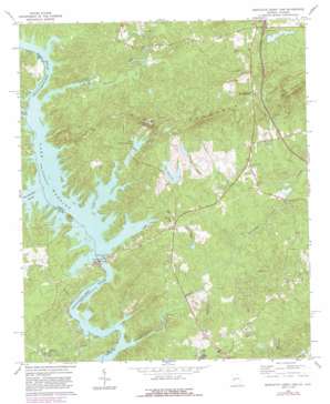
Bartletts Ferry Dam Topo Map Georgia
To zoom in, hover over the map of Bartletts Ferry Dam
USGS Topo Quad 32085f1 - 1:24,000 scale
| Topo Map Name: | Bartletts Ferry Dam |
| USGS Topo Quad ID: | 32085f1 |
| Print Size: | ca. 21 1/4" wide x 27" high |
| Southeast Coordinates: | 32.625° N latitude / 85° W longitude |
| Map Center Coordinates: | 32.6875° N latitude / 85.0625° W longitude |
| U.S. States: | GA, AL |
| Filename: | o32085f1.jpg |
| Download Map JPG Image: | Bartletts Ferry Dam topo map 1:24,000 scale |
| Map Type: | Topographic |
| Topo Series: | 7.5´ |
| Map Scale: | 1:24,000 |
| Source of Map Images: | United States Geological Survey (USGS) |
| Alternate Map Versions: |
Bartletts Ferry Dam GA 1965, updated 1966 Download PDF Buy paper map Bartletts Ferry Dam GA 1965, updated 1984 Download PDF Buy paper map Bartletts Ferry Dam GA 2011 Download PDF Buy paper map Bartletts Ferry Dam GA 2014 Download PDF Buy paper map |
1:24,000 Topo Quads surrounding Bartletts Ferry Dam
> Back to 32085e1 at 1:100,000 scale
> Back to 32084a1 at 1:250,000 scale
> Back to U.S. Topo Maps home
Bartletts Ferry Dam topo map: Gazetteer
Bartletts Ferry Dam: Bridges
Jacksons Mill Covered Bridge (historical) elevation 146m 479′Mitchell Bridge elevation 151m 495′
Bartletts Ferry Dam: Crossings
Bartletts Ferry (historical) elevation 159m 521′Blanton Ferry (historical) elevation 159m 521′
Brawner Ferry (historical) elevation 159m 521′
Dixon Ferry (historical) elevation 159m 521′
Interchange 11 elevation 218m 715′
Bartletts Ferry Dam: Dams
Barletts Ferry Dam elevation 122m 400′Bartletts Ferry Dam elevation 122m 400′
Bishop Lake Dam elevation 156m 511′
Davis Pond Dam elevation 188m 616′
Day Lake Dam elevation 160m 524′
Lake Walter Richards Dam elevation 191m 626′
Lake Williams Dam elevation 186m 610′
Middle Huston Lake Dam elevation 175m 574′
Peterson Lake Dam elevation 212m 695′
Riley Lake Dam elevation 201m 659′
South Huston Lake Dam elevation 168m 551′
Bartletts Ferry Dam: Islands
Cooks Island elevation 159m 521′Hargett Island (historical) elevation 159m 521′
Herrington Island elevation 169m 554′
Phipps Island (historical) elevation 159m 521′
Bartletts Ferry Dam: Lakes
Lake Rebel elevation 162m 531′Bartletts Ferry Dam: Populated Places
Acton (historical) elevation 193m 633′Antioch elevation 179m 587′
Clines Crossroads elevation 202m 662′
Mountain Hill elevation 219m 718′
Piney Grove elevation 181m 593′
Bartletts Ferry Dam: Reservoirs
Bartletts Ferry Lake elevation 122m 400′Bishop Lake elevation 156m 511′
Davis Pond elevation 188m 616′
Day Lake elevation 160m 524′
Lake Walter Richards elevation 191m 626′
Lake Williams elevation 186m 610′
Middle Huston Lake elevation 175m 574′
Peterson Lake elevation 212m 695′
Riley Lake elevation 201m 659′
South Huston Lake elevation 168m 551′
Bartletts Ferry Dam: Streams
Halawakee Creek elevation 159m 521′Mill Creek elevation 123m 403′
Mountain Oak Creek elevation 159m 521′
Mulberry Creek elevation 122m 400′
Osanippa Creek elevation 159m 521′
Wacoochee Creek elevation 124m 406′
Bartletts Ferry Dam: Summits
German Mountain elevation 297m 974′Williams Mountain elevation 284m 931′
Bartletts Ferry Dam digital topo map on disk
Buy this Bartletts Ferry Dam topo map showing relief, roads, GPS coordinates and other geographical features, as a high-resolution digital map file on DVD:
Gulf Coast (LA, MS, AL, FL) & Southwestern Georgia
Buy digital topo maps: Gulf Coast (LA, MS, AL, FL) & Southwestern Georgia


