Holly Bluff Topo Map Mississippi
To zoom in, hover over the map of Holly Bluff
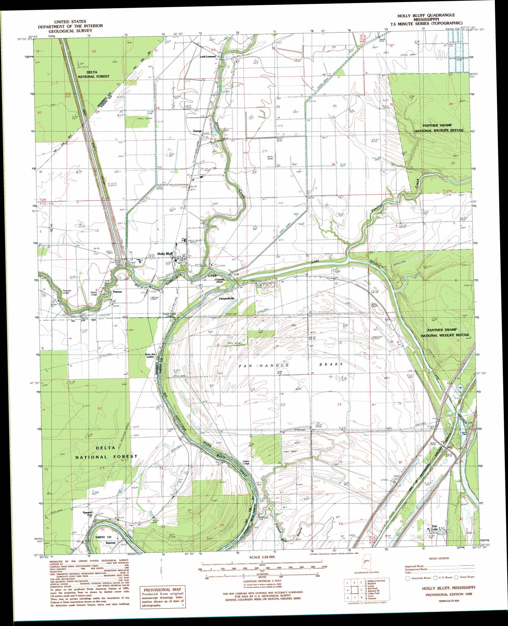
USGS Topo Quad 32090g6 - 1:24,000 scale
| Topo Map Name: | Holly Bluff |
| USGS Topo Quad ID: | 32090g6 |
| Print Size: | ca. 21 1/4" wide x 27" high |
| Southeast Coordinates: | 32.75° N latitude / 90.625° W longitude |
| Map Center Coordinates: | 32.8125° N latitude / 90.6875° W longitude |
| U.S. State: | MS |
| Filename: | o32090g6.jpg |
| Download Map JPG Image: | Holly Bluff topo map 1:24,000 scale |
| Map Type: | Topographic |
| Topo Series: | 7.5´ |
| Map Scale: | 1:24,000 |
| Source of Map Images: | United States Geological Survey (USGS) |
| Alternate Map Versions: |
Holly Bluff MS 1988, updated 1988 Download PDF Buy paper map Holly Bluff MS 2000, updated 2002 Download PDF Buy paper map Holly Bluff MS 2012 Download PDF Buy paper map Holly Bluff MS 2015 Download PDF Buy paper map |
| FStopo: | US Forest Service topo Holly Bluff is available: Download FStopo PDF Download FStopo TIF |
1:24,000 Topo Quads surrounding Holly Bluff
Percy |
Delta City |
Richey |
Midnight |
Silver City |
Rolling Fork West |
Rolling Fork East |
Bayland |
Louise |
Carter |
Cary |
Red Rock |
Holly Bluff |
Bayland Se |
Yazoo City |
Onward |
Valley Park |
Lucre |
Satartia |
Tinsley |
Cane Bayou |
Floweree |
Eldorado |
Phoenix |
Coxs Ferry |
> Back to 32090e1 at 1:100,000 scale
> Back to 32090a1 at 1:250,000 scale
> Back to U.S. Topo Maps home
Holly Bluff topo map: Gazetteer
Holly Bluff: Bends
Pan Handle Brake elevation 25m 82′Holly Bluff: Capes
Crippen Point elevation 24m 78′Holly Bluff: Guts
Fifteen Mile Bayou elevation 28m 91′Holly Bluff: Islands
Fifteen Mile Island elevation 23m 75′Mabin Island elevation 22m 72′
Holly Bluff: Lakes
Fish Lake elevation 29m 95′Holly Bluff: Populated Places
Campbellville elevation 29m 95′George elevation 30m 98′
Holly Bluff elevation 30m 98′
Kearney elevation 30m 98′
Loch Lomond elevation 30m 98′
Patmos elevation 30m 98′
Spanish Fort elevation 29m 95′
Holly Bluff: Streams
Panther Creek elevation 23m 75′Silver Creek elevation 27m 88′
Holly Bluff digital topo map on disk
Buy this Holly Bluff topo map showing relief, roads, GPS coordinates and other geographical features, as a high-resolution digital map file on DVD: