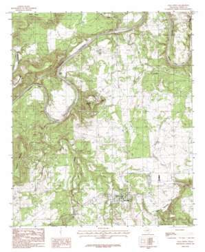
Palo Pinto Topo Map Texas
To zoom in, hover over the map of Palo Pinto
USGS Topo Quad 32098g3 - 1:24,000 scale
| Topo Map Name: | Palo Pinto |
| USGS Topo Quad ID: | 32098g3 |
| Print Size: | ca. 21 1/4" wide x 27" high |
| Southeast Coordinates: | 32.75° N latitude / 98.25° W longitude |
| Map Center Coordinates: | 32.8125° N latitude / 98.3125° W longitude |
| U.S. State: | TX |
| Filename: | o32098g3.jpg |
| Download Map JPG Image: | Palo Pinto topo map 1:24,000 scale |
| Map Type: | Topographic |
| Topo Series: | 7.5´ |
| Map Scale: | 1:24,000 |
| Source of Map Images: | United States Geological Survey (USGS) |
| Alternate Map Versions: |
Palo Pinto TX 1984, updated 1984 Download PDF Buy paper map Palo Pinto TX 2010 Download PDF Buy paper map Palo Pinto TX 2012 Download PDF Buy paper map Palo Pinto TX 2016 Download PDF Buy paper map |
1:24,000 Topo Quads surrounding Palo Pinto
> Back to 32098e1 at 1:100,000 scale
> Back to 32098a1 at 1:250,000 scale
> Back to U.S. Topo Maps home
Palo Pinto topo map: Gazetteer
Palo Pinto: Areas
Rocky Prairie elevation 379m 1243′Palo Pinto: Bends
B C Harris Bend elevation 287m 941′Chick Bend elevation 277m 908′
Crawford Bend elevation 277m 908′
Dalton Bend elevation 268m 879′
Post Oak Bend elevation 277m 908′
Palo Pinto: Dams
Costello Lake Dam elevation 339m 1112′McMurrey Lake Dam elevation 285m 935′
Palo Pinto: Populated Places
Palo Pinto elevation 318m 1043′Palo Pinto: Reservoirs
Costello Lake elevation 339m 1112′McMurrey Lake elevation 285m 935′
Palo Pinto: Streams
Dark Valley Creek elevation 255m 836′Eagle Creek elevation 258m 846′
Elm Creek elevation 252m 826′
Little Keechi Creek elevation 251m 823′
Mill Branch elevation 312m 1023′
Mill Branch elevation 282m 925′
Town Branch elevation 282m 925′
Wolf Branch elevation 271m 889′
Palo Pinto: Summits
Crawford Mountain elevation 443m 1453′Kyle Mountain elevation 414m 1358′
Wynn Mountain elevation 371m 1217′
Palo Pinto digital topo map on disk
Buy this Palo Pinto topo map showing relief, roads, GPS coordinates and other geographical features, as a high-resolution digital map file on DVD:


