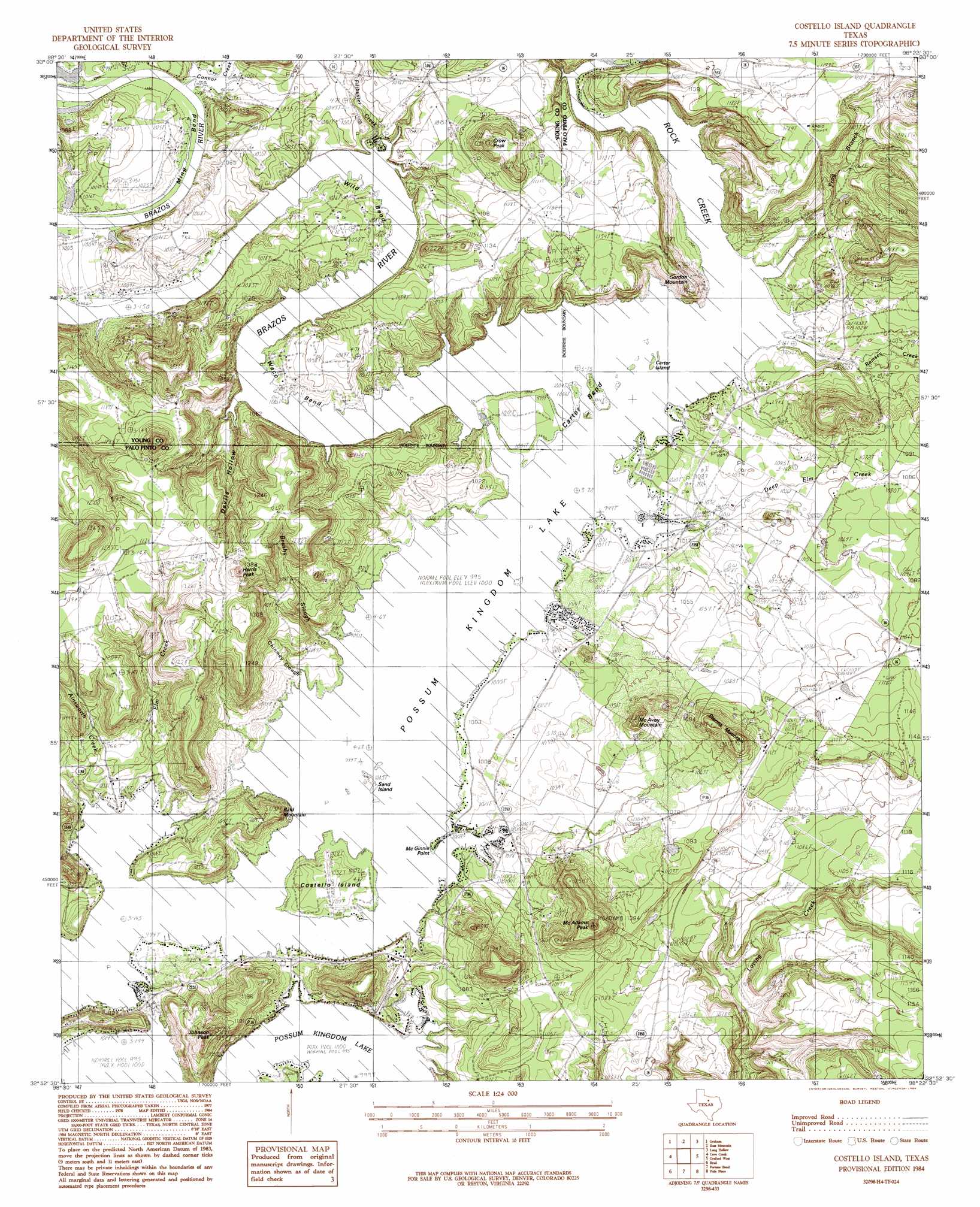
Costello Island Topo Map Texas
To zoom in, hover over the map of Costello Island
USGS Topo Quad 32098h4 - 1:24,000 scale
| Topo Map Name: | Costello Island |
| USGS Topo Quad ID: | 32098h4 |
| Print Size: | ca. 21 1/4" wide x 27" high |
| Southeast Coordinates: | 32.875° N latitude / 98.375° W longitude |
| Map Center Coordinates: | 32.9375° N latitude / 98.4375° W longitude |
| U.S. State: | TX |
| Filename: | o32098h4.jpg |
| Download Map JPG Image: | Costello Island topo map 1:24,000 scale |
| Map Type: | Topographic |
| Topo Series: | 7.5´ |
| Map Scale: | 1:24,000 |
| Source of Map Images: | United States Geological Survey (USGS) |
| Alternate Map Versions: |
Costello Island TX 1984, updated 1984 Download PDF Buy paper map Costello Island TX 2010 Download PDF Buy paper map Costello Island TX 2012 Download PDF Buy paper map Costello Island TX 2016 Download PDF Buy paper map |
1:24,000 Topo Quads surrounding Costello Island
Newcastle |
Lake Eddleman |
Bryson |
Senate |
Jacksboro |
South Bend |
Graham |
Ross Mountain |
Long Hollow |
Bartons Chapel |
Ivan North |
Cove Creek |
Costello Island |
Graford West |
Graford East |
Ivan South |
Brad |
Fortune Bend |
Palo Pinto |
Mineral Wells West |
Caddo |
Caddo Ne |
Metcalf Gap |
Lone Camp |
Brazos West |
> Back to 32098e1 at 1:100,000 scale
> Back to 32098a1 at 1:250,000 scale
> Back to U.S. Topo Maps home
Costello Island topo map: Gazetteer
Costello Island: Airports
Costello Island, Incorporated Airport elevation 313m 1026′Possum Kingdom Airport elevation 307m 1007′
Costello Island: Bays
Chimney Slough elevation 303m 994′Costello Island: Bends
Carter Bend elevation 303m 994′Ming Bend elevation 317m 1040′
Waco Bend elevation 315m 1033′
Wild Bend elevation 310m 1017′
Costello Island: Capes
McGinnis Point elevation 305m 1000′Costello Island: Islands
Bloodweed Island elevation 303m 994′Carter Island elevation 303m 994′
Costello Island elevation 316m 1036′
Sand Island elevation 303m 994′
Costello Island: Streams
Ainsworth Creek elevation 309m 1013′Brushy Slough elevation 303m 994′
Connor Creek elevation 308m 1010′
Deep Elm Creek elevation 303m 994′
Elm Creek elevation 304m 997′
Filibuster Creek elevation 303m 994′
Frog Branch elevation 303m 994′
Ramsey Creek elevation 303m 994′
Rock Creek elevation 303m 994′
Costello Island: Summits
Bald Mountain elevation 333m 1092′Crow Peak elevation 379m 1243′
Gordon Mountain elevation 332m 1089′
Harris Peak elevation 422m 1384′
Johnson Peak elevation 401m 1315′
McAdams Peak elevation 401m 1315′
McAvoy Mountain elevation 376m 1233′
Storms Mountain elevation 394m 1292′
Costello Island: Valleys
Devils Hollow elevation 303m 994′Costello Island digital topo map on disk
Buy this Costello Island topo map showing relief, roads, GPS coordinates and other geographical features, as a high-resolution digital map file on DVD: