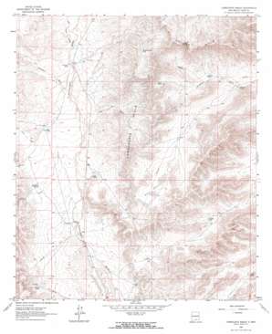
Cornucopia Ranch Topo Map New Mexico
To zoom in, hover over the map of Cornucopia Ranch
USGS Topo Quad 32105d3 - 1:24,000 scale
| Topo Map Name: | Cornucopia Ranch |
| USGS Topo Quad ID: | 32105d3 |
| Print Size: | ca. 21 1/4" wide x 27" high |
| Southeast Coordinates: | 32.375° N latitude / 105.25° W longitude |
| Map Center Coordinates: | 32.4375° N latitude / 105.3125° W longitude |
| U.S. State: | NM |
| Filename: | o32105d3.jpg |
| Download Map JPG Image: | Cornucopia Ranch topo map 1:24,000 scale |
| Map Type: | Topographic |
| Topo Series: | 7.5´ |
| Map Scale: | 1:24,000 |
| Source of Map Images: | United States Geological Survey (USGS) |
| Alternate Map Versions: |
Cornucopia Ranch NM 2010 Download PDF Buy paper map Cornucopia Ranch NM 2013 Download PDF Buy paper map Cornucopia Ranch NM 2017 Download PDF Buy paper map |
1:24,000 Topo Quads surrounding Cornucopia Ranch
> Back to 32105a1 at 1:100,000 scale
> Back to 32104a1 at 1:250,000 scale
> Back to U.S. Topo Maps home
Cornucopia Ranch topo map: Gazetteer
Cornucopia Ranch: Lakes
Dry Lakes elevation 1570m 5150′Cornucopia Ranch: Ranges
Cornucopia Hills elevation 1702m 5583′Cornucopia Ranch: Reservoirs
Bird Tank elevation 1648m 5406′E L Paso Tank elevation 1478m 4849′
Inman Tank elevation 1524m 5000′
Lake Tank elevation 1520m 4986′
Lucky Tank elevation 1507m 4944′
Middle Rincon Tank elevation 1698m 5570′
Mitchell Tank elevation 1537m 5042′
New Tank elevation 1369m 4491′
New Tank elevation 1544m 5065′
Rincon Tank elevation 1617m 5305′
Venado Tank elevation 1569m 5147′
Cornucopia Ranch: Valleys
Cat Draw elevation 1543m 5062′Juniper Draw elevation 1549m 5082′
McLane Draw elevation 1494m 4901′
Moccasin Draw elevation 1573m 5160′
New Tank Draw elevation 1598m 5242′
Otto Draw elevation 1546m 5072′
Cornucopia Ranch digital topo map on disk
Buy this Cornucopia Ranch topo map showing relief, roads, GPS coordinates and other geographical features, as a high-resolution digital map file on DVD:


