Sycamore Topo Map South Carolina
To zoom in, hover over the map of Sycamore
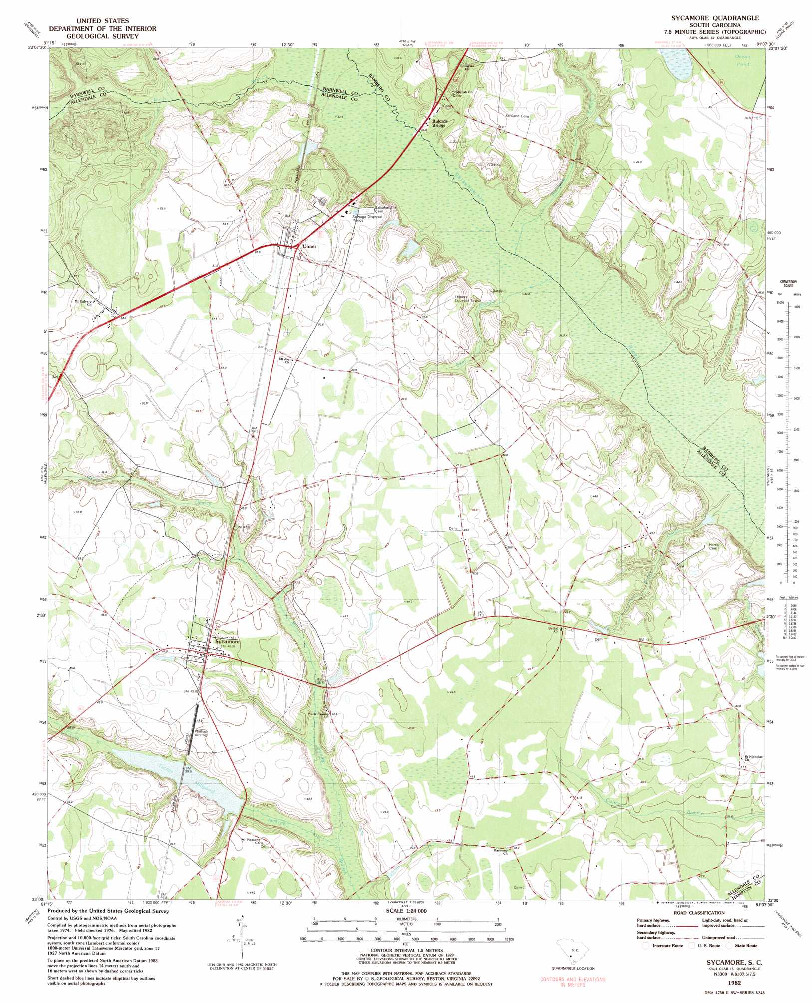
USGS Topo Quad 33081a2 - 1:24,000 scale
| Topo Map Name: | Sycamore |
| USGS Topo Quad ID: | 33081a2 |
| Print Size: | ca. 21 1/4" wide x 27" high |
| Southeast Coordinates: | 33° N latitude / 81.125° W longitude |
| Map Center Coordinates: | 33.0625° N latitude / 81.1875° W longitude |
| U.S. State: | SC |
| Filename: | o33081a2.jpg |
| Download Map JPG Image: | Sycamore topo map 1:24,000 scale |
| Map Type: | Topographic |
| Topo Series: | 7.5´ |
| Map Scale: | 1:24,000 |
| Source of Map Images: | United States Geological Survey (USGS) |
| Alternate Map Versions: |
Sycamore SC 1982, updated 1983 Download PDF Buy paper map Sycamore SC 2011 Download PDF Buy paper map Sycamore SC 2014 Download PDF Buy paper map |
1:24,000 Topo Quads surrounding Sycamore
Long Branch |
Blackville |
Denmark |
Bamberg |
Midway |
Snelling |
Barnwell |
Olar |
Clear Pond |
Tony Hill Bay |
Martin |
Allendale |
Sycamore |
Ehrhardt |
Lodge |
Bull Pond |
Barton |
Fairfax |
Crocketville |
Islandton |
Brier Creek Landing |
Solomons Crossroads |
Gifford |
Hampton |
Cummings |
> Back to 33081a1 at 1:100,000 scale
> Back to 33080a1 at 1:250,000 scale
> Back to U.S. Topo Maps home
Sycamore topo map: Gazetteer
Sycamore: Airports
Phillips Airstrip elevation 47m 154′Sycamore: Basins
Ocean Pond elevation 48m 157′Sycamore: Bridges
Beaufort Bridge elevation 51m 167′Sycamore: Dams
Tutens Mill Pond Dam D-2569 elevation 45m 147′Sycamore: Populated Places
Bufords Bridge elevation 30m 98′Sycamore elevation 45m 147′
Tuten (historical) elevation 44m 144′
Ulmer elevation 49m 160′
Sycamore: Post Offices
Sycamore Post Office elevation 45m 147′Ulmer Post Office elevation 46m 150′
Sycamore: Reservoirs
Tutens Millpond elevation 45m 147′Sycamore: Streams
Bear Branch elevation 31m 101′Caddins Branch elevation 47m 154′
Kirkland Creek elevation 30m 98′
Miller Swamp elevation 31m 101′
Pretty Creek elevation 27m 88′
Wells Branch elevation 35m 114′
Sycamore digital topo map on disk
Buy this Sycamore topo map showing relief, roads, GPS coordinates and other geographical features, as a high-resolution digital map file on DVD:
South Carolina, Western North Carolina & Northeastern Georgia
Buy digital topo maps: South Carolina, Western North Carolina & Northeastern Georgia