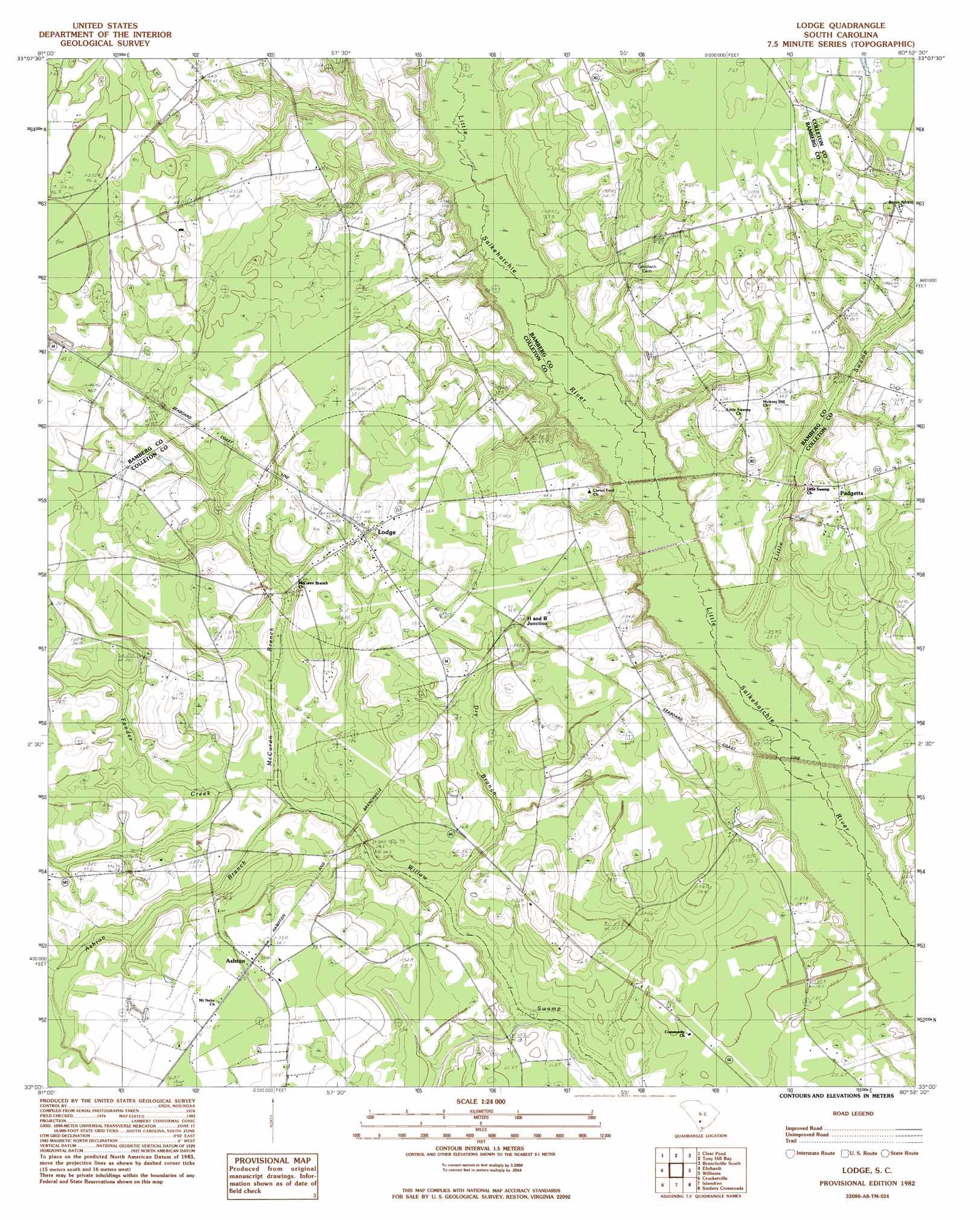
Lodge Topo Map South Carolina
To zoom in, hover over the map of Lodge
USGS Topo Quad 33080a8 - 1:24,000 scale
| Topo Map Name: | Lodge |
| USGS Topo Quad ID: | 33080a8 |
| Print Size: | ca. 21 1/4" wide x 27" high |
| Southeast Coordinates: | 33° N latitude / 80.875° W longitude |
| Map Center Coordinates: | 33.0625° N latitude / 80.9375° W longitude |
| U.S. State: | SC |
| Filename: | o33080a8.jpg |
| Download Map JPG Image: | Lodge topo map 1:24,000 scale |
| Map Type: | Topographic |
| Topo Series: | 7.5´ |
| Map Scale: | 1:24,000 |
| Source of Map Images: | United States Geological Survey (USGS) |
| Alternate Map Versions: |
Lodge SC 1982, updated 1983 Download PDF Buy paper map Lodge SC 2011 Download PDF Buy paper map Lodge SC 2014 Download PDF Buy paper map |
1:24,000 Topo Quads surrounding Lodge
Denmark |
Bamberg |
Midway |
Branchville North |
Bowman |
Olar |
Clear Pond |
Tony Hill Bay |
Branchville South |
Reevesville |
Sycamore |
Ehrhardt |
Lodge |
Williams |
Saint George Sw |
Fairfax |
Crocketville |
Islandton |
Sniders Crossroads |
Walterboro |
Gifford |
Hampton |
Cummings |
Black Creek |
Hendersonville |
> Back to 33080a1 at 1:100,000 scale
> Back to 33080a1 at 1:250,000 scale
> Back to U.S. Topo Maps home
Lodge topo map: Gazetteer
Lodge: Populated Places
Ashton elevation 35m 114′Caldwell elevation 30m 98′
Colleton elevation 23m 75′
Lodge elevation 33m 108′
Padgetts elevation 34m 111′
Lodge: Post Offices
Lodge Post Office elevation 33m 108′Lodge: Streams
Ashton Branch elevation 21m 68′Dry Branch elevation 20m 65′
Fender Creek elevation 22m 72′
McCuren Branch elevation 21m 68′
Smith Drain elevation 22m 72′
Lodge: Swamps
Copeland Drain elevation 39m 127′Lodge digital topo map on disk
Buy this Lodge topo map showing relief, roads, GPS coordinates and other geographical features, as a high-resolution digital map file on DVD:
South Carolina, Western North Carolina & Northeastern Georgia
Buy digital topo maps: South Carolina, Western North Carolina & Northeastern Georgia