Banks Topo Map Arkansas
To zoom in, hover over the map of Banks
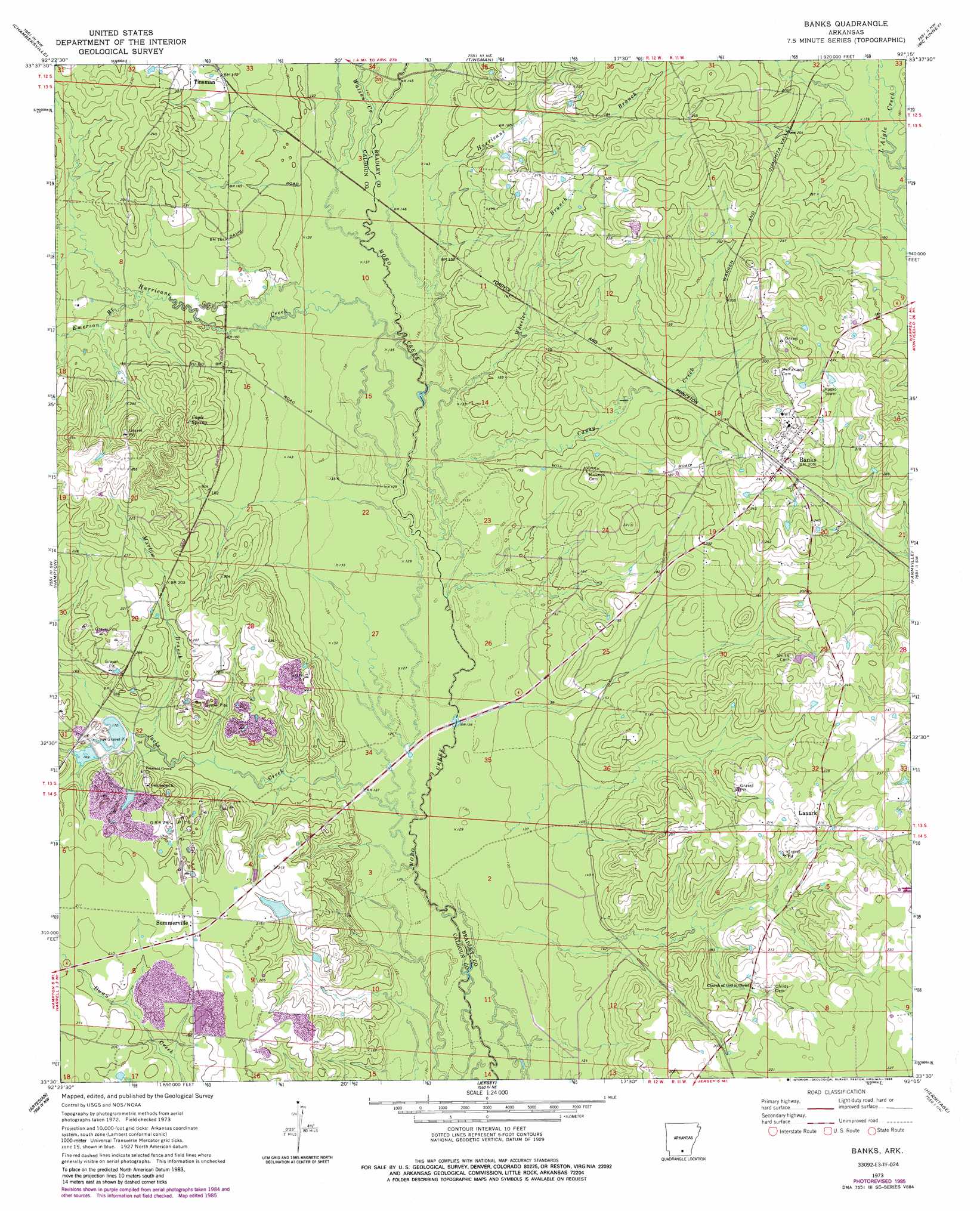
USGS Topo Quad 33092e3 - 1:24,000 scale
| Topo Map Name: | Banks |
| USGS Topo Quad ID: | 33092e3 |
| Print Size: | ca. 21 1/4" wide x 27" high |
| Southeast Coordinates: | 33.5° N latitude / 92.25° W longitude |
| Map Center Coordinates: | 33.5625° N latitude / 92.3125° W longitude |
| U.S. State: | AR |
| Filename: | o33092e3.jpg |
| Download Map JPG Image: | Banks topo map 1:24,000 scale |
| Map Type: | Topographic |
| Topo Series: | 7.5´ |
| Map Scale: | 1:24,000 |
| Source of Map Images: | United States Geological Survey (USGS) |
| Alternate Map Versions: |
Banks AR 1973, updated 1975 Download PDF Buy paper map Banks AR 1973, updated 1986 Download PDF Buy paper map Banks AR 2011 Download PDF Buy paper map Banks AR 2014 Download PDF Buy paper map |
1:24,000 Topo Quads surrounding Banks
Hopeville |
Fordyce |
Kingsland |
New Edinburg |
Herbine |
Bearden |
Chambersville |
Tinsman |
Mckinney |
Warren Ne |
Woodberry |
Hampton |
Banks |
Farmville |
Warren |
Smackover Ne |
Artesian |
Jersey |
Hermitage |
Sumpter |
Calion |
Harrell Brake |
Moro Bay |
Marsden |
Vick |
> Back to 33092e1 at 1:100,000 scale
> Back to 33092a1 at 1:250,000 scale
> Back to U.S. Topo Maps home
Banks topo map: Gazetteer
Banks: Dams
Harrell Lake Dam elevation 59m 193′Banks: Populated Places
Banks elevation 64m 209′Glynn (historical) elevation 62m 203′
Lanark elevation 68m 223′
Summerville elevation 70m 229′
Banks: Reservoirs
Harrell Lake elevation 59m 193′Banks: Springs
Cagle Spring elevation 70m 229′Banks: Streams
Caney Creek elevation 41m 134′Emerson Branch elevation 51m 167′
Hurricane Branch elevation 42m 137′
Hurricane Creek elevation 42m 137′
Jacks Creek elevation 40m 131′
Marlow Branch elevation 49m 160′
Watson Creek elevation 45m 147′
Wheeler Branch elevation 44m 144′
Banks digital topo map on disk
Buy this Banks topo map showing relief, roads, GPS coordinates and other geographical features, as a high-resolution digital map file on DVD: