Hodgson Topo Map Texas
To zoom in, hover over the map of Hodgson
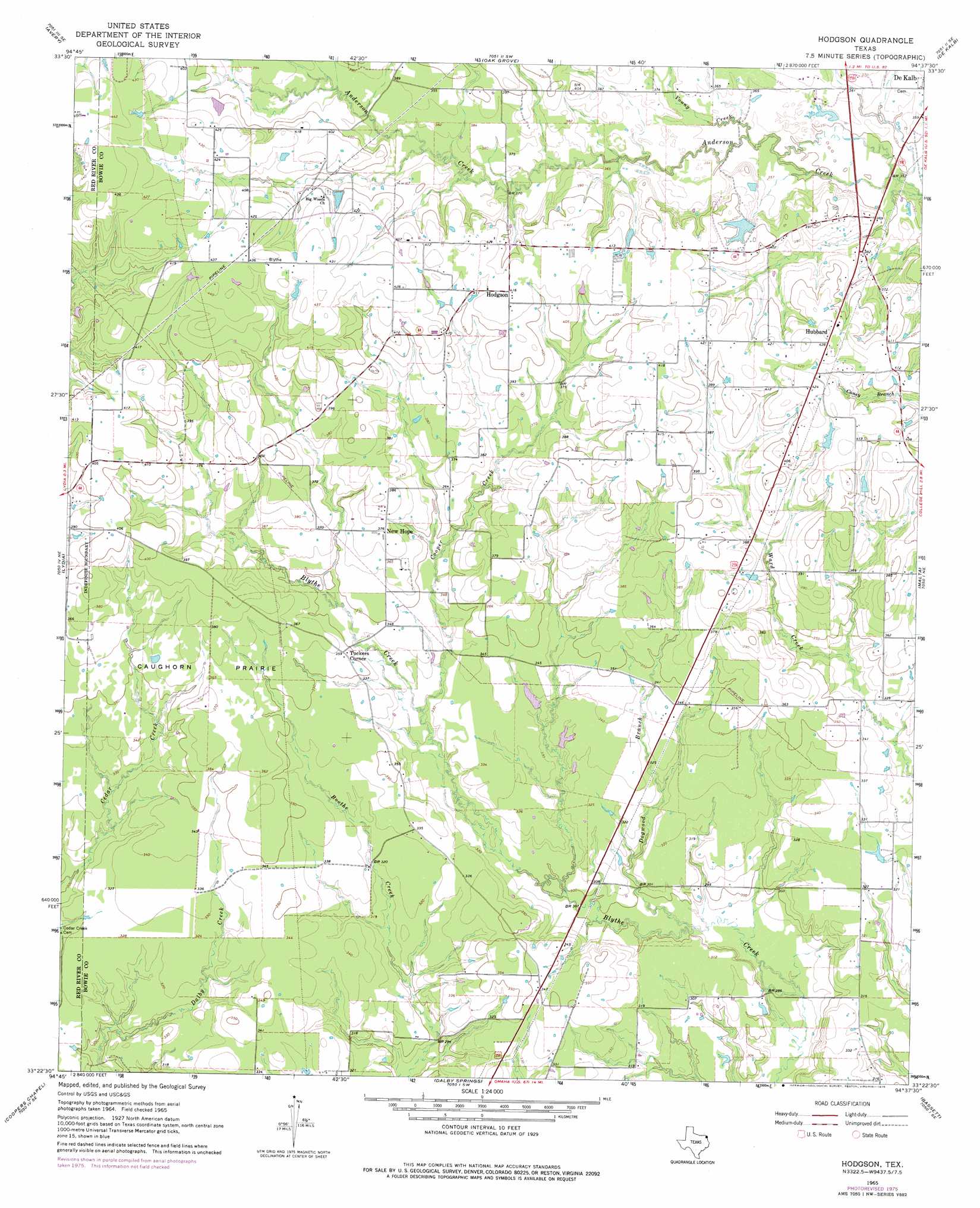
USGS Topo Quad 33094d6 - 1:24,000 scale
| Topo Map Name: | Hodgson |
| USGS Topo Quad ID: | 33094d6 |
| Print Size: | ca. 21 1/4" wide x 27" high |
| Southeast Coordinates: | 33.375° N latitude / 94.625° W longitude |
| Map Center Coordinates: | 33.4375° N latitude / 94.6875° W longitude |
| U.S. State: | TX |
| Filename: | o33094d6.jpg |
| Download Map JPG Image: | Hodgson topo map 1:24,000 scale |
| Map Type: | Topographic |
| Topo Series: | 7.5´ |
| Map Scale: | 1:24,000 |
| Source of Map Images: | United States Geological Survey (USGS) |
| Alternate Map Versions: |
Hodgson TX 1965, updated 1967 Download PDF Buy paper map Hodgson TX 1965, updated 1976 Download PDF Buy paper map Hodgson TX 2010 Download PDF Buy paper map Hodgson TX 2012 Download PDF Buy paper map Hodgson TX 2016 Download PDF Buy paper map |
1:24,000 Topo Quads surrounding Hodgson
White Rock |
English |
De Kalb Nw |
Tom |
Foreman |
Annona |
Avery |
Oak Grove |
De Kalb |
Daniels Chapel |
Boxelder |
Lydia |
Hodgson |
Malta |
New Boston |
Wilkinson |
Coopers Chapel |
Dalby Springs |
Bassett |
Corley |
Mount Pleasant |
Cookville |
Naples |
Marietta |
Bryans Mill |
> Back to 33094a1 at 1:100,000 scale
> Back to 33094a1 at 1:250,000 scale
> Back to U.S. Topo Maps home
Hodgson topo map: Gazetteer
Hodgson: Dams
De Kalb Lake Dam elevation 113m 370′Hodgson: Flats
Caughorn Prairie elevation 112m 367′Hodgson: Populated Places
Hodgson elevation 126m 413′Hubbard elevation 130m 426′
New Hope elevation 114m 374′
Tuckers Corner elevation 109m 357′
Hodgson: Reservoirs
De Kalb Lake elevation 113m 370′Hodgson: Streams
Cooper Creek elevation 98m 321′Dogwood Branch elevation 88m 288′
Young Creek elevation 107m 351′
Hodgson digital topo map on disk
Buy this Hodgson topo map showing relief, roads, GPS coordinates and other geographical features, as a high-resolution digital map file on DVD: