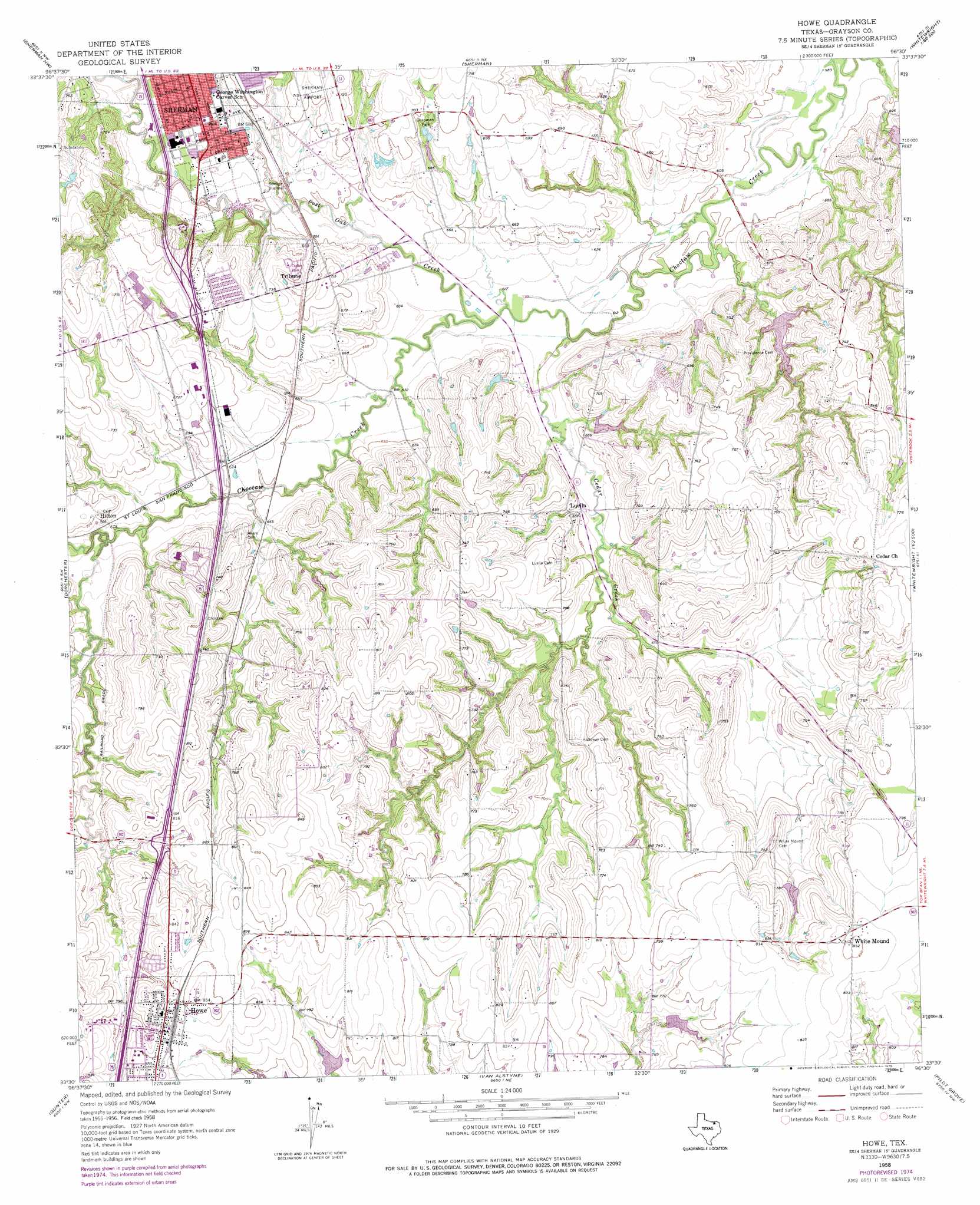
Howe Topo Map Texas
To zoom in, hover over the map of Howe
USGS Topo Quad 33096e5 - 1:24,000 scale
| Topo Map Name: | Howe |
| USGS Topo Quad ID: | 33096e5 |
| Print Size: | ca. 21 1/4" wide x 27" high |
| Southeast Coordinates: | 33.5° N latitude / 96.5° W longitude |
| Map Center Coordinates: | 33.5625° N latitude / 96.5625° W longitude |
| U.S. State: | TX |
| Filename: | o33096e5.jpg |
| Download Map JPG Image: | Howe topo map 1:24,000 scale |
| Map Type: | Topographic |
| Topo Series: | 7.5´ |
| Map Scale: | 1:24,000 |
| Source of Map Images: | United States Geological Survey (USGS) |
| Alternate Map Versions: |
Howe TX 1958, updated 1959 Download PDF Buy paper map Howe TX 1958, updated 1975 Download PDF Buy paper map Howe TX 1958, updated 1975 Download PDF Buy paper map Howe TX 2010 Download PDF Buy paper map Howe TX 2013 Download PDF Buy paper map Howe TX 2016 Download PDF Buy paper map |
1:24,000 Topo Quads surrounding Howe
Gordonville |
Pottsboro |
Denison Dam |
Achille |
Kemp |
Sadler |
Sherman Nw |
Sherman |
Ambrose |
Mulberry |
Ethel |
Dorchester |
Howe |
Whitewright |
Ector |
Marilee |
Gunter |
Van Alstyne |
Pilot Grove |
Trenton |
Celina |
Weston |
Anna |
Blue Ridge |
Pike |
> Back to 33096e1 at 1:100,000 scale
> Back to 33096a1 at 1:250,000 scale
> Back to U.S. Topo Maps home
Howe topo map: Gazetteer
Howe: Airports
Sherman Municipal Airport elevation 221m 725′Howe: Dams
Soil Conservation Service Site 12 Dam elevation 225m 738′Soil Conservation Service Site 14 Dam elevation 204m 669′
Soil Conservation Service Site 15 Dam elevation 202m 662′
Soil Conservation Service Site 16 Dam elevation 194m 636′
Soil Conservation Service Site 17 Dam elevation 190m 623′
Soil Conservation Service Site 18 Dam elevation 229m 751′
Soil Conservation Service Site 20 Dam elevation 185m 606′
Soil Conservation Service Site 27 Dam elevation 236m 774′
Howe: Parks
Chapman Park elevation 211m 692′Howe: Populated Places
Hilton elevation 217m 711′Howe elevation 256m 839′
Luella elevation 198m 649′
Tribune elevation 211m 692′
White Mound elevation 256m 839′
Howe: Reservoirs
Soil Conservation Service Site 12 Reservoir elevation 225m 738′Soil Conservation Service Site 14 Reservoir elevation 204m 669′
Soil Conservation Service Site 15 Reservoir elevation 202m 662′
Soil Conservation Service Site 16 Reservoir elevation 194m 636′
Soil Conservation Service Site 17 Reservoir elevation 190m 623′
Soil Conservation Service Site 18 Reservoir elevation 229m 751′
Soil Conservation Service Site 20 Reservoir elevation 185m 606′
Soil Conservation Service Site 27 Reservoir elevation 236m 774′
Howe: Streams
Cedar Creek elevation 183m 600′Post Oak Creek elevation 186m 610′
Sand Creek elevation 199m 652′
Howe digital topo map on disk
Buy this Howe topo map showing relief, roads, GPS coordinates and other geographical features, as a high-resolution digital map file on DVD: