Tackett Mountain Topo Map Texas
To zoom in, hover over the map of Tackett Mountain
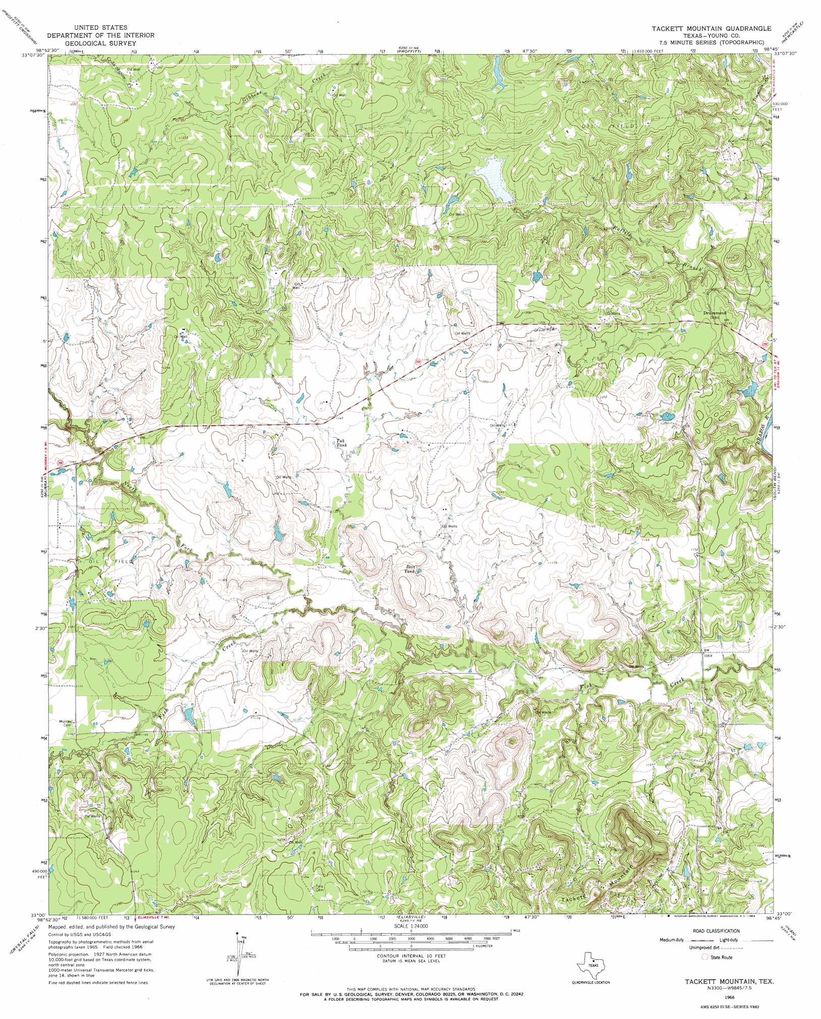
USGS Topo Quad 33098a7 - 1:24,000 scale
| Topo Map Name: | Tackett Mountain |
| USGS Topo Quad ID: | 33098a7 |
| Print Size: | ca. 21 1/4" wide x 27" high |
| Southeast Coordinates: | 33° N latitude / 98.75° W longitude |
| Map Center Coordinates: | 33.0625° N latitude / 98.8125° W longitude |
| U.S. State: | TX |
| Filename: | o33098a7.jpg |
| Download Map JPG Image: | Tackett Mountain topo map 1:24,000 scale |
| Map Type: | Topographic |
| Topo Series: | 7.5´ |
| Map Scale: | 1:24,000 |
| Source of Map Images: | United States Geological Survey (USGS) |
| Alternate Map Versions: |
Tackett Mountain TX 1966, updated 1969 Download PDF Buy paper map Tackett Mountain TX 2010 Download PDF Buy paper map Tackett Mountain TX 2012 Download PDF Buy paper map Tackett Mountain TX 2016 Download PDF Buy paper map |
1:24,000 Topo Quads surrounding Tackett Mountain
Westover Se |
Padgett |
Olney |
True |
Loving |
Throckmorton Ne |
Proffitt Crossing |
Proffitt |
Newcastle |
Lake Eddleman |
Woodson |
Murray |
Tackett Mountain |
South Bend |
Graham |
Lusk |
Crystal Falls |
Eliasville |
Ivan North |
Cove Creek |
Edwards Branch |
Breckenridge |
Grand Lake |
Ivan South |
Brad |
> Back to 33098a1 at 1:100,000 scale
> Back to 33098a1 at 1:250,000 scale
> Back to U.S. Topo Maps home
Tackett Mountain topo map: Gazetteer
Tackett Mountain: Dams
Manning Vick Lake Number 2 Dam elevation 353m 1158′Tackett Mountain: Reservoirs
Bait Tank elevation 347m 1138′Manning Vick Lake Number 2 elevation 353m 1158′
Tub Tank elevation 346m 1135′
Tackett Mountain: Streams
North Fork Fish Creek elevation 334m 1095′Tackett Mountain: Summits
Tackett Mountain elevation 406m 1332′Tackett Mountain digital topo map on disk
Buy this Tackett Mountain topo map showing relief, roads, GPS coordinates and other geographical features, as a high-resolution digital map file on DVD: