Vashti Topo Map Texas
To zoom in, hover over the map of Vashti
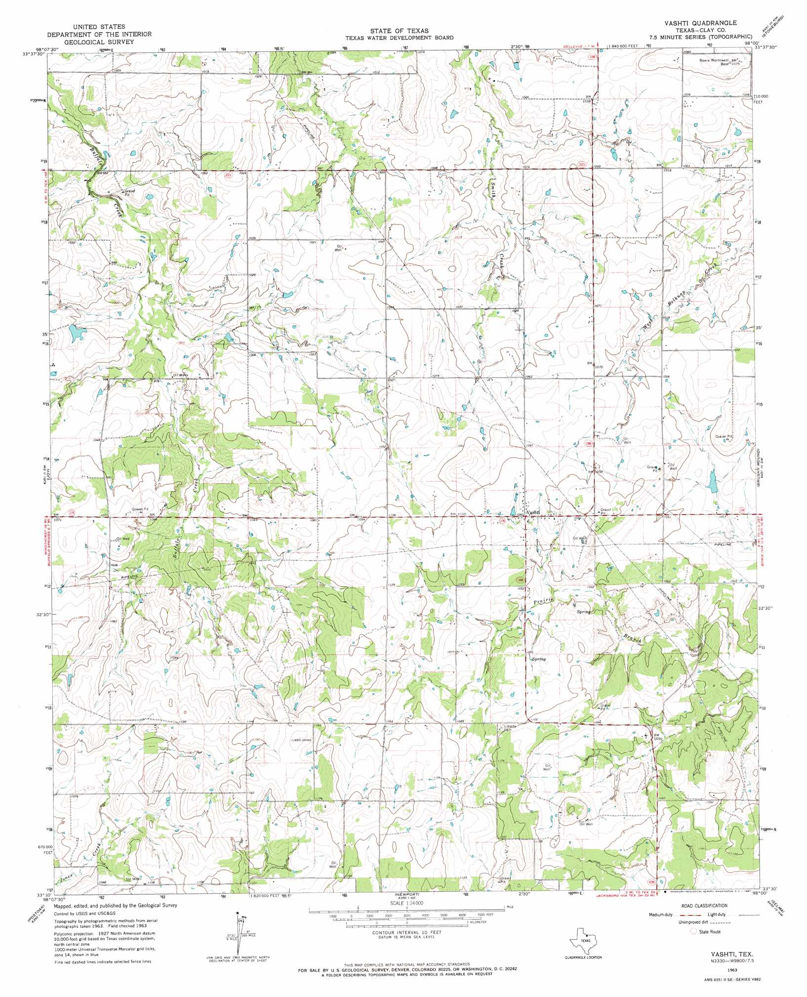
USGS Topo Quad 33098e1 - 1:24,000 scale
| Topo Map Name: | Vashti |
| USGS Topo Quad ID: | 33098e1 |
| Print Size: | ca. 21 1/4" wide x 27" high |
| Southeast Coordinates: | 33.5° N latitude / 98° W longitude |
| Map Center Coordinates: | 33.5625° N latitude / 98.0625° W longitude |
| U.S. State: | TX |
| Filename: | o33098e1.jpg |
| Download Map JPG Image: | Vashti topo map 1:24,000 scale |
| Map Type: | Topographic |
| Topo Series: | 7.5´ |
| Map Scale: | 1:24,000 |
| Source of Map Images: | United States Geological Survey (USGS) |
| Alternate Map Versions: |
Vashti TX 1963, updated 1967 Download PDF Buy paper map Vashti TX 2010 Download PDF Buy paper map Vashti TX 2012 Download PDF Buy paper map Vashti TX 2016 Download PDF Buy paper map |
1:24,000 Topo Quads surrounding Vashti
Jolly |
Henrietta |
Dickworsham |
Ringgold |
Belcherville |
Deer Creek |
Bluegrove |
Bellevue |
Stoneburg |
Buzzard Roost Knob |
Scotland Se |
Joy |
Vashti |
Brushy Mound |
Bowie |
Antelope |
Postoak |
Newport |
Selma |
Sunset |
Lynn Creek |
Johnson Lake |
Cundiff |
Crafton |
Chico |
> Back to 33098e1 at 1:100,000 scale
> Back to 33098a1 at 1:250,000 scale
> Back to U.S. Topo Maps home
Vashti topo map: Gazetteer
Vashti: Dams
Scott Lake Dam elevation 303m 994′Soil Conservation Service Site 2 Dam elevation 323m 1059′
Soil Conservation Service Site 4 Dam elevation 303m 994′
Vashti: Populated Places
Vashti elevation 330m 1082′Vashti: Reservoirs
Scott Lake elevation 303m 994′Soil Conservation Service Site 2 Reservoir elevation 323m 1059′
Soil Conservation Service Site 4 Reservoir elevation 303m 994′
Vashti digital topo map on disk
Buy this Vashti topo map showing relief, roads, GPS coordinates and other geographical features, as a high-resolution digital map file on DVD: