Bluegrove Topo Map Texas
To zoom in, hover over the map of Bluegrove
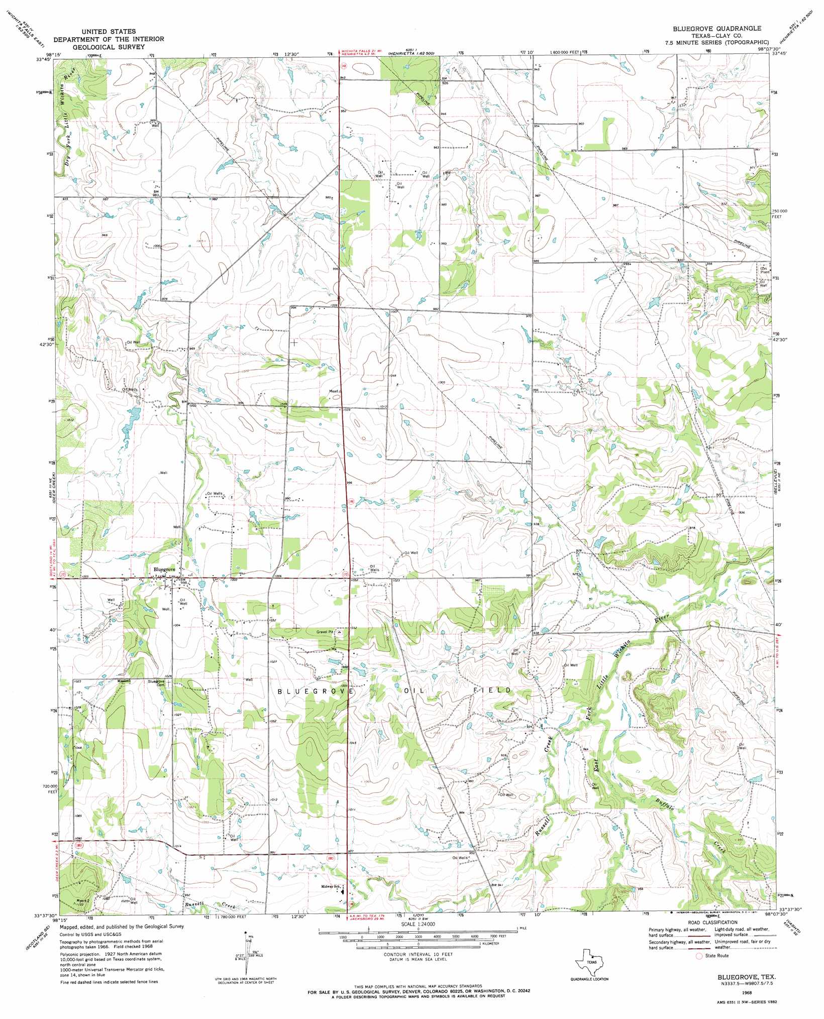
USGS Topo Quad 33098f2 - 1:24,000 scale
| Topo Map Name: | Bluegrove |
| USGS Topo Quad ID: | 33098f2 |
| Print Size: | ca. 21 1/4" wide x 27" high |
| Southeast Coordinates: | 33.625° N latitude / 98.125° W longitude |
| Map Center Coordinates: | 33.6875° N latitude / 98.1875° W longitude |
| U.S. State: | TX |
| Filename: | o33098f2.jpg |
| Download Map JPG Image: | Bluegrove topo map 1:24,000 scale |
| Map Type: | Topographic |
| Topo Series: | 7.5´ |
| Map Scale: | 1:24,000 |
| Source of Map Images: | United States Geological Survey (USGS) |
| Alternate Map Versions: |
Bluegrove TX 1968, updated 1971 Download PDF Buy paper map Bluegrove TX 2010 Download PDF Buy paper map Bluegrove TX 2012 Download PDF Buy paper map Bluegrove TX 2016 Download PDF Buy paper map |
1:24,000 Topo Quads surrounding Bluegrove
Wichita Falls East |
Dean |
Hurnville |
Riverland Cemetery |
Terral |
Sloop Creek |
Jolly |
Henrietta |
Dickworsham |
Ringgold |
Scotland |
Deer Creek |
Bluegrove |
Bellevue |
Stoneburg |
Windthorst |
Scotland Se |
Joy |
Vashti |
Brushy Mound |
Darnell Branch |
Antelope |
Postoak |
Newport |
Selma |
> Back to 33098e1 at 1:100,000 scale
> Back to 33098a1 at 1:250,000 scale
> Back to U.S. Topo Maps home
Bluegrove topo map: Gazetteer
Bluegrove: Dams
Fields Lake Dam elevation 293m 961′Near Pipeline Lake Dam elevation 289m 948′
Bluegrove: Oilfields
Bluegrove Oil Field elevation 303m 994′Bluegrove: Populated Places
Bluegrove elevation 304m 997′Bluegrove: Reservoirs
Fields Lake elevation 293m 961′Near Pipeline Lake elevation 289m 948′
Bluegrove: Streams
Buffalo Creek elevation 280m 918′Russell Creek elevation 279m 915′
Bluegrove digital topo map on disk
Buy this Bluegrove topo map showing relief, roads, GPS coordinates and other geographical features, as a high-resolution digital map file on DVD: