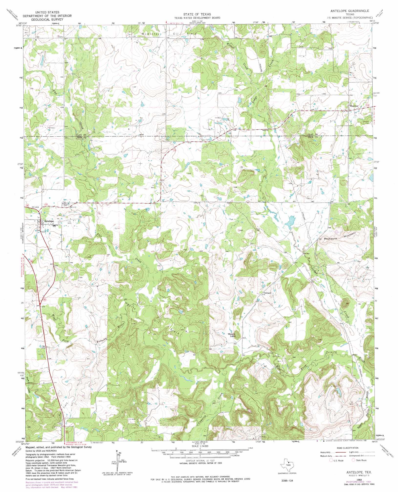
Antelope Topo Map Texas
To zoom in, hover over the map of Antelope
USGS Topo Quad 33098d3 - 1:24,000 scale
| Topo Map Name: | Antelope |
| USGS Topo Quad ID: | 33098d3 |
| Print Size: | ca. 21 1/4" wide x 27" high |
| Southeast Coordinates: | 33.375° N latitude / 98.25° W longitude |
| Map Center Coordinates: | 33.4375° N latitude / 98.3125° W longitude |
| U.S. State: | TX |
| Filename: | o33098d3.jpg |
| Download Map JPG Image: | Antelope topo map 1:24,000 scale |
| Map Type: | Topographic |
| Topo Series: | 7.5´ |
| Map Scale: | 1:24,000 |
| Source of Map Images: | United States Geological Survey (USGS) |
| Alternate Map Versions: |
Antelope Creek NE TX 1962, updated 1982 Download PDF Buy paper map Antelope TX 1964, updated 1967 Download PDF Buy paper map Antelope TX 1964, updated 1982 Download PDF Buy paper map Antelope TX 2010 Download PDF Buy paper map Antelope TX 2012 Download PDF Buy paper map Antelope TX 2016 Download PDF Buy paper map |
1:24,000 Topo Quads surrounding Antelope
Archer City Ne |
Scotland |
Deer Creek |
Bluegrove |
Bellevue |
Archer City East |
Windthorst |
Scotland Se |
Joy |
Vashti |
Prickly Pear Branch |
Darnell Branch |
Antelope |
Postoak |
Newport |
Loving |
Markley |
Lynn Creek |
Johnson Lake |
Cundiff |
Lake Eddleman |
Bryson |
Senate |
Jacksboro |
Jacksboro Ne |
> Back to 33098a1 at 1:100,000 scale
> Back to 33098a1 at 1:250,000 scale
> Back to U.S. Topo Maps home
Antelope topo map: Gazetteer
Antelope: Dams
Ellenburg Lake Dam elevation 309m 1013′Smith Lake Dam elevation 303m 994′
Antelope: Oilfields
Hoefle Oil Field elevation 306m 1003′Antelope: Populated Places
Antelope elevation 313m 1026′Oakland elevation 310m 1017′
Shannon elevation 316m 1036′
Antelope: Reservoirs
Ellenburg Lake elevation 309m 1013′Smith Lake elevation 303m 994′
Antelope: Streams
Cameron Creek elevation 292m 958′Flat Creek elevation 293m 961′
Lodge Creek elevation 288m 944′
Roberts Prairie Branch elevation 285m 935′
Willow Creek elevation 298m 977′
Antelope: Summits
Backbone Mountain elevation 338m 1108′Mount Lebo elevation 316m 1036′
Antelope digital topo map on disk
Buy this Antelope topo map showing relief, roads, GPS coordinates and other geographical features, as a high-resolution digital map file on DVD: