Double Mountains Topo Map Texas
To zoom in, hover over the map of Double Mountains
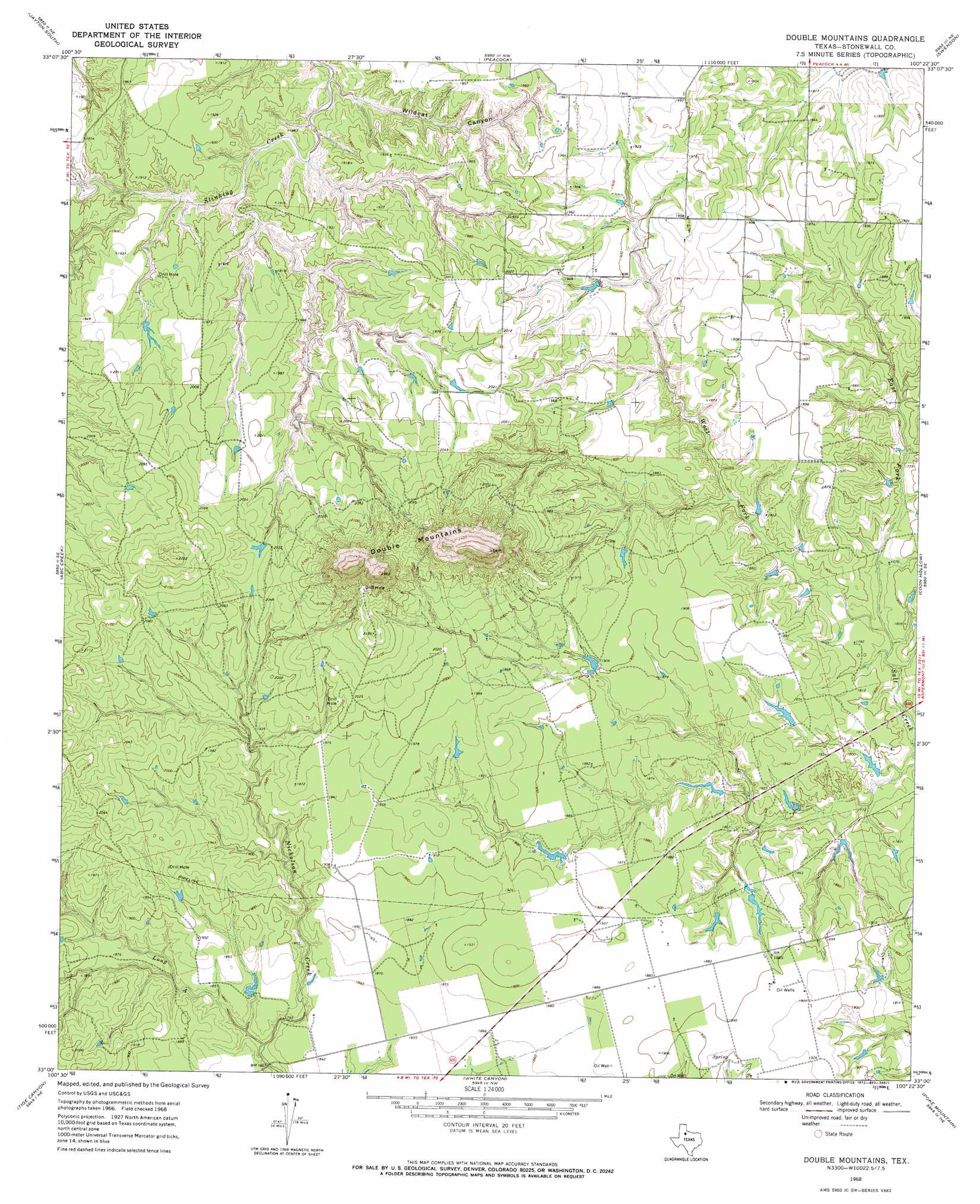
USGS Topo Quad 33100a4 - 1:24,000 scale
| Topo Map Name: | Double Mountains |
| USGS Topo Quad ID: | 33100a4 |
| Print Size: | ca. 21 1/4" wide x 27" high |
| Southeast Coordinates: | 33° N latitude / 100.375° W longitude |
| Map Center Coordinates: | 33.0625° N latitude / 100.4375° W longitude |
| U.S. State: | TX |
| Filename: | o33100a4.jpg |
| Download Map JPG Image: | Double Mountains topo map 1:24,000 scale |
| Map Type: | Topographic |
| Topo Series: | 7.5´ |
| Map Scale: | 1:24,000 |
| Source of Map Images: | United States Geological Survey (USGS) |
| Alternate Map Versions: |
Double Mountains TX 1968, updated 1972 Download PDF Buy paper map Double Mountains TX 2010 Download PDF Buy paper map Double Mountains TX 2012 Download PDF Buy paper map Double Mountains TX 2016 Download PDF Buy paper map |
1:24,000 Topo Quads surrounding Double Mountains
Girard |
Jayton North |
Seven Diamond L Canyon |
Lovers Resort |
Kiowa Peak Sw |
Clairemont East |
Jayton South |
Peacock |
Swenson |
Aspermont |
Gant Hills |
A B C Creek |
Double Mountains |
Coon Hollow |
Aspermont Lake |
Hudd |
Tige Canyon |
White Canyon |
Poke Mountain |
Hamlin Nw |
Camp Springs |
Hobbs |
Rotan |
Royston |
Mccaulley |
> Back to 33100a1 at 1:100,000 scale
> Back to 33100a1 at 1:250,000 scale
> Back to U.S. Topo Maps home
Double Mountains topo map: Gazetteer
Double Mountains: Populated Places
Dorras elevation 552m 1811′Double Mountains: Streams
Bough Creek elevation 556m 1824′Count Creek elevation 556m 1824′
East Fork Salt Creek elevation 537m 1761′
Long A elevation 553m 1814′
West Fork Salt Creek elevation 537m 1761′
Double Mountains: Summits
Double Mountains elevation 742m 2434′Double Mountains: Valleys
Wildcat Canyon elevation 552m 1811′Double Mountains digital topo map on disk
Buy this Double Mountains topo map showing relief, roads, GPS coordinates and other geographical features, as a high-resolution digital map file on DVD: