Prairie Spring Topo Map New Mexico
To zoom in, hover over the map of Prairie Spring
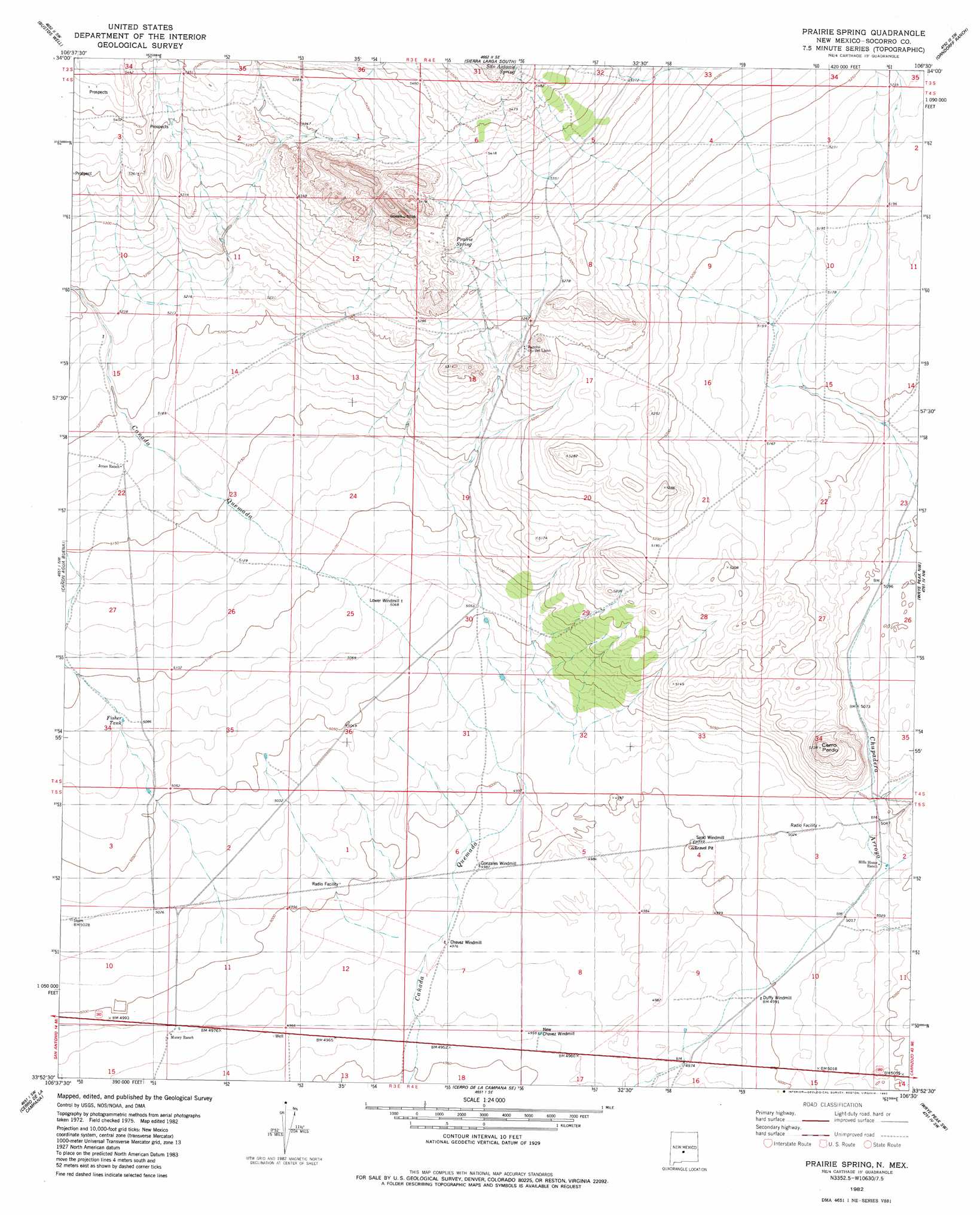
USGS Topo Quad 33106h5 - 1:24,000 scale
| Topo Map Name: | Prairie Spring |
| USGS Topo Quad ID: | 33106h5 |
| Print Size: | ca. 21 1/4" wide x 27" high |
| Southeast Coordinates: | 33.875° N latitude / 106.5° W longitude |
| Map Center Coordinates: | 33.9375° N latitude / 106.5625° W longitude |
| U.S. State: | NM |
| Filename: | o33106h5.jpg |
| Download Map JPG Image: | Prairie Spring topo map 1:24,000 scale |
| Map Type: | Topographic |
| Topo Series: | 7.5´ |
| Map Scale: | 1:24,000 |
| Source of Map Images: | United States Geological Survey (USGS) |
| Alternate Map Versions: |
Prairie Spring NM 1982, updated 1982 Download PDF Buy paper map Prairie Spring NM 2010 Download PDF Buy paper map Prairie Spring NM 2013 Download PDF Buy paper map Prairie Spring NM 2017 Download PDF Buy paper map |
1:24,000 Topo Quads surrounding Prairie Spring
Mesa Del Yeso |
Sierra De La Cruz |
Sierra Larga North |
Bishop Ranch |
Chupadera Spring |
Loma De Las Canas |
Bustos Well |
Sierra Larga South |
Orndorff Ranch |
Wilson Ranch |
San Antonio |
Canon Agua Buena |
Prairie Spring |
Wrye Peak Nw |
Wrye Peak |
San Antonio Se |
Cerro De La Campana |
Cerro De La Campana Se |
Wrye Peak Sw |
Garden Spring Canyon |
Little San Pasqual Mountain |
Granjean Well |
Greens Baber Well |
Trinity Site |
Oscura Peak |
> Back to 33106e1 at 1:100,000 scale
> Back to 33106a1 at 1:250,000 scale
> Back to U.S. Topo Maps home
Prairie Spring topo map: Gazetteer
Prairie Spring: Reservoirs
Fernandez Tank elevation 1583m 5193′Fisher Tank elevation 1551m 5088′
Prairie Spring: Springs
Llano Spring elevation 1630m 5347′Prairie Spring elevation 1632m 5354′
Prairie Spring: Summits
Cerro Pardo elevation 1595m 5232′Prairie Spring: Valleys
Cañon Quemado elevation 1594m 5229′Prairie Spring: Wells
10041 Water Well elevation 1558m 5111′Little Well elevation 1555m 5101′
Nep Chaves Water Well elevation 1509m 4950′
Prairie Spring digital topo map on disk
Buy this Prairie Spring topo map showing relief, roads, GPS coordinates and other geographical features, as a high-resolution digital map file on DVD: