Elevator Mountain Topo Map Arizona
To zoom in, hover over the map of Elevator Mountain
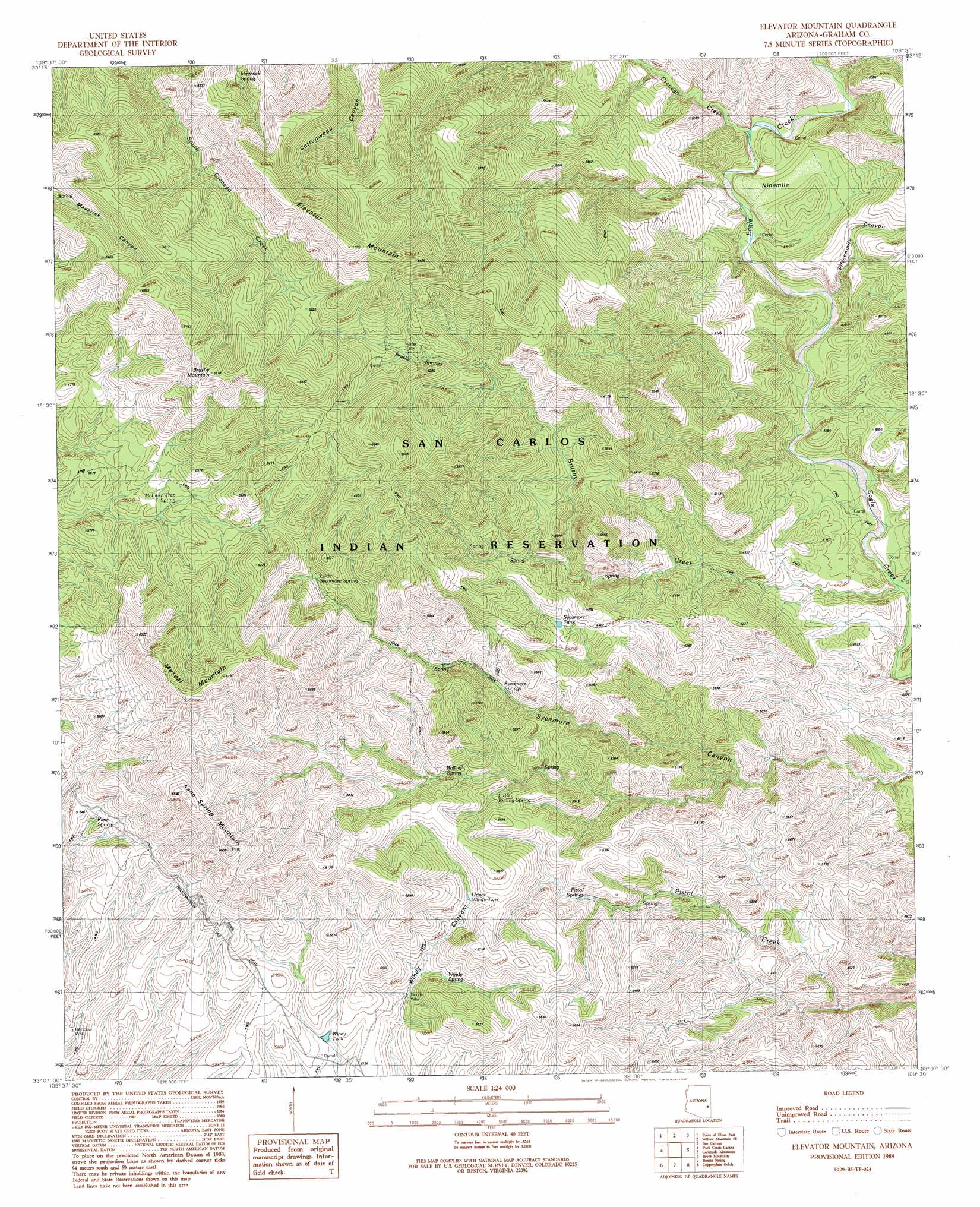
USGS Topo Quad 33109b5 - 1:24,000 scale
| Topo Map Name: | Elevator Mountain |
| USGS Topo Quad ID: | 33109b5 |
| Print Size: | ca. 21 1/4" wide x 27" high |
| Southeast Coordinates: | 33.125° N latitude / 109.5° W longitude |
| Map Center Coordinates: | 33.1875° N latitude / 109.5625° W longitude |
| U.S. State: | AZ |
| Filename: | o33109b5.jpg |
| Download Map JPG Image: | Elevator Mountain topo map 1:24,000 scale |
| Map Type: | Topographic |
| Topo Series: | 7.5´ |
| Map Scale: | 1:24,000 |
| Source of Map Images: | United States Geological Survey (USGS) |
| Alternate Map Versions: |
Elevator Mountain AZ 1989, updated 1990 Download PDF Buy paper map Elevator Mountain AZ 2011 Download PDF Buy paper map Elevator Mountain AZ 2014 Download PDF Buy paper map |
1:24,000 Topo Quads surrounding Elevator Mountain
Natanes Mountains Ne |
Sawbuck Mountain |
Willow Mountain |
Robinson Mesa |
Rose Peak |
Point Of Pines West |
Point Of Pines East |
Willow Mountain Se |
Bee Canyon |
Pipestem Mountain |
Bonita Tank |
Park Creek Cabins |
Elevator Mountain |
Coronado Mountain |
Mitchell Peak |
Markham Creek |
Bryce Mountain |
Bonita Spring |
Copperplate Gulch |
Clifton |
Pima |
Weber Peak |
Lone Star Mountain |
Gila Box |
Guthrie |
> Back to 33109a1 at 1:100,000 scale
> Back to 33108a1 at 1:250,000 scale
> Back to U.S. Topo Maps home
Elevator Mountain topo map: Gazetteer
Elevator Mountain: Areas
Holding Pasture elevation 1353m 4438′Ninemile elevation 1429m 4688′
Elevator Mountain: Reservoirs
Sycamore Tank elevation 1581m 5187′Upper Windy Tank elevation 1595m 5232′
Windy Tank elevation 1553m 5095′
Elevator Mountain: Springs
Boiling Spring elevation 1572m 5157′Brushy Springs elevation 1758m 5767′
Kane Spring elevation 1637m 5370′
Little Boiling Spring elevation 1558m 5111′
Little Sycamore Spring elevation 1720m 5643′
Maverick Spring elevation 1742m 5715′
McEwen Trap Spring elevation 1718m 5636′
Sycamore Springs elevation 1555m 5101′
Windy Spring elevation 1534m 5032′
Elevator Mountain: Streams
Brushy Creek elevation 1272m 4173′Cienega Creek elevation 1339m 4393′
Tule Creek elevation 1272m 4173′
Elevator Mountain: Summits
Brushy Mountain elevation 2078m 6817′Elevator Mountain elevation 2156m 7073′
Kane Spring Mountain elevation 2021m 6630′
Mescal Mountain elevation 2036m 6679′
Elevator Mountain: Valleys
Fifteenmile Canyon elevation 1314m 4311′Elevator Mountain: Wells
Windy Well elevation 1530m 5019′Elevator Mountain digital topo map on disk
Buy this Elevator Mountain topo map showing relief, roads, GPS coordinates and other geographical features, as a high-resolution digital map file on DVD: