Montezuma Peak Topo Map Arizona
To zoom in, hover over the map of Montezuma Peak
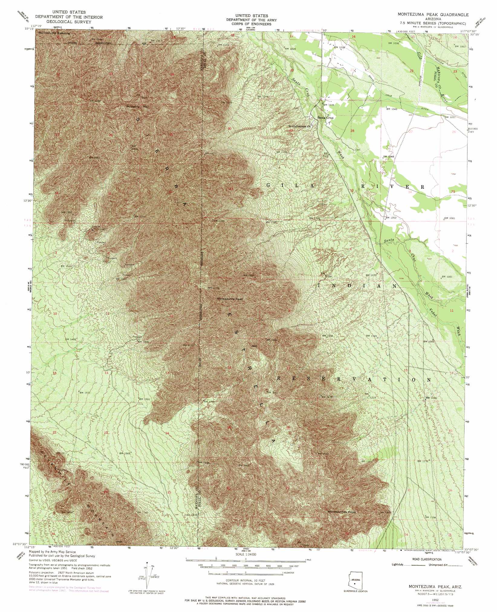
USGS Topo Quad 33112b2 - 1:24,000 scale
| Topo Map Name: | Montezuma Peak |
| USGS Topo Quad ID: | 33112b2 |
| Print Size: | ca. 21 1/4" wide x 27" high |
| Southeast Coordinates: | 33.125° N latitude / 112.125° W longitude |
| Map Center Coordinates: | 33.1875° N latitude / 112.1875° W longitude |
| U.S. State: | AZ |
| Filename: | o33112b2.jpg |
| Download Map JPG Image: | Montezuma Peak topo map 1:24,000 scale |
| Map Type: | Topographic |
| Topo Series: | 7.5´ |
| Map Scale: | 1:24,000 |
| Source of Map Images: | United States Geological Survey (USGS) |
| Alternate Map Versions: |
Montezuma Peak AZ 1952, updated 1957 Download PDF Buy paper map Montezuma Peak AZ 1952, updated 1968 Download PDF Buy paper map Montezuma Peak AZ 1952, updated 1978 Download PDF Buy paper map Montezuma Peak AZ 1971, updated 1972 Download PDF Buy paper map Montezuma Peak AZ 2011 Download PDF Buy paper map Montezuma Peak AZ 2014 Download PDF Buy paper map |
1:24,000 Topo Quads surrounding Montezuma Peak
Perryville |
Tolleson |
Fowler |
Phoenix |
Tempe |
Avondale Sw |
Avondale Se |
Laveen |
Lone Butte |
Guadalupe |
Mobile Nw |
Mobile Ne |
Montezuma Peak |
Pima Butte |
Gila Butte Nw |
Butterfield Pass |
Mobile |
Enid |
Maricopa |
Sacaton Butte |
Estrella |
Conley Well |
Haley Hills |
Antelope Peak Ne |
Stanfield |
> Back to 33112a1 at 1:100,000 scale
> Back to 33112a1 at 1:250,000 scale
> Back to U.S. Topo Maps home
Montezuma Peak topo map: Gazetteer
Montezuma Peak: Canals
Santa Cruz Ditch elevation 0m 0′Montezuma Peak: Mines
Crusher Mica Quarry elevation 528m 1732′Montezuma Peak: Populated Places
Santa Cruz elevation 318m 1043′Montezuma Peak: Ridges
Sierra Estrella elevation 0m 0′Montezuma Peak: Streams
Vekol Wash elevation 320m 1049′Montezuma Peak: Summits
Butterfly Mountain elevation 1221m 4005′Montezuma Peak elevation 1313m 4307′
Montezuma Sleeping elevation 1113m 3651′
Montezumas Head elevation 644m 2112′
Montezuma Peak digital topo map on disk
Buy this Montezuma Peak topo map showing relief, roads, GPS coordinates and other geographical features, as a high-resolution digital map file on DVD: