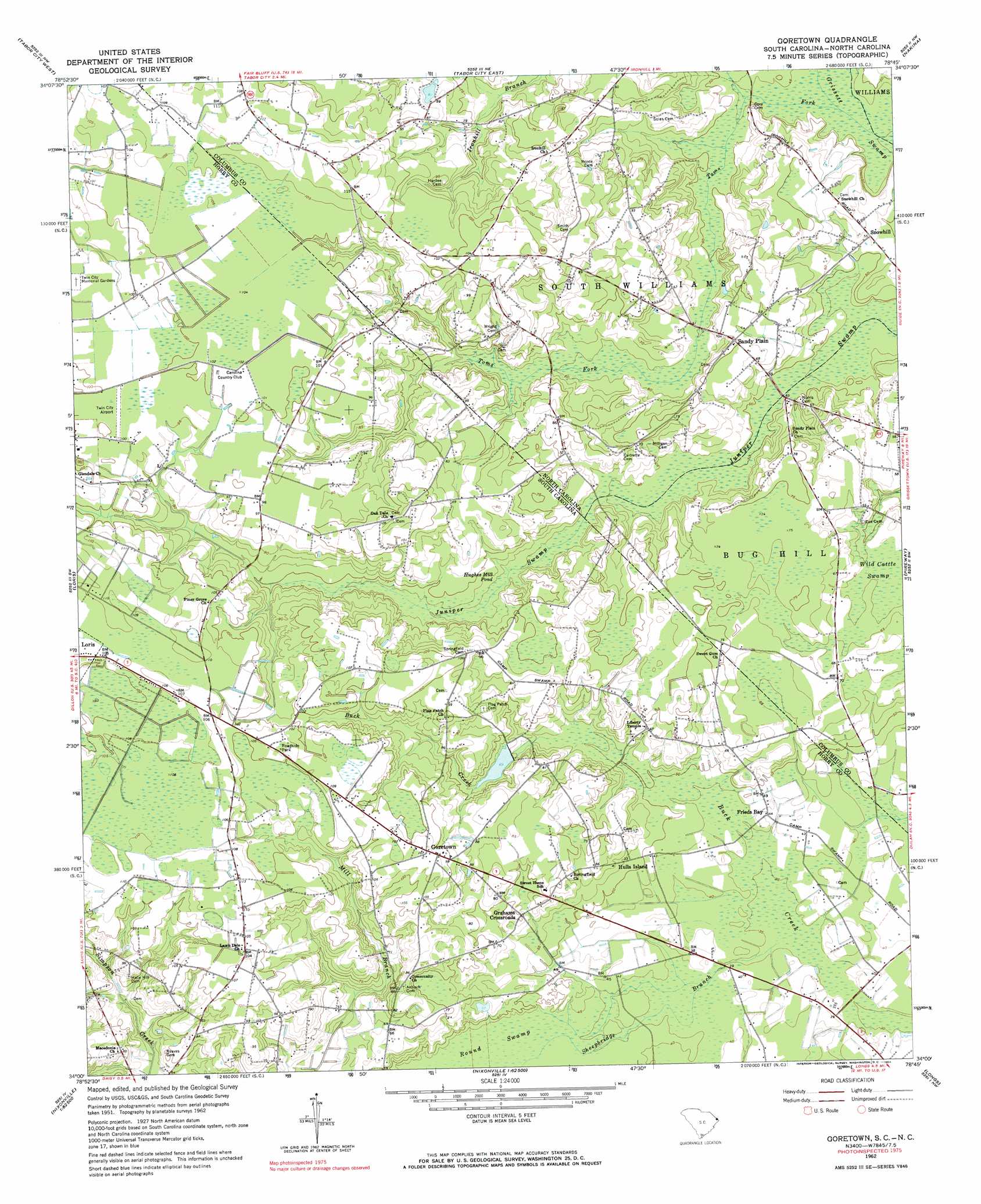
Goretown Topo Map South Carolina
To zoom in, hover over the map of Goretown
USGS Topo Quad 34078a7 - 1:24,000 scale
| Topo Map Name: | Goretown |
| USGS Topo Quad ID: | 34078a7 |
| Print Size: | ca. 21 1/4" wide x 27" high |
| Southeast Coordinates: | 34° N latitude / 78.75° W longitude |
| Map Center Coordinates: | 34.0625° N latitude / 78.8125° W longitude |
| U.S. States: | SC, NC |
| Filename: | o34078a7.jpg |
| Download Map JPG Image: | Goretown topo map 1:24,000 scale |
| Map Type: | Topographic |
| Topo Series: | 7.5´ |
| Map Scale: | 1:24,000 |
| Source of Map Images: | United States Geological Survey (USGS) |
| Alternate Map Versions: |
Goretown SC 1962, updated 1964 Download PDF Buy paper map Goretown SC 1962, updated 1975 Download PDF Buy paper map Goretown SC 2011 Download PDF Buy paper map Goretown SC 2014 Download PDF Buy paper map |
1:24,000 Topo Quads surrounding Goretown
Fair Bluff |
Cerro Gordo |
Chadbourn |
Whiteville |
Lake Waccamaw West |
Duford |
Tabor City West |
Tabor City East |
Nakina |
Old Dock |
Bayboro |
Loris |
Goretown |
Pireway |
Freeland |
Adrian |
Shell |
Hammond |
Longs |
Calabash |
Conway |
Nixonville |
Hand |
Wampee |
Little River |
> Back to 34078a1 at 1:100,000 scale
> Back to 34078a1 at 1:250,000 scale
> Back to U.S. Topo Maps home
Goretown topo map: Gazetteer
Goretown: Airports
Twin City Airport elevation 30m 98′Goretown: Lakes
Hughes Mill Pond elevation 19m 62′Goretown: Populated Places
Frieds Bay elevation 13m 42′Goretown elevation 32m 104′
Grahams Crossroads elevation 21m 68′
Hulls Island elevation 14m 45′
Sandy Plain elevation 22m 72′
Snowhill elevation 16m 52′
Goretown: Streams
Sheepbridge Branch elevation 10m 32′Toms Fork elevation 13m 42′
Toms Fork elevation 12m 39′
Goretown: Swamps
Round Swamp elevation 13m 42′Wild Cattle Swamp elevation 17m 55′
Goretown digital topo map on disk
Buy this Goretown topo map showing relief, roads, GPS coordinates and other geographical features, as a high-resolution digital map file on DVD:
South Carolina, Western North Carolina & Northeastern Georgia
Buy digital topo maps: South Carolina, Western North Carolina & Northeastern Georgia