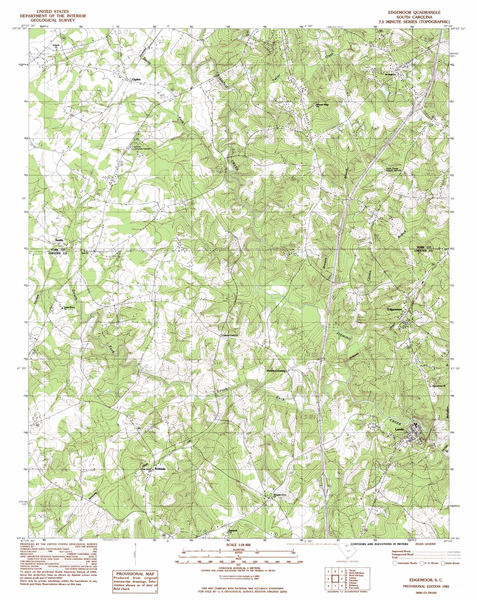
Edgemoor Topo Map South Carolina
To zoom in, hover over the map of Edgemoor
USGS Topo Quad 34081g1 - 1:24,000 scale
| Topo Map Name: | Edgemoor |
| USGS Topo Quad ID: | 34081g1 |
| Print Size: | ca. 21 1/4" wide x 27" high |
| Southeast Coordinates: | 34.75° N latitude / 81° W longitude |
| Map Center Coordinates: | 34.8125° N latitude / 81.0625° W longitude |
| U.S. State: | SC |
| Filename: | o34081g1.jpg |
| Download Map JPG Image: | Edgemoor topo map 1:24,000 scale |
| Map Type: | Topographic |
| Topo Series: | 7.5´ |
| Map Scale: | 1:24,000 |
| Source of Map Images: | United States Geological Survey (USGS) |
| Alternate Map Versions: |
Edgemoor SC 1982, updated 1983 Download PDF Buy paper map Edgemoor SC 2011 Download PDF Buy paper map Edgemoor SC 2014 Download PDF Buy paper map |
1:24,000 Topo Quads surrounding Edgemoor
Filbert |
Clover |
Lake Wylie |
Fort Mill |
Weddington |
Sharon |
Tirzah |
Rock Hill West |
Rock Hill East |
Catawba Ne |
Armenia |
Lowrys |
Edgemoor |
Catawba |
Van Wyck |
Baton Rouge |
Chester |
Richburg |
Fort Lawn |
Lancaster |
Carlisle Se |
Blackstock |
Stover |
Great Falls |
Lancaster Se |
> Back to 34081e1 at 1:100,000 scale
> Back to 34080a1 at 1:250,000 scale
> Back to U.S. Topo Maps home
Edgemoor topo map: Gazetteer
Edgemoor: Crossings
Interchange 73 elevation 191m 626′Edgemoor: Populated Places
Deas Mill elevation 156m 511′Edgemoor elevation 180m 590′
Hicklin Crossing elevation 162m 531′
Lando elevation 155m 508′
Ogden elevation 162m 531′
Rodman elevation 176m 577′
Smith elevation 162m 531′
Edgemoor: Reservoirs
Reids Pool elevation 170m 557′Edgemoor: Streams
Browns Branch elevation 143m 469′Clinton Branch elevation 141m 462′
Hicklin Branch elevation 125m 410′
South Fork Fishing Creek elevation 140m 459′
Stony Fork elevation 147m 482′
Taylor Creek elevation 150m 492′
Edgemoor digital topo map on disk
Buy this Edgemoor topo map showing relief, roads, GPS coordinates and other geographical features, as a high-resolution digital map file on DVD:
South Carolina, Western North Carolina & Northeastern Georgia
Buy digital topo maps: South Carolina, Western North Carolina & Northeastern Georgia