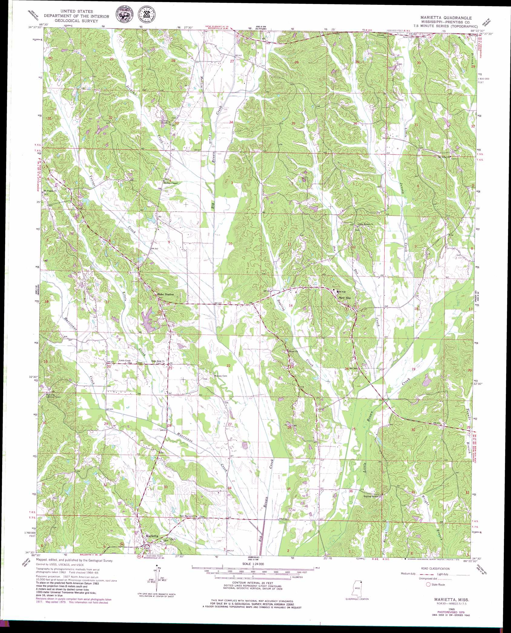
Marietta Topo Map Mississippi
To zoom in, hover over the map of Marietta
USGS Topo Quad 34088e4 - 1:24,000 scale
| Topo Map Name: | Marietta |
| USGS Topo Quad ID: | 34088e4 |
| Print Size: | ca. 21 1/4" wide x 27" high |
| Southeast Coordinates: | 34.5° N latitude / 88.375° W longitude |
| Map Center Coordinates: | 34.5625° N latitude / 88.4375° W longitude |
| U.S. State: | MS |
| Filename: | o34088e4.jpg |
| Download Map JPG Image: | Marietta topo map 1:24,000 scale |
| Map Type: | Topographic |
| Topo Series: | 7.5´ |
| Map Scale: | 1:24,000 |
| Source of Map Images: | United States Geological Survey (USGS) |
| Alternate Map Versions: |
Marietta MS 1965, updated 1966 Download PDF Buy paper map Marietta MS 1965, updated 1979 Download PDF Buy paper map Marietta MS 2012 Download PDF Buy paper map Marietta MS 2015 Download PDF Buy paper map |
1:24,000 Topo Quads surrounding Marietta
Kossuth South |
Rienzi |
Glens |
Burnsville |
Iuka |
Jumpertown |
Booneville |
Altitude |
Paden |
Tishomingo |
Baldwyn |
Wheeler |
Marietta |
Paden Se |
Belmont |
Guntown |
Ratliff |
Kirkville |
Fulton Ne |
Red Bay |
Tupelo |
Mooreville |
Fulton |
Fulton Se |
Shottsville |
> Back to 34088e1 at 1:100,000 scale
> Back to 34088a1 at 1:250,000 scale
> Back to U.S. Topo Maps home
Marietta topo map: Gazetteer
Marietta: Dams
Depoyster Lake Dam elevation 110m 360′Marietta: Populated Places
Blythes Chapel elevation 110m 360′Hobo Station elevation 123m 403′
Marietta elevation 116m 380′
New Site elevation 123m 403′
Marietta: Streams
Hurricane Creek elevation 93m 305′Jenkins Creek elevation 98m 321′
Little Creek elevation 96m 314′
Little Jensay Creek elevation 99m 324′
Martin Creek elevation 98m 321′
Pee Dee Creek elevation 97m 318′
Sapling Creek elevation 96m 314′
Youngs Creek elevation 95m 311′
Marietta digital topo map on disk
Buy this Marietta topo map showing relief, roads, GPS coordinates and other geographical features, as a high-resolution digital map file on DVD: