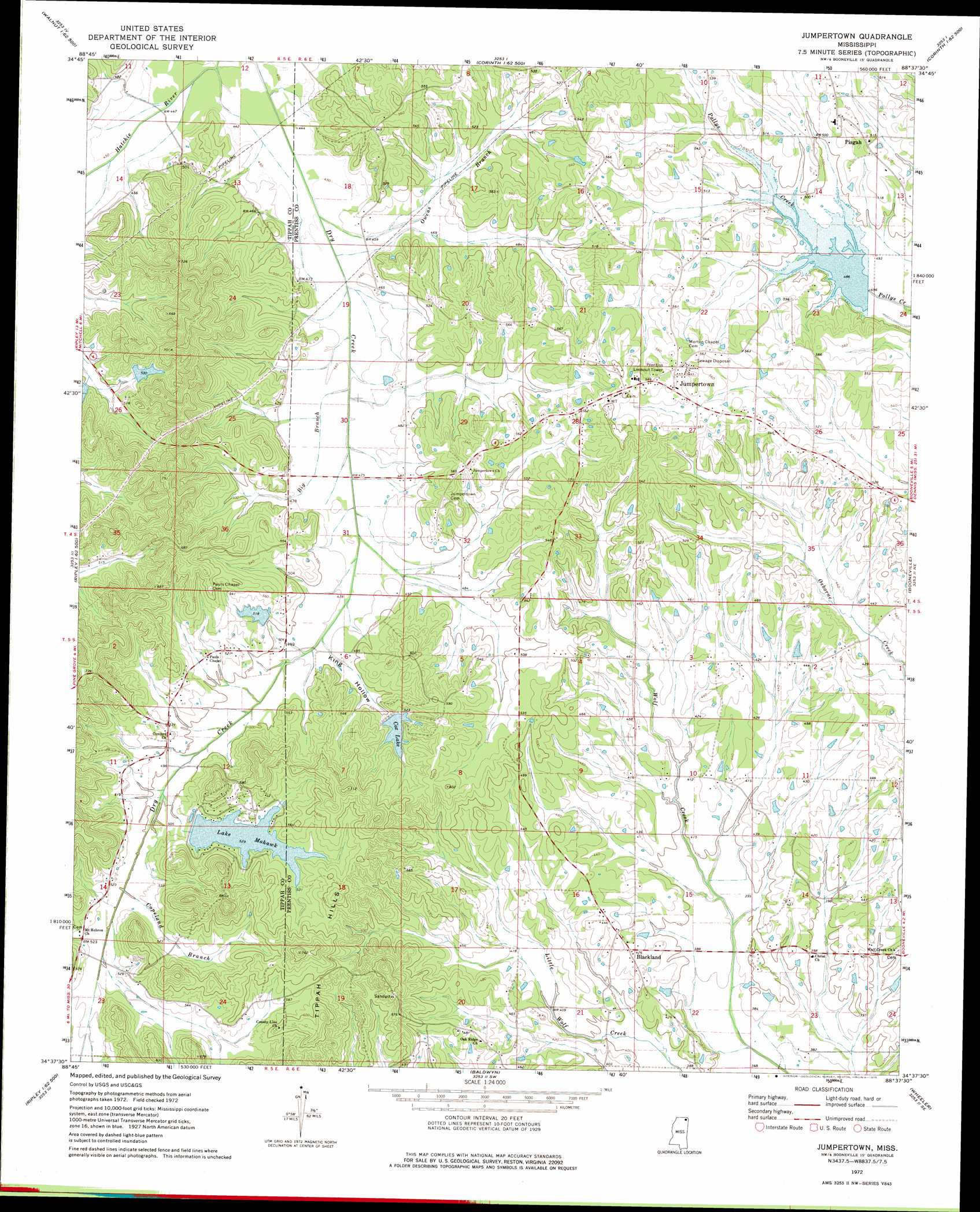
Jumpertown Topo Map Mississippi
To zoom in, hover over the map of Jumpertown
USGS Topo Quad 34088f6 - 1:24,000 scale
| Topo Map Name: | Jumpertown |
| USGS Topo Quad ID: | 34088f6 |
| Print Size: | ca. 21 1/4" wide x 27" high |
| Southeast Coordinates: | 34.625° N latitude / 88.625° W longitude |
| Map Center Coordinates: | 34.6875° N latitude / 88.6875° W longitude |
| U.S. State: | MS |
| Filename: | o34088f6.jpg |
| Download Map JPG Image: | Jumpertown topo map 1:24,000 scale |
| Map Type: | Topographic |
| Topo Series: | 7.5´ |
| Map Scale: | 1:24,000 |
| Source of Map Images: | United States Geological Survey (USGS) |
| Alternate Map Versions: |
Jumpertown MS 1972, updated 1975 Download PDF Buy paper map Jumpertown MS 2012 Download PDF Buy paper map Jumpertown MS 2015 Download PDF Buy paper map |
1:24,000 Topo Quads surrounding Jumpertown
Walnut |
Chalybeate |
Kossuth North |
Corinth |
Kendrick |
Falkner |
Peoples |
Kossuth South |
Rienzi |
Glens |
Ripley |
Dumas |
Jumpertown |
Booneville |
Altitude |
Keownville |
Pleasant Ridge |
Baldwyn |
Wheeler |
Marietta |
New Albany East |
Ellistown |
Guntown |
Ratliff |
Kirkville |
> Back to 34088e1 at 1:100,000 scale
> Back to 34088a1 at 1:250,000 scale
> Back to U.S. Topo Maps home
Jumpertown topo map: Gazetteer
Jumpertown: Dams
Cornelius Lake Dam elevation 158m 518′D Carmichael lake Dam elevation 153m 501′
Doyle Cox Lake Dam elevation 163m 534′
Lake Mohawk Dam elevation 159m 521′
Tuscumbia Structure 38 Dam elevation 147m 482′
Jumpertown: Populated Places
Blackland elevation 133m 436′Dry Creek elevation 157m 515′
Jumpertown elevation 177m 580′
Pisgah elevation 165m 541′
Jumpertown: Reservoirs
Cox Lake elevation 154m 505′Lake Mohawk elevation 159m 521′
Jumpertown: Streams
Big Branch elevation 137m 449′Copeland Branch elevation 151m 495′
Guin Branch elevation 140m 459′
Owens Branch elevation 135m 442′
Jumpertown: Valleys
King Hollow elevation 144m 472′Jumpertown digital topo map on disk
Buy this Jumpertown topo map showing relief, roads, GPS coordinates and other geographical features, as a high-resolution digital map file on DVD: