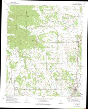
Baldwyn Topo Map Mississippi
To zoom in, hover over the map of Baldwyn
USGS Topo Quad 34088e6 - 1:24,000 scale
| Topo Map Name: | Baldwyn |
| USGS Topo Quad ID: | 34088e6 |
| Print Size: | ca. 21 1/4" wide x 27" high |
| Southeast Coordinates: | 34.5° N latitude / 88.625° W longitude |
| Map Center Coordinates: | 34.5625° N latitude / 88.6875° W longitude |
| U.S. State: | MS |
| Filename: | o34088e6.jpg |
| Download Map JPG Image: | Baldwyn topo map 1:24,000 scale |
| Map Type: | Topographic |
| Topo Series: | 7.5´ |
| Map Scale: | 1:24,000 |
| Source of Map Images: | United States Geological Survey (USGS) |
| Alternate Map Versions: |
Baldwyn MS 1973, updated 1975 Download PDF Buy paper map Baldwyn MS 1973, updated 1975 Download PDF Buy paper map Baldwyn MS 2012 Download PDF Buy paper map Baldwyn MS 2015 Download PDF Buy paper map |
1:24,000 Topo Quads surrounding Baldwyn
> Back to 34088e1 at 1:100,000 scale
> Back to 34088a1 at 1:250,000 scale
> Back to U.S. Topo Maps home
Baldwyn topo map: Gazetteer
Baldwyn: Airports
Booneville-Baldwyn Airport elevation 116m 380′Baldwyn: Parks
Brices Cross Roads National Battlefield Site elevation 139m 456′Baldwyn: Populated Places
Baldwyn elevation 122m 400′Bethany elevation 140m 459′
Frankstown elevation 122m 400′
Geeville elevation 141m 462′
Lebanon elevation 141m 462′
Baldwyn: Streams
Little Wolf Creek elevation 106m 347′Baldwyn: Summits
Geeville Mountain elevation 217m 711′Kitchen Mountain elevation 221m 725′
Lebanon Mountain elevation 242m 793′
Tippah Hills elevation 228m 748′
Baldwyn digital topo map on disk
Buy this Baldwyn topo map showing relief, roads, GPS coordinates and other geographical features, as a high-resolution digital map file on DVD:


