Tula Topo Map Mississippi
To zoom in, hover over the map of Tula
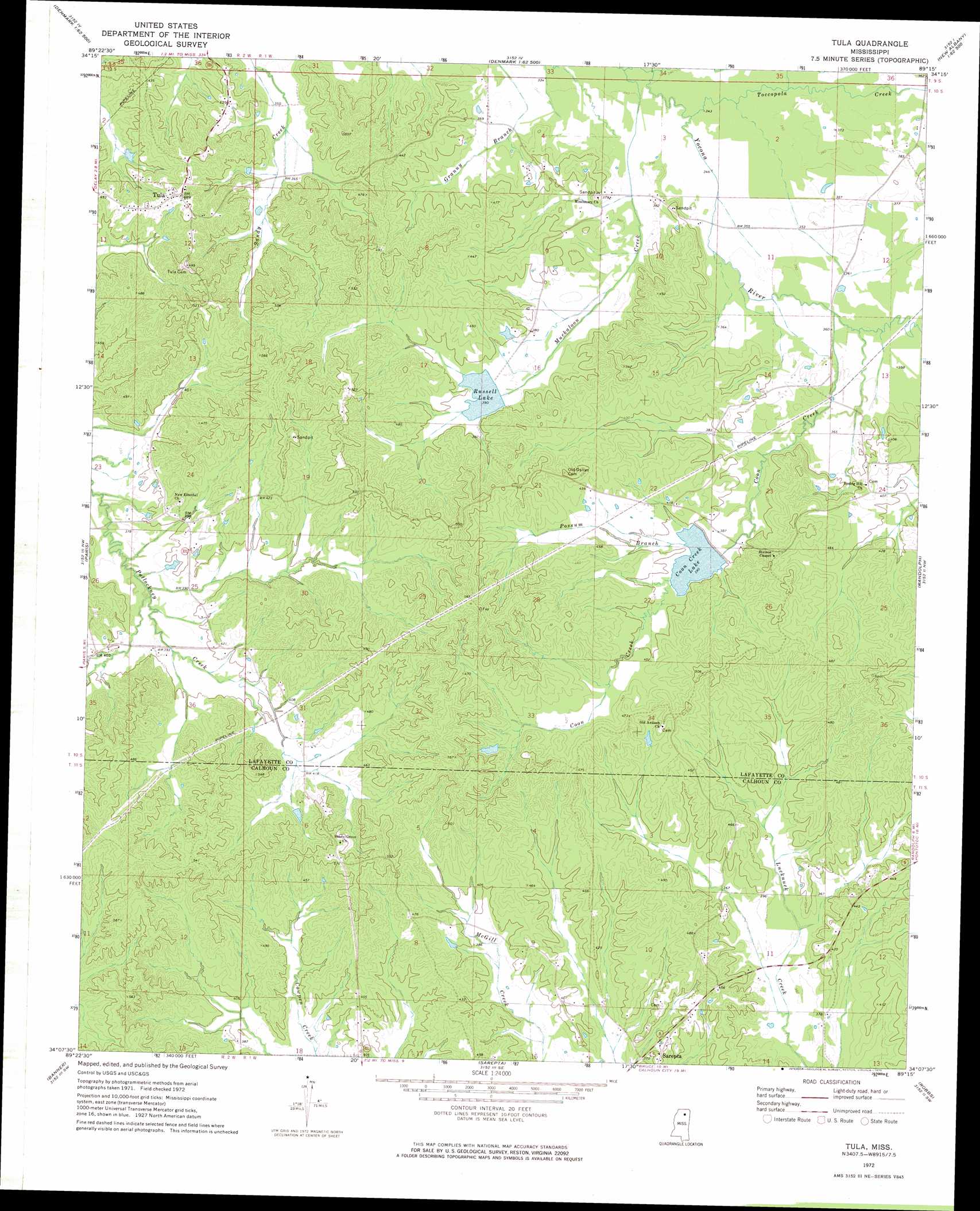
USGS Topo Quad 34089b3 - 1:24,000 scale
| Topo Map Name: | Tula |
| USGS Topo Quad ID: | 34089b3 |
| Print Size: | ca. 21 1/4" wide x 27" high |
| Southeast Coordinates: | 34.125° N latitude / 89.25° W longitude |
| Map Center Coordinates: | 34.1875° N latitude / 89.3125° W longitude |
| U.S. State: | MS |
| Filename: | o34089b3.jpg |
| Download Map JPG Image: | Tula topo map 1:24,000 scale |
| Map Type: | Topographic |
| Topo Series: | 7.5´ |
| Map Scale: | 1:24,000 |
| Source of Map Images: | United States Geological Survey (USGS) |
| Alternate Map Versions: |
Tula MS 1972, updated 1975 Download PDF Buy paper map Tula MS 2012 Download PDF Buy paper map Tula MS 2015 Download PDF Buy paper map |
1:24,000 Topo Quads surrounding Tula
Oxford North |
Bagley Lake |
Puskus Lake |
Etta |
New Albany West |
Oxford South |
Yocona |
Denmark |
Thaxton |
Northwest Pontotoc |
Water Valley East |
Paris |
Tula |
Randolph |
Southwest Pontotoc |
Pine Valley |
Banner |
Sarepta |
Robbs |
Houlka |
Benwood |
Skuna |
Bruce |
Vardaman |
Houston West |
> Back to 34089a1 at 1:100,000 scale
> Back to 34088a1 at 1:250,000 scale
> Back to U.S. Topo Maps home
Tula topo map: Gazetteer
Tula: Dams
Yocona Watershed Y-14-14 Dam elevation 116m 380′Yocona Watershed Y-14-15 Dam elevation 118m 387′
Yocona Watershed Y-14-16 Dam elevation 111m 364′
Tula: Populated Places
Potlockney elevation 123m 403′Spring Hill elevation 128m 419′
Tula elevation 148m 485′
Tula: Reservoirs
Coon Creek Lake elevation 116m 380′Russell Lake elevation 116m 380′
Tula: Streams
Coon Creek elevation 107m 351′McGlawin Creek elevation 103m 337′
Muckaloon Creek elevation 102m 334′
Possum Branch elevation 116m 380′
Toccopola Creek elevation 104m 341′
Tula digital topo map on disk
Buy this Tula topo map showing relief, roads, GPS coordinates and other geographical features, as a high-resolution digital map file on DVD: