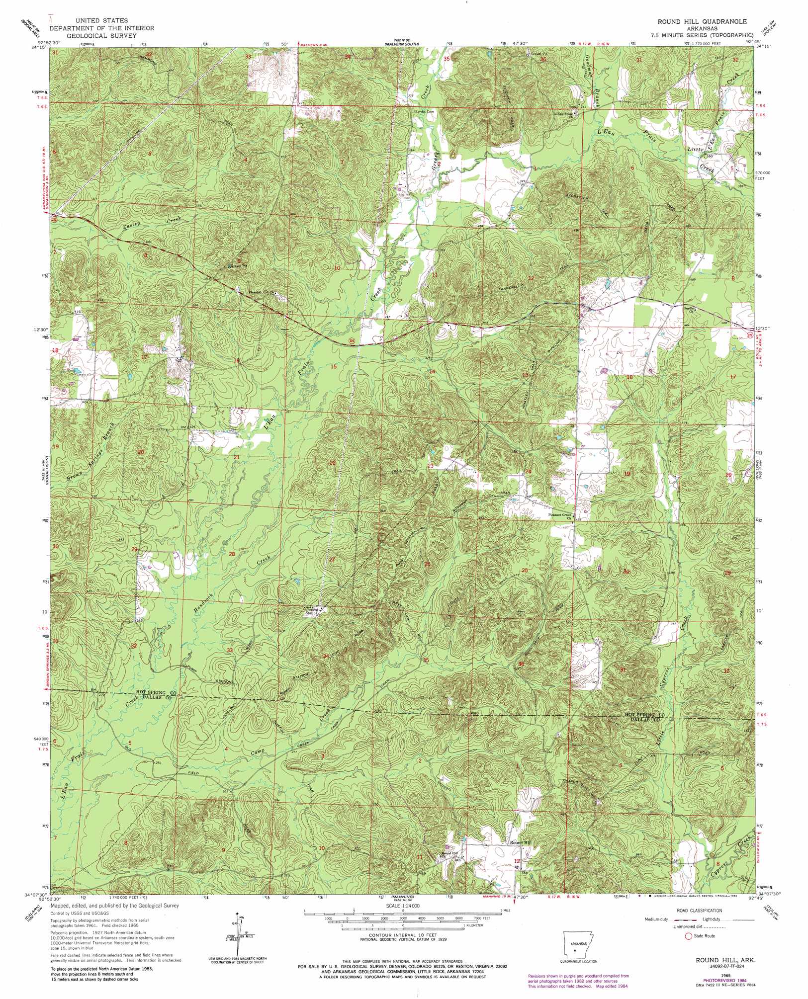
Round Hill Topo Map Arkansas
To zoom in, hover over the map of Round Hill
USGS Topo Quad 34092b7 - 1:24,000 scale
| Topo Map Name: | Round Hill |
| USGS Topo Quad ID: | 34092b7 |
| Print Size: | ca. 21 1/4" wide x 27" high |
| Southeast Coordinates: | 34.125° N latitude / 92.75° W longitude |
| Map Center Coordinates: | 34.1875° N latitude / 92.8125° W longitude |
| U.S. State: | AR |
| Filename: | o34092b7.jpg |
| Download Map JPG Image: | Round Hill topo map 1:24,000 scale |
| Map Type: | Topographic |
| Topo Series: | 7.5´ |
| Map Scale: | 1:24,000 |
| Source of Map Images: | United States Geological Survey (USGS) |
| Alternate Map Versions: |
Round Hill AR 1965, updated 1966 Download PDF Buy paper map Round Hill AR 1965, updated 1984 Download PDF Buy paper map Round Hill AR 2011 Download PDF Buy paper map Round Hill AR 2014 Download PDF Buy paper map |
1:24,000 Topo Quads surrounding Round Hill
Hot Springs South |
Lake Catherine |
Malvern North |
Traskwood |
Tull |
De Roche |
Social Hill |
Malvern South |
Poyen |
Prattsville |
Caddo Valley |
Donaldson |
Round Hill |
Willow |
Leola |
Arkadelphia |
Dalark |
Manning |
Tulip |
Carthage |
Curtis |
Sparkman Nw |
Sparkman |
Princeton West |
Princeton East |
> Back to 34092a1 at 1:100,000 scale
> Back to 34092a1 at 1:250,000 scale
> Back to U.S. Topo Maps home
Round Hill topo map: Gazetteer
Round Hill: Populated Places
Round Hill elevation 141m 462′Round Hill: Streams
Camp Creek elevation 84m 275′Goodman Branch elevation 106m 347′
Greasy Creek elevation 96m 314′
Handcock Creek elevation 77m 252′
Little Cypress Creek elevation 106m 347′
Little L'Eau Frais Creek elevation 109m 357′
Round Hill digital topo map on disk
Buy this Round Hill topo map showing relief, roads, GPS coordinates and other geographical features, as a high-resolution digital map file on DVD: