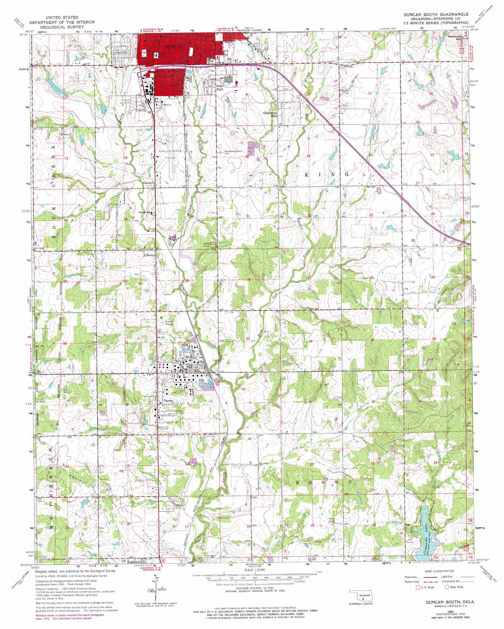
Duncan South Topo Map Oklahoma
To zoom in, hover over the map of Duncan South
USGS Topo Quad 34097d8 - 1:24,000 scale
| Topo Map Name: | Duncan South |
| USGS Topo Quad ID: | 34097d8 |
| Print Size: | ca. 21 1/4" wide x 27" high |
| Southeast Coordinates: | 34.375° N latitude / 97.875° W longitude |
| Map Center Coordinates: | 34.4375° N latitude / 97.9375° W longitude |
| U.S. State: | OK |
| Filename: | o34097d8.jpg |
| Download Map JPG Image: | Duncan South topo map 1:24,000 scale |
| Map Type: | Topographic |
| Topo Series: | 7.5´ |
| Map Scale: | 1:24,000 |
| Source of Map Images: | United States Geological Survey (USGS) |
| Alternate Map Versions: |
Duncan South OK 1964, updated 1965 Download PDF Buy paper map Duncan South OK 1964, updated 1977 Download PDF Buy paper map Duncan South OK 2009 Download PDF Buy paper map Duncan South OK 2012 Download PDF Buy paper map Duncan South OK 2016 Download PDF Buy paper map |
1:24,000 Topo Quads surrounding Duncan South
Sterling |
Denton |
Marlow |
Bray |
Cox City |
Letitia |
Nellie |
Duncan North |
Hope |
Lake Fuqua |
Temple Nw |
Empire City |
Duncan South |
Harrisburg |
Velma |
Temple |
Corum |
Comanche |
Comanche Se |
Loco |
Hooper |
Waurika West |
Waurika East |
Ryan Ne |
Ringling Nw |
> Back to 34097a1 at 1:100,000 scale
> Back to 34096a1 at 1:250,000 scale
> Back to U.S. Topo Maps home
Duncan South topo map: Gazetteer
Duncan South: Airports
Halliburton Field elevation 334m 1095′Duncan South: Dams
Buckhorn Stockpond Dam elevation 347m 1138′Cow Creek Site 15 Dam elevation 344m 1128′
Cow Creek Site Number 14 Dam elevation 319m 1046′
Ok Number Name 137087 Dam elevation 332m 1089′
Oknoname 137045 Dam elevation 332m 1089′
Oknoname 137053 Dam elevation 336m 1102′
Oknoname 137092 Dam elevation 322m 1056′
Duncan South: Populated Places
Dixie Park elevation 336m 1102′Liberty elevation 321m 1053′
Meridian elevation 333m 1092′
Oklahoma Hills elevation 332m 1089′
Sunray elevation 324m 1062′
Duncan South: Reservoirs
Cow Creek Site 15 Reservoir elevation 344m 1128′Cow Creek Site Number 14 Reservoir elevation 319m 1046′
Oknoname 137045 Reservoir elevation 332m 1089′
Oknoname 137053 Reservoir elevation 336m 1102′
Oknoname 137087 Reservoir elevation 332m 1089′
Oknoname 137092 Reservoir elevation 322m 1056′
Duncan South: Streams
Claridy Creek elevation 304m 997′Willow Creek elevation 310m 1017′
Duncan South: Summits
Petticoat Hill elevation 384m 1259′Duncan South digital topo map on disk
Buy this Duncan South topo map showing relief, roads, GPS coordinates and other geographical features, as a high-resolution digital map file on DVD: