Arrowhead Well Topo Map New Mexico
To zoom in, hover over the map of Arrowhead Well
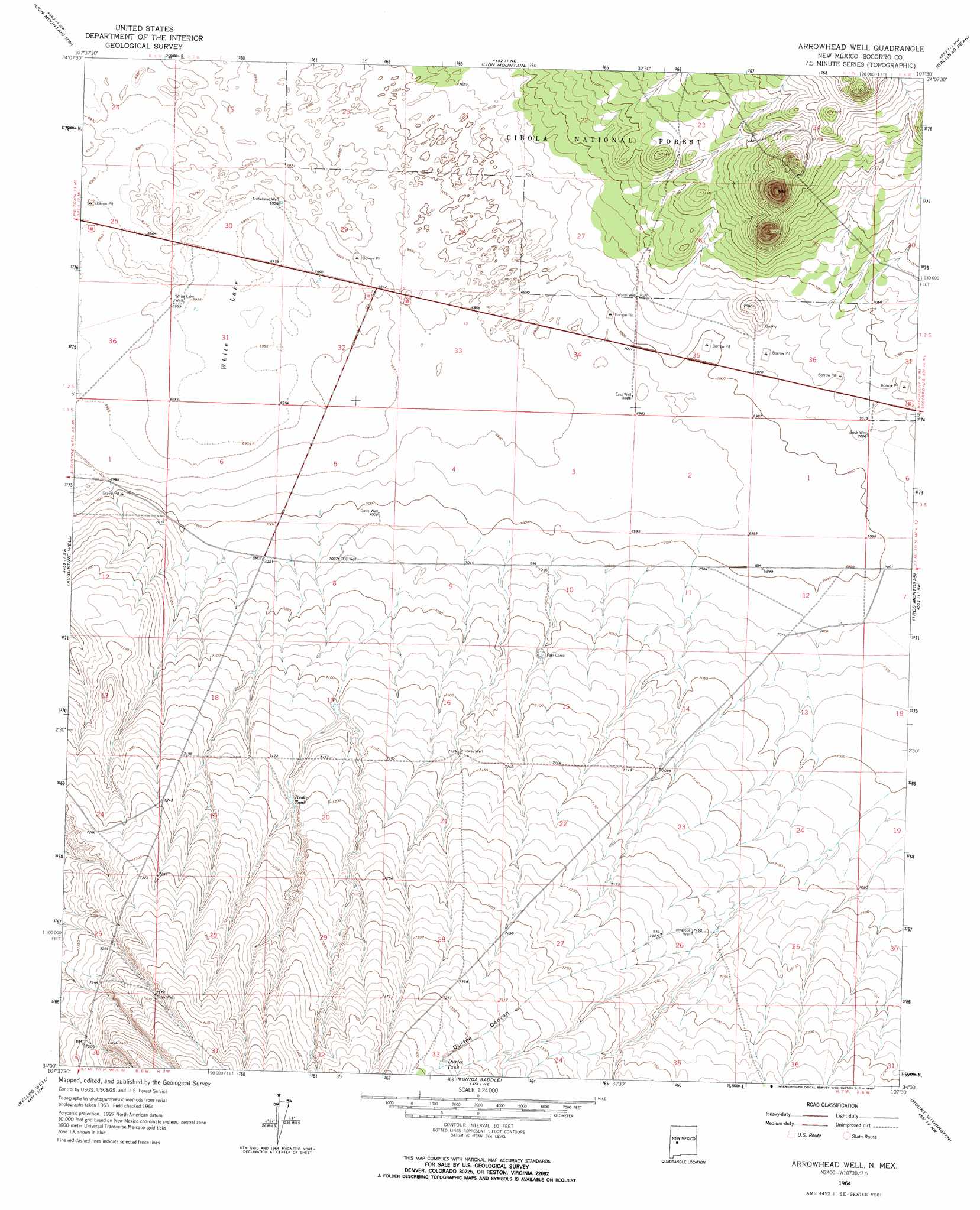
USGS Topo Quad 34107a5 - 1:24,000 scale
| Topo Map Name: | Arrowhead Well |
| USGS Topo Quad ID: | 34107a5 |
| Print Size: | ca. 21 1/4" wide x 27" high |
| Southeast Coordinates: | 34° N latitude / 107.5° W longitude |
| Map Center Coordinates: | 34.0625° N latitude / 107.5625° W longitude |
| U.S. State: | NM |
| Filename: | o34107a5.jpg |
| Download Map JPG Image: | Arrowhead Well topo map 1:24,000 scale |
| Map Type: | Topographic |
| Topo Series: | 7.5´ |
| Map Scale: | 1:24,000 |
| Source of Map Images: | United States Geological Survey (USGS) |
| Alternate Map Versions: |
Arrowhead Well NM 1964 Download PDF Buy paper map Arrowhead Well NM 1995, updated 1998 Download PDF Buy paper map Arrowhead Well NM 2011 Download PDF Buy paper map Arrowhead Well NM 2013 Download PDF Buy paper map Arrowhead Well NM 2017 Download PDF Buy paper map |
| FStopo: | US Forest Service topo Arrowhead Well is available: Download FStopo PDF Download FStopo TIF |
1:24,000 Topo Quads surrounding Arrowhead Well
Cal Ship Mesa |
Dog Springs |
Indian Mesa |
Indian Spring Canyon |
Mesa Cencerro |
Datil |
Lion Mountain Nw |
Lion Mountain |
Gallinas Peak |
Silver Hill |
Anderson Peak |
Augustine Well |
Arrowhead Well |
Tres Montosas |
Arroyo Landavaso |
C-N Lake |
Kellog Well |
Monica Saddle |
Mount Withington |
Squaw Peak |
Luera Mountains East |
Oak Peak |
Bay Buck Peaks |
Grassy Lookout |
Tenmile Hill |
> Back to 34107a1 at 1:100,000 scale
> Back to 34106a1 at 1:250,000 scale
> Back to U.S. Topo Maps home
Arrowhead Well topo map: Gazetteer
Arrowhead Well: Basins
White Lake elevation 2121m 6958′Arrowhead Well: Ranges
Sand Hills elevation 2122m 6961′Arrowhead Well: Reservoirs
Broke Tank elevation 2185m 7168′Durfee Tank elevation 2251m 7385′
Arrowhead Well: Valleys
Durfee Canyon elevation 2150m 7053′Arrowhead Well: Wells
Antelope Well elevation 2183m 7162′Arrowhead Well elevation 2121m 6958′
Buck Well elevation 2137m 7011′
CCC Well elevation 2144m 7034′
Davis Well elevation 2136m 7007′
Driveway Well elevation 2174m 7132′
East Well elevation 2132m 6994′
Gose Well elevation 2251m 7385′
Warm Well elevation 2142m 7027′
White Lake Well elevation 2122m 6961′
Arrowhead Well digital topo map on disk
Buy this Arrowhead Well topo map showing relief, roads, GPS coordinates and other geographical features, as a high-resolution digital map file on DVD: