Siberia Topo Map California
To zoom in, hover over the map of Siberia
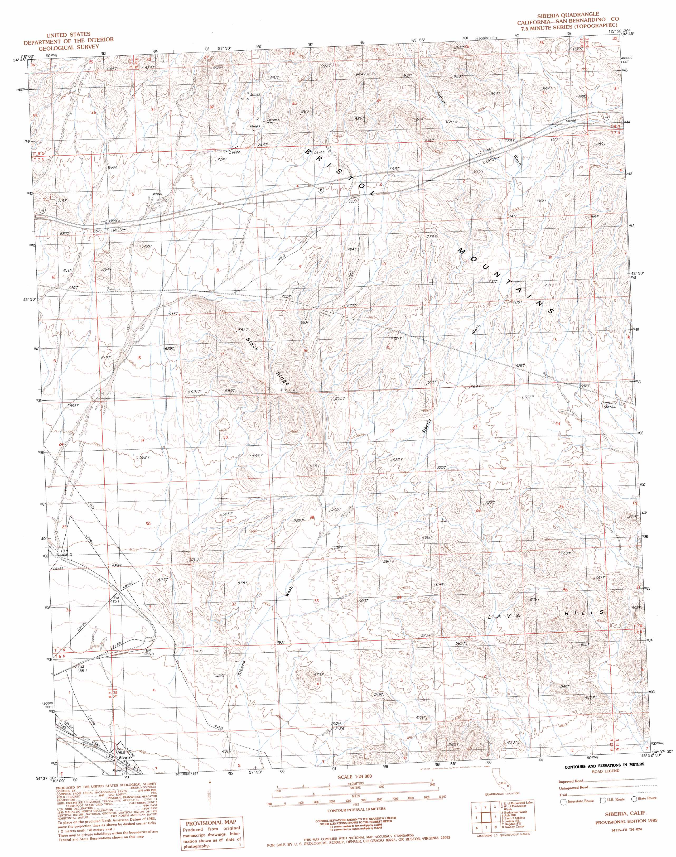
USGS Topo Quad 34115f8 - 1:24,000 scale
| Topo Map Name: | Siberia |
| USGS Topo Quad ID: | 34115f8 |
| Print Size: | ca. 21 1/4" wide x 27" high |
| Southeast Coordinates: | 34.625° N latitude / 115.875° W longitude |
| Map Center Coordinates: | 34.6875° N latitude / 115.9375° W longitude |
| U.S. State: | CA |
| Filename: | o34115f8.jpg |
| Download Map JPG Image: | Siberia topo map 1:24,000 scale |
| Map Type: | Topographic |
| Topo Series: | 7.5´ |
| Map Scale: | 1:24,000 |
| Source of Map Images: | United States Geological Survey (USGS) |
| Alternate Map Versions: |
Siberia CA 1985, updated 1985 Download PDF Buy paper map Siberia CA 2012 Download PDF Buy paper map Siberia CA 2015 Download PDF Buy paper map |
1:24,000 Topo Quads surrounding Siberia
West Of Broadwell Mesa |
Broadwell Mesa |
West Of Glasgow |
Glasgow |
Kelso Dunes |
Broadwell Lake |
East Of Broadwell Lake |
West Of Budweiser Wash |
Budweiser Wash |
Bighorn Basin |
Ludlow |
Ash Hill |
Siberia |
East Of Siberia |
Brown Buttes |
Morgans Well |
Ludlow Se |
Bagdad Sw |
Amboy Crater |
Amboy |
Deadman Lake Nw |
Deadman Lake Ne |
Lead Mountain |
Lead Mountain Ne |
Bristol Lake Nw |
> Back to 34115e1 at 1:100,000 scale
> Back to 34114a1 at 1:250,000 scale
> Back to U.S. Topo Maps home
Siberia topo map: Gazetteer
Siberia: Lavas
Lava Hills elevation 650m 2132′Siberia: Mines
California Mine elevation 760m 2493′Siberia: Populated Places
Siberia elevation 391m 1282′Siberia: Ridges
Black Ridge elevation 792m 2598′Siberia digital topo map on disk
Buy this Siberia topo map showing relief, roads, GPS coordinates and other geographical features, as a high-resolution digital map file on DVD: