Glasgow Topo Map California
To zoom in, hover over the map of Glasgow
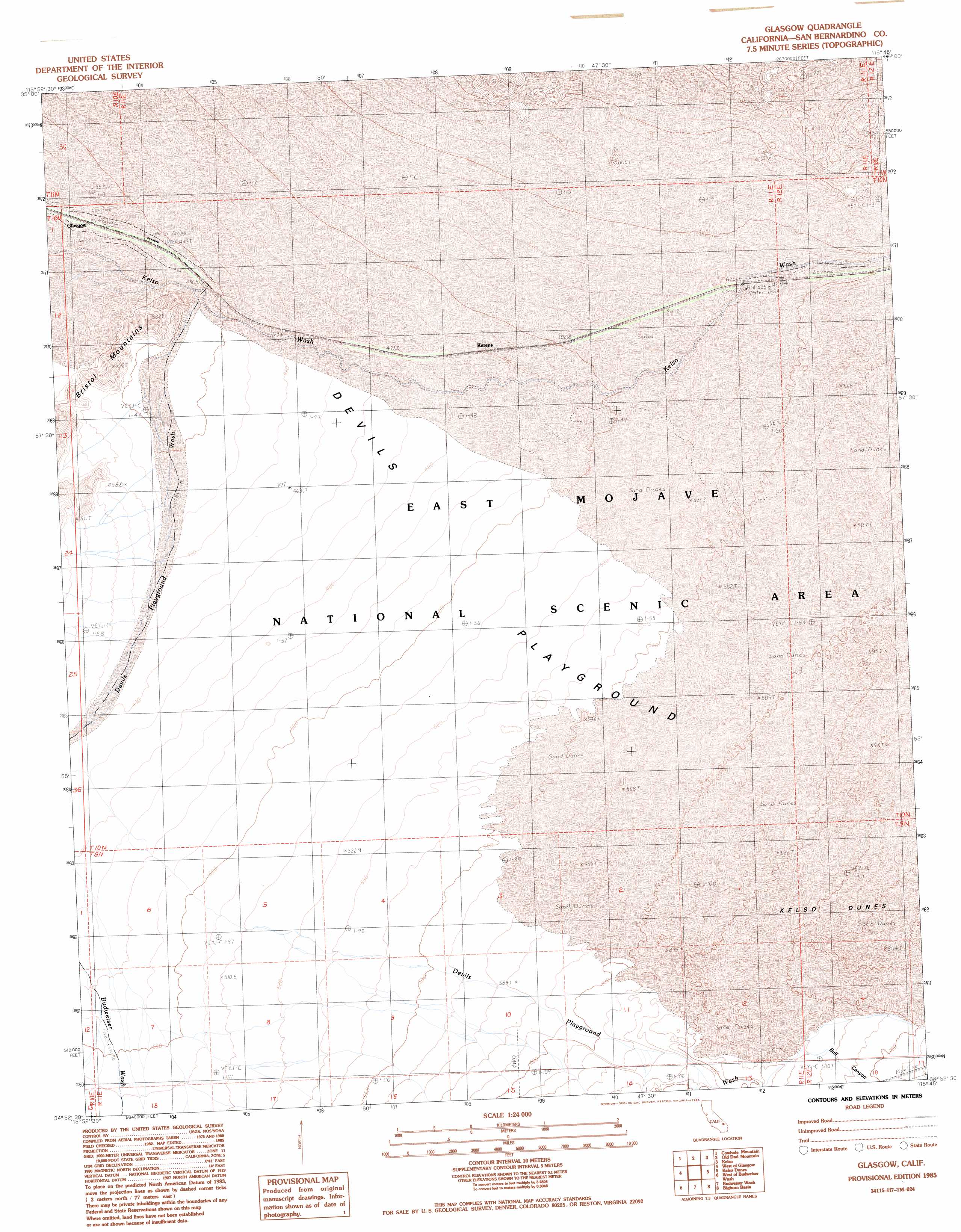
USGS Topo Quad 34115h7 - 1:24,000 scale
| Topo Map Name: | Glasgow |
| USGS Topo Quad ID: | 34115h7 |
| Print Size: | ca. 21 1/4" wide x 27" high |
| Southeast Coordinates: | 34.875° N latitude / 115.75° W longitude |
| Map Center Coordinates: | 34.9375° N latitude / 115.8125° W longitude |
| U.S. State: | CA |
| Filename: | o34115h7.jpg |
| Download Map JPG Image: | Glasgow topo map 1:24,000 scale |
| Map Type: | Topographic |
| Topo Series: | 7.5´ |
| Map Scale: | 1:24,000 |
| Source of Map Images: | United States Geological Survey (USGS) |
| Alternate Map Versions: |
Glasgow CA 1985, updated 1985 Download PDF Buy paper map Glasgow CA 2012 Download PDF Buy paper map Glasgow CA 2015 Download PDF Buy paper map |
1:24,000 Topo Quads surrounding Glasgow
Soda Lake North |
Seventeenmile Point |
Indian Spring |
Marl Mountains |
Cima |
Soda Lake South |
Cowhole Mountain |
Old Dad Mountain |
Kelso |
Hayden |
Broadwell Mesa |
West Of Glasgow |
Glasgow |
Kelso Dunes |
Fountain Peak |
East Of Broadwell Lake |
West Of Budweiser Wash |
Budweiser Wash |
Bighorn Basin |
Van Winkle Spring |
Ash Hill |
Siberia |
East Of Siberia |
Brown Buttes |
Van Winkle Wash |
> Back to 34115e1 at 1:100,000 scale
> Back to 34114a1 at 1:250,000 scale
> Back to U.S. Topo Maps home
Glasgow topo map: Gazetteer
Glasgow: Flats
Devils Playground elevation 479m 1571′Glasgow: Populated Places
Glasgow elevation 431m 1414′Kerens elevation 496m 1627′
Glasgow: Valleys
Devils Playground Wash elevation 461m 1512′Glasgow digital topo map on disk
Buy this Glasgow topo map showing relief, roads, GPS coordinates and other geographical features, as a high-resolution digital map file on DVD: