Camp Rock Mine Topo Map California
To zoom in, hover over the map of Camp Rock Mine
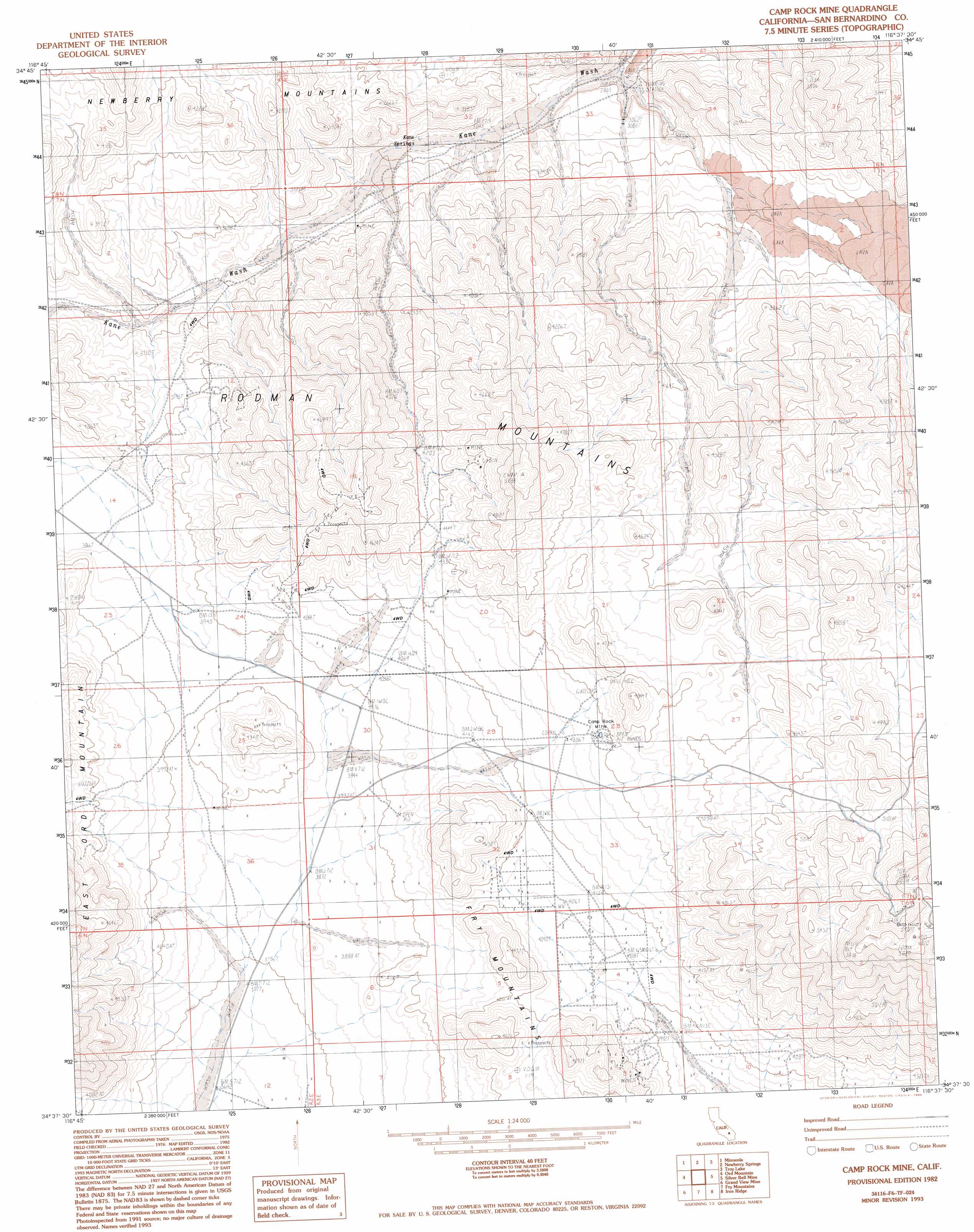
USGS Topo Quad 34116f6 - 1:24,000 scale
| Topo Map Name: | Camp Rock Mine |
| USGS Topo Quad ID: | 34116f6 |
| Print Size: | ca. 21 1/4" wide x 27" high |
| Southeast Coordinates: | 34.625° N latitude / 116.625° W longitude |
| Map Center Coordinates: | 34.6875° N latitude / 116.6875° W longitude |
| U.S. State: | CA |
| Filename: | o34116f6.jpg |
| Download Map JPG Image: | Camp Rock Mine topo map 1:24,000 scale |
| Map Type: | Topographic |
| Topo Series: | 7.5´ |
| Map Scale: | 1:24,000 |
| Source of Map Images: | United States Geological Survey (USGS) |
| Alternate Map Versions: |
Camp Rock Mine CA 1982, updated 1983 Download PDF Buy paper map Camp Rock Mine CA 1982, updated 1993 Download PDF Buy paper map Camp Rock Mine CA 2012 Download PDF Buy paper map Camp Rock Mine CA 2015 Download PDF Buy paper map |
1:24,000 Topo Quads surrounding Camp Rock Mine
Nebo |
Yermo |
Harvard Hill |
Manix |
Hidden Valley West |
Daggett |
Minneola |
Newberry Springs |
Troy Lake |
Hector |
West Ord Mountain |
Ord Mountain |
Camp Rock Mine |
Silver Bell Mine |
Sunshine Peak |
White Horse Mountain |
Grand View Mine |
Fry Mountains |
Iron Ridge |
Galway Lake |
Lucerne Valley |
Cougar Buttes |
Old Woman Springs |
Melville Lake |
Emerson Lake |
> Back to 34116e1 at 1:100,000 scale
> Back to 34116a1 at 1:250,000 scale
> Back to U.S. Topo Maps home
Camp Rock Mine topo map: Gazetteer
Camp Rock Mine: Mines
Camp Rock Mine elevation 1338m 4389′Copper Strand Mine elevation 1286m 4219′
Camp Rock Mine: Ranges
Rodman Mountains elevation 1323m 4340′Camp Rock Mine: Springs
Kane Springs elevation 977m 3205′Camp Rock Mine digital topo map on disk
Buy this Camp Rock Mine topo map showing relief, roads, GPS coordinates and other geographical features, as a high-resolution digital map file on DVD: