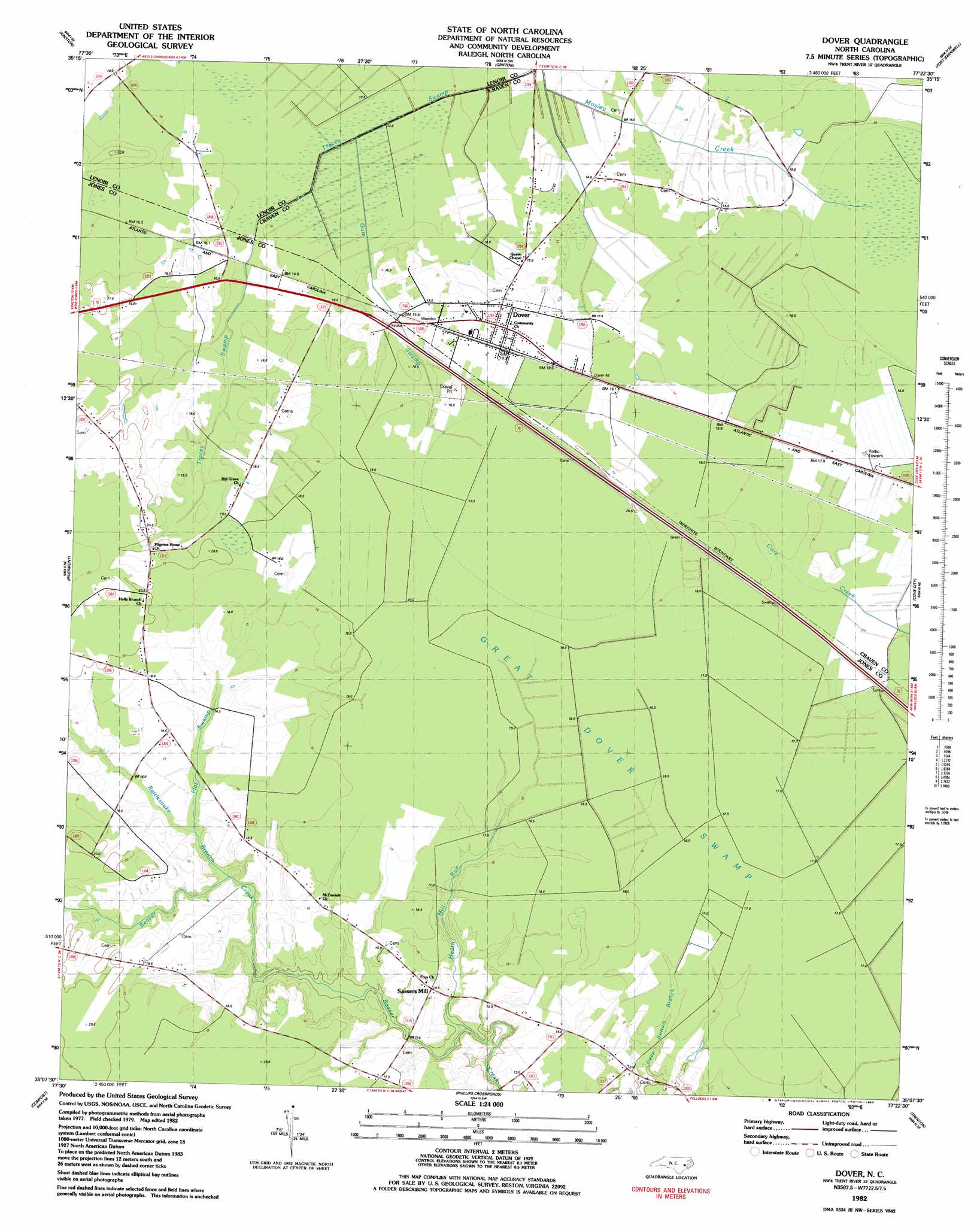
Dover Topo Map North Carolina
To zoom in, hover over the map of Dover
USGS Topo Quad 35077b4 - 1:24,000 scale
| Topo Map Name: | Dover |
| USGS Topo Quad ID: | 35077b4 |
| Print Size: | ca. 21 1/4" wide x 27" high |
| Southeast Coordinates: | 35.125° N latitude / 77.375° W longitude |
| Map Center Coordinates: | 35.1875° N latitude / 77.4375° W longitude |
| U.S. State: | NC |
| Filename: | o35077b4.jpg |
| Download Map JPG Image: | Dover topo map 1:24,000 scale |
| Map Type: | Topographic |
| Topo Series: | 7.5´ |
| Map Scale: | 1:24,000 |
| Source of Map Images: | United States Geological Survey (USGS) |
| Alternate Map Versions: |
Dover NC 1982, updated 1983 Download PDF Buy paper map Dover NC 2010 Download PDF Buy paper map Dover NC 2013 Download PDF Buy paper map Dover NC 2016 Download PDF Buy paper map |
1:24,000 Topo Quads surrounding Dover
Snow Hill |
Hookerton |
Ayden |
Gardnerville |
Wilmar |
Falling Creek |
Kinston |
Grifton |
Fort Barnwell |
Vanceboro |
Deep Run |
Rivermont |
Dover |
Cove City |
Jasper |
Pink Hill |
Comfort |
Phillips Crossroads |
Trenton |
Pollocksville |
Potters Hill |
Richlands |
Jacksonville Nw |
Jacksonville Ne |
Maysville |
> Back to 35077a1 at 1:100,000 scale
> Back to 35076a1 at 1:250,000 scale
> Back to U.S. Topo Maps home
Dover topo map: Gazetteer
Dover: Areas
Beaver Creek elevation 18m 59′Dover: Populated Places
Dover elevation 19m 62′Sassers Mill elevation 14m 45′
Dover: Post Offices
Bonus Post Office (historical) elevation 15m 49′Dover: Streams
Flat Swamp elevation 13m 42′Gum Swamp elevation 13m 42′
Heath Mill Run elevation 8m 26′
Mosley Creek elevation 12m 39′
Rattlesnake Branch elevation 13m 42′
Trace Branch elevation 9m 29′
Vine Swamp elevation 11m 36′
Dover digital topo map on disk
Buy this Dover topo map showing relief, roads, GPS coordinates and other geographical features, as a high-resolution digital map file on DVD:
Atlantic Coast (NY, NJ, PA, DE, MD, VA, NC)
Buy digital topo maps: Atlantic Coast (NY, NJ, PA, DE, MD, VA, NC)
 map DVD")