Pond Creek Nw Topo Map Texas
To zoom in, hover over the map of Pond Creek Nw
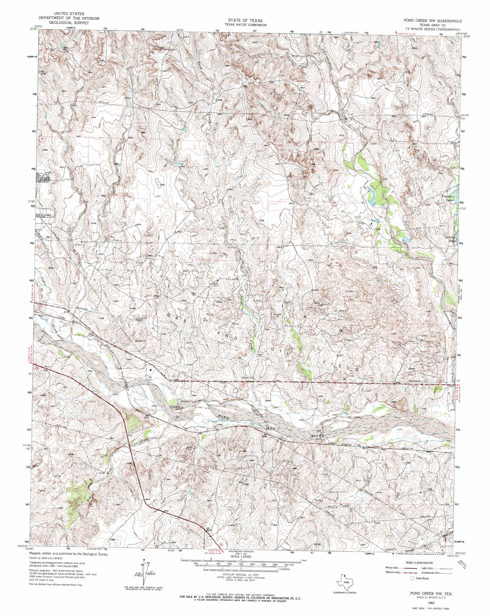
USGS Topo Quad 35100d6 - 1:24,000 scale
| Topo Map Name: | Pond Creek Nw |
| USGS Topo Quad ID: | 35100d6 |
| Print Size: | ca. 21 1/4" wide x 27" high |
| Southeast Coordinates: | 35.375° N latitude / 100.625° W longitude |
| Map Center Coordinates: | 35.4375° N latitude / 100.6875° W longitude |
| U.S. State: | TX |
| Filename: | o35100d6.jpg |
| Download Map JPG Image: | Pond Creek Nw topo map 1:24,000 scale |
| Map Type: | Topographic |
| Topo Series: | 7.5´ |
| Map Scale: | 1:24,000 |
| Source of Map Images: | United States Geological Survey (USGS) |
| Alternate Map Versions: |
Pond Creek NW TX 1962, updated 1965 Download PDF Buy paper map Pond Creek NW TX 2010 Download PDF Buy paper map Pond Creek NW TX 2012 Download PDF Buy paper map Pond Creek NW TX 2016 Download PDF Buy paper map |
1:24,000 Topo Quads surrounding Pond Creek Nw
Pampa Nw |
Pampa Ne |
Miami |
Lora |
Young Ranch |
Pampa |
Hoover |
Laketon |
Tody School |
Mobeetie |
Bowers City |
Lefors |
Pond Creek Nw |
Pond Creek |
Spring Creek |
Deep Lake |
Taylor Ranch |
Hudgens Ranch |
Back |
Pakan |
Jericho |
Rockledge |
Alanreed |
Mclean |
Ramsdell |
> Back to 35100a1 at 1:100,000 scale
> Back to 35100a1 at 1:250,000 scale
> Back to U.S. Topo Maps home
Pond Creek Nw topo map: Gazetteer
Pond Creek Nw: Reservoirs
Franklin Lakes elevation 818m 2683′Pond Creek Nw: Streams
Cabin Creek elevation 821m 2693′Red Mud Creek elevation 808m 2650′
Sand Creek elevation 798m 2618′
Pond Creek Nw digital topo map on disk
Buy this Pond Creek Nw topo map showing relief, roads, GPS coordinates and other geographical features, as a high-resolution digital map file on DVD: