Logan Ne Topo Map New Mexico
To zoom in, hover over the map of Logan Ne
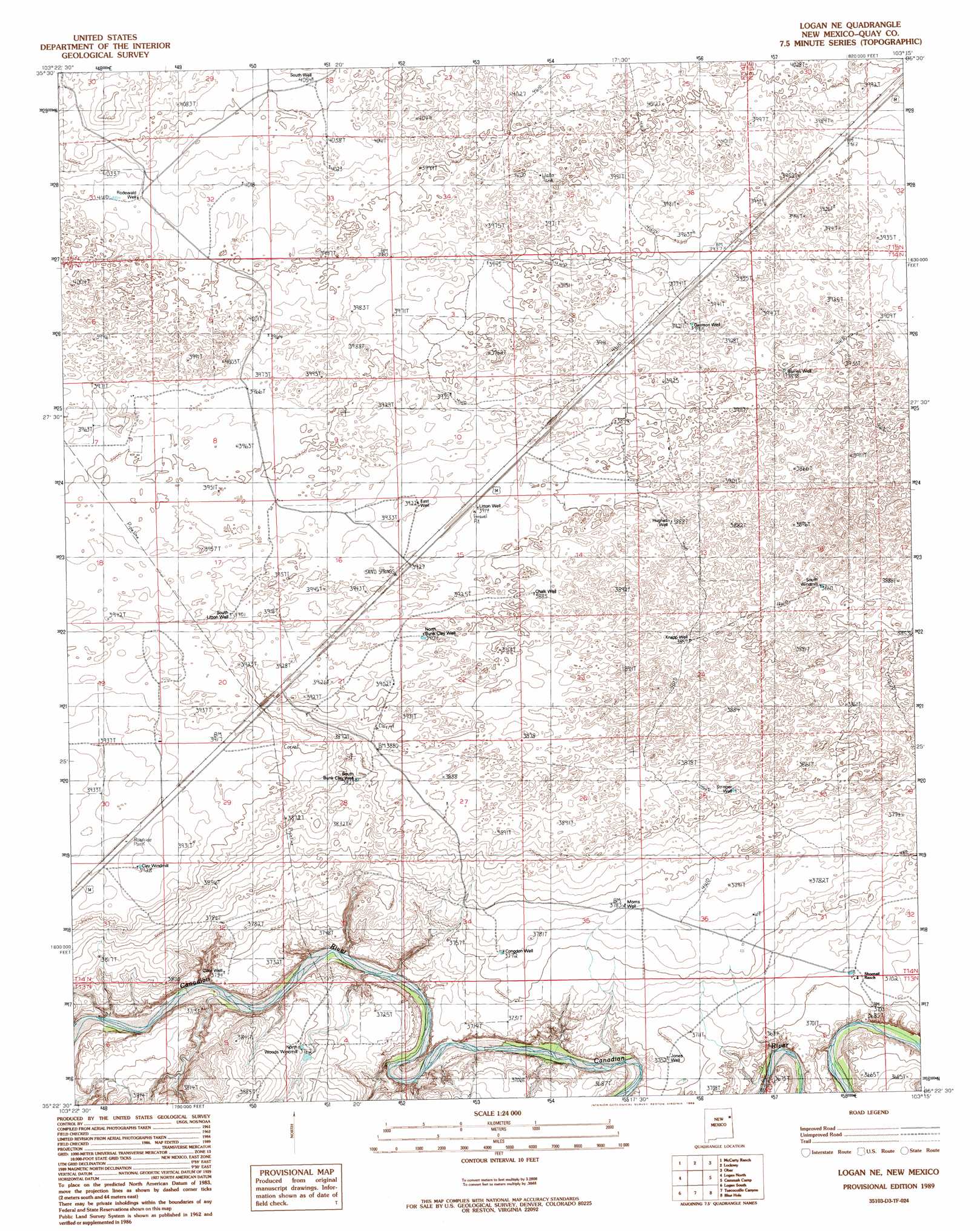
USGS Topo Quad 35103d3 - 1:24,000 scale
| Topo Map Name: | Logan Ne |
| USGS Topo Quad ID: | 35103d3 |
| Print Size: | ca. 21 1/4" wide x 27" high |
| Southeast Coordinates: | 35.375° N latitude / 103.25° W longitude |
| Map Center Coordinates: | 35.4375° N latitude / 103.3125° W longitude |
| U.S. State: | NM |
| Filename: | o35103d3.jpg |
| Download Map JPG Image: | Logan Ne topo map 1:24,000 scale |
| Map Type: | Topographic |
| Topo Series: | 7.5´ |
| Map Scale: | 1:24,000 |
| Source of Map Images: | United States Geological Survey (USGS) |
| Alternate Map Versions: |
Logan NE NM 1989, updated 1989 Download PDF Buy paper map Logan NE NM 2010 Download PDF Buy paper map Logan NE NM 2013 Download PDF Buy paper map Logan NE NM 2017 Download PDF Buy paper map |
1:24,000 Topo Quads surrounding Logan Ne
Gallegos Ne |
Mccloy Ranch |
Cherokee Valley |
Kerlin Hill |
Doyle Hill |
Fuentes Ranch |
Mccarty Ranch |
Lockney |
Obar |
Nara Visa |
Montesito Creek |
Logan North |
Logan Ne |
Cammak Camp |
Sanchez Springs |
Hudson |
Logan South |
Tuscocoillo Canyon |
Blue Hole |
Martin Draw |
Lesbia |
San Jon Nw |
Porter |
Bard |
Glenrio |
> Back to 35103a1 at 1:100,000 scale
> Back to 35102a1 at 1:250,000 scale
> Back to U.S. Topo Maps home
Logan Ne topo map: Gazetteer
Logan Ne: Basins
Litton Well Gravel Pit elevation 1194m 3917′Logan Ne: Populated Places
Bunk Clay Place elevation 1171m 3841′Canode (historical) elevation 1201m 3940′
Sand Springs elevation 1198m 3930′
Logan Ne: Post Offices
Canode Post Office (historical) elevation 1201m 3940′Logan Ne: Springs
Sand Springs elevation 1198m 3930′Logan Ne: Valleys
Shallow Well Draw elevation 1237m 4058′Logan Ne: Wells
05235 Water Well elevation 1195m 3920′05236 Water Well elevation 1201m 3940′
05237 Water Well elevation 1200m 3937′
05238 Water Well elevation 1189m 3900′
05239 Water Well elevation 1180m 3871′
05242 Water Well elevation 1138m 3733′
05244 Water Well elevation 1177m 3861′
05262 Water Well elevation 1236m 4055′
05263 Water Well elevation 1229m 4032′
05475 Water Well elevation 1245m 4084′
05488 Water Well elevation 1194m 3917′
05489 Water Well elevation 1182m 3877′
05490 Water Well elevation 1184m 3884′
05491 Water Well elevation 1180m 3871′
05492 Water Well elevation 1193m 3914′
05493 Water Well elevation 1180m 3871′
05494 Water Well elevation 1171m 3841′
05495 Water Well elevation 1148m 3766′
05497 Water Well elevation 1189m 3900′
Logan Ne digital topo map on disk
Buy this Logan Ne topo map showing relief, roads, GPS coordinates and other geographical features, as a high-resolution digital map file on DVD: