Punta Del Chorro Topo Map New Mexico
To zoom in, hover over the map of Punta Del Chorro
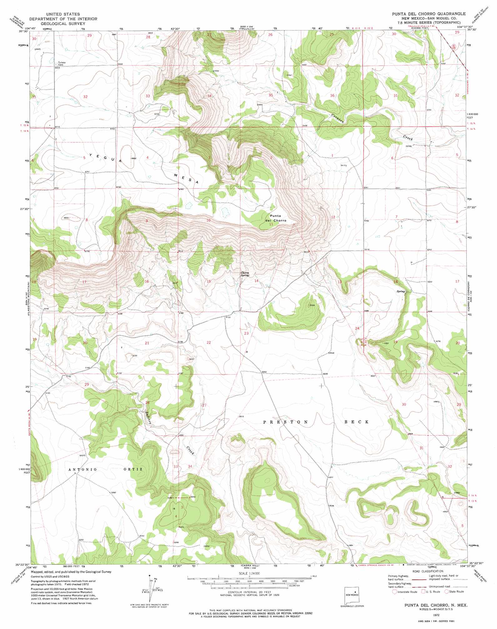
USGS Topo Quad 35104d6 - 1:24,000 scale
| Topo Map Name: | Punta Del Chorro |
| USGS Topo Quad ID: | 35104d6 |
| Print Size: | ca. 21 1/4" wide x 27" high |
| Southeast Coordinates: | 35.375° N latitude / 104.625° W longitude |
| Map Center Coordinates: | 35.4375° N latitude / 104.6875° W longitude |
| U.S. State: | NM |
| Filename: | o35104d6.jpg |
| Download Map JPG Image: | Punta Del Chorro topo map 1:24,000 scale |
| Map Type: | Topographic |
| Topo Series: | 7.5´ |
| Map Scale: | 1:24,000 |
| Source of Map Images: | United States Geological Survey (USGS) |
| Alternate Map Versions: |
Punta Del Chorro NM 1972, updated 1975 Download PDF Buy paper map Punta Del Chorro NM 2010 Download PDF Buy paper map Punta Del Chorro NM 2013 Download PDF Buy paper map Punta Del Chorro NM 2017 Download PDF Buy paper map |
1:24,000 Topo Quads surrounding Punta Del Chorro
Goetsch Lake |
Canon Pedroso |
Llonidas Lake |
Maes |
Sabinoso |
Laguna La Monia |
Laguna Huerfana |
Trujillo |
Canon Olguin |
San Ramon |
Mesa Lauriano |
Flagstone Mountain |
Punta Del Chorro |
Cerro De Corazon |
Variadero |
Chaperito |
Cactus Tank |
Cabra Hill |
Mesa Pino |
La Silla |
Pedro Miguel Peak |
Horse Pasture Tank |
Bar Y Ranch |
Mesa Cherisco |
Mesita Del Gato |
> Back to 35104a1 at 1:100,000 scale
> Back to 35104a1 at 1:250,000 scale
> Back to U.S. Topo Maps home
Punta Del Chorro topo map: Gazetteer
Punta Del Chorro: Springs
Chorro Spring elevation 1608m 5275′Punta Del Chorro: Summits
Punta del Chorro elevation 2058m 6751′Punta Del Salitre elevation 2067m 6781′
Yegua Mesa elevation 2074m 6804′
Punta Del Chorro digital topo map on disk
Buy this Punta Del Chorro topo map showing relief, roads, GPS coordinates and other geographical features, as a high-resolution digital map file on DVD: