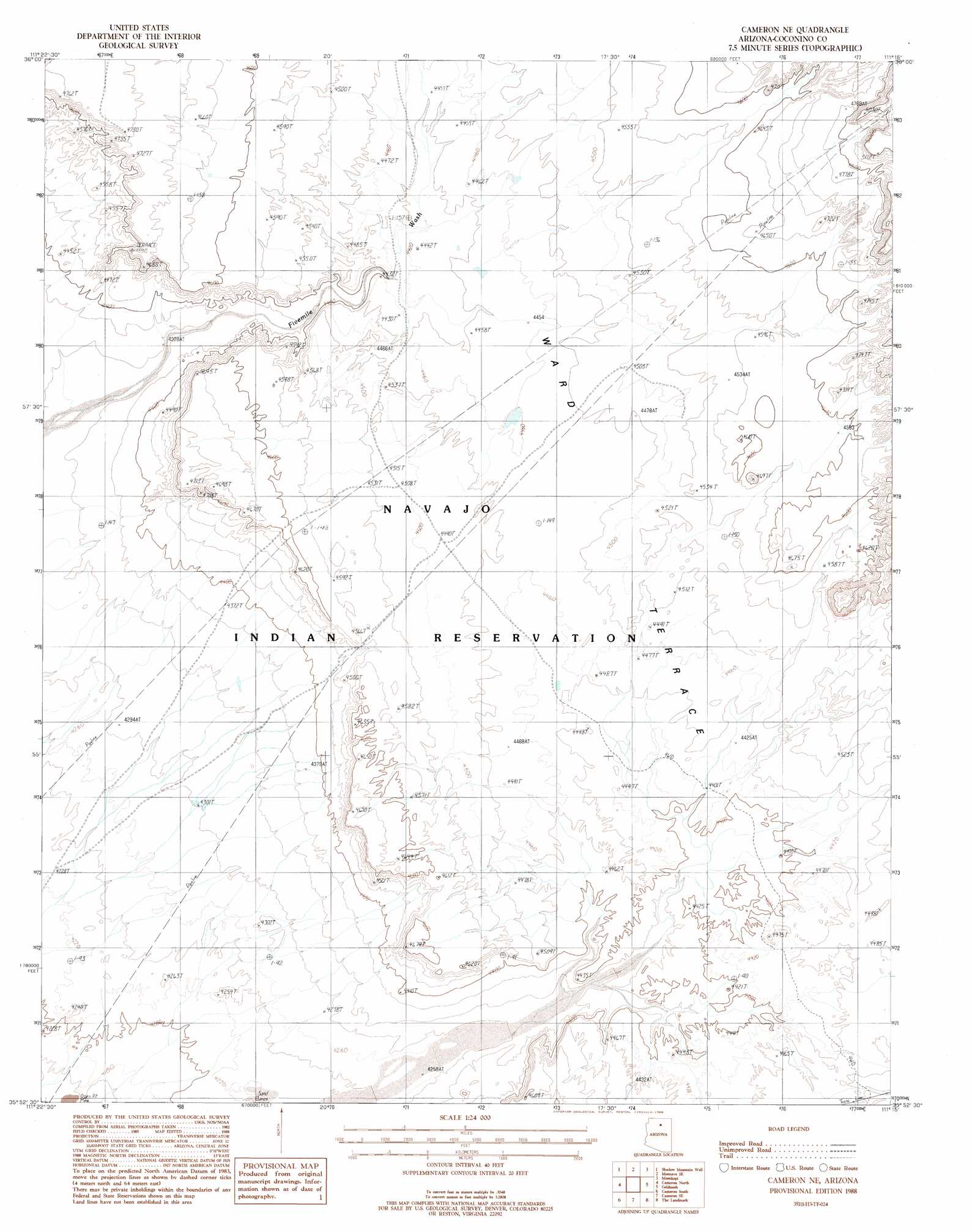
Cameron Ne Topo Map Arizona
To zoom in, hover over the map of Cameron Ne
USGS Topo Quad 35111h3 - 1:24,000 scale
| Topo Map Name: | Cameron Ne |
| USGS Topo Quad ID: | 35111h3 |
| Print Size: | ca. 21 1/4" wide x 27" high |
| Southeast Coordinates: | 35.875° N latitude / 111.25° W longitude |
| Map Center Coordinates: | 35.9375° N latitude / 111.3125° W longitude |
| U.S. State: | AZ |
| Filename: | o35111h3.jpg |
| Download Map JPG Image: | Cameron Ne topo map 1:24,000 scale |
| Map Type: | Topographic |
| Topo Series: | 7.5´ |
| Map Scale: | 1:24,000 |
| Source of Map Images: | United States Geological Survey (USGS) |
| Alternate Map Versions: |
Cameron NE AZ 1988, updated 1988 Download PDF Buy paper map Cameron NE AZ 2011 Download PDF Buy paper map Cameron NE AZ 2014 Download PDF Buy paper map |
1:24,000 Topo Quads surrounding Cameron Ne
Pillow Mountain |
Willow Springs |
Moenave |
Tuba City |
Middle Mesa |
Blue Spring Se |
Shadow Mountain Well |
Moenave Se |
Moenkopi |
Tuba City Se |
Coconino Point |
Cameron North |
Cameron Ne |
Goldtooth |
Appaloosa Ridge |
Coconino Point Se |
Cameron South |
Cameron Se |
The Landmark |
Gold Spring |
Campbell Francis Wash |
Gray Mountain |
Wupatki Ne |
Badger Spring |
Rock Head |
> Back to 35111e1 at 1:100,000 scale
> Back to 35110a1 at 1:250,000 scale
> Back to U.S. Topo Maps home
Cameron Ne digital topo map on disk
Buy this Cameron Ne topo map showing relief, roads, GPS coordinates and other geographical features, as a high-resolution digital map file on DVD: