Moenave Se Topo Map Arizona
To zoom in, hover over the map of Moenave Se
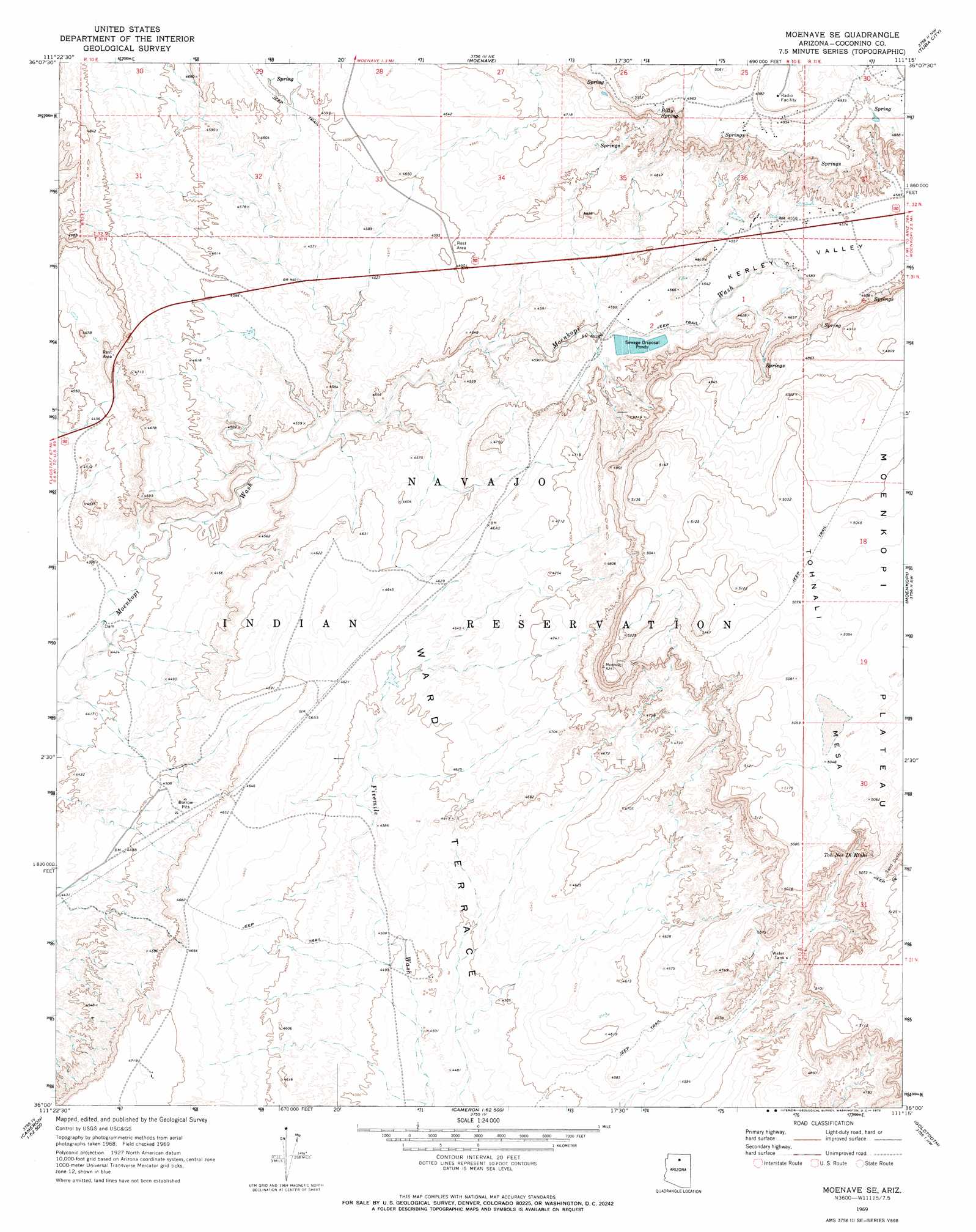
USGS Topo Quad 36111a3 - 1:24,000 scale
| Topo Map Name: | Moenave Se |
| USGS Topo Quad ID: | 36111a3 |
| Print Size: | ca. 21 1/4" wide x 27" high |
| Southeast Coordinates: | 36° N latitude / 111.25° W longitude |
| Map Center Coordinates: | 36.0625° N latitude / 111.3125° W longitude |
| U.S. State: | AZ |
| Filename: | o36111a3.jpg |
| Download Map JPG Image: | Moenave Se topo map 1:24,000 scale |
| Map Type: | Topographic |
| Topo Series: | 7.5´ |
| Map Scale: | 1:24,000 |
| Source of Map Images: | United States Geological Survey (USGS) |
| Alternate Map Versions: |
Moenave SE AZ 1969, updated 1972 Download PDF Buy paper map Moenave SE AZ 2011 Download PDF Buy paper map Moenave SE AZ 2014 Download PDF Buy paper map |
1:24,000 Topo Quads surrounding Moenave Se
Bodaway Mesa |
The Gap |
Preston Well |
Preston Mesa South |
Gopher Spring |
Pillow Mountain |
Willow Springs |
Moenave |
Tuba City |
Middle Mesa |
Blue Spring Se |
Shadow Mountain Well |
Moenave Se |
Moenkopi |
Tuba City Se |
Coconino Point |
Cameron North |
Cameron Ne |
Goldtooth |
Appaloosa Ridge |
Coconino Point Se |
Cameron South |
Cameron Se |
The Landmark |
Gold Spring |
> Back to 36111a1 at 1:100,000 scale
> Back to 36110a1 at 1:250,000 scale
> Back to U.S. Topo Maps home
Moenave Se topo map: Gazetteer
Moenave Se: Arches
Tuba Arch elevation 1399m 4589′Moenave Se: Areas
Dinosaur Tracks elevation 1391m 4563′Moenave Se: Springs
Billy Spring elevation 1508m 4947′Toh Nee Di Kishi elevation 1498m 4914′
Moenave Se: Valleys
Kerley Valley elevation 1379m 4524′Moenave Se digital topo map on disk
Buy this Moenave Se topo map showing relief, roads, GPS coordinates and other geographical features, as a high-resolution digital map file on DVD: