Moenave Topo Map Arizona
To zoom in, hover over the map of Moenave
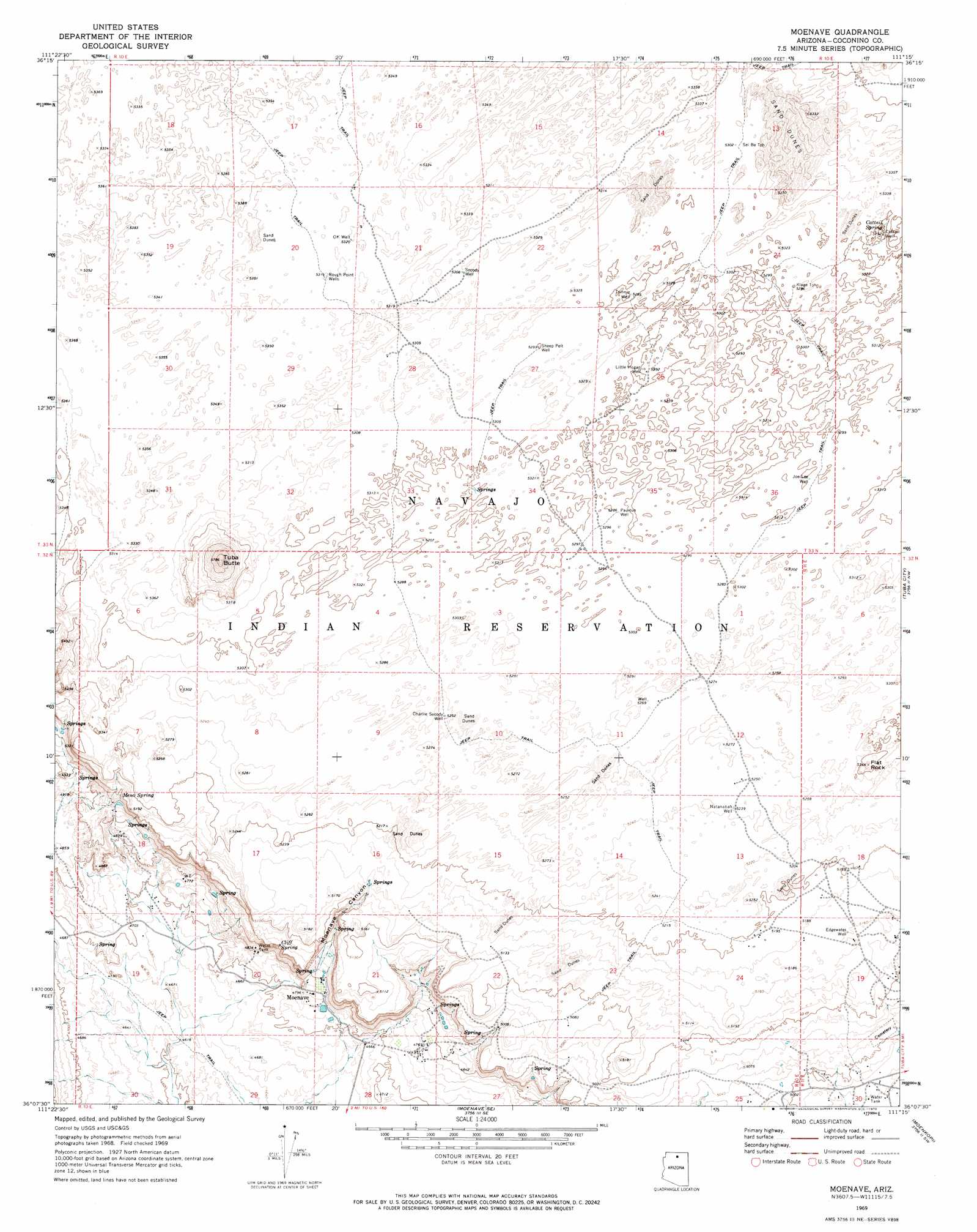
USGS Topo Quad 36111b3 - 1:24,000 scale
| Topo Map Name: | Moenave |
| USGS Topo Quad ID: | 36111b3 |
| Print Size: | ca. 21 1/4" wide x 27" high |
| Southeast Coordinates: | 36.125° N latitude / 111.25° W longitude |
| Map Center Coordinates: | 36.1875° N latitude / 111.3125° W longitude |
| U.S. State: | AZ |
| Filename: | o36111b3.jpg |
| Download Map JPG Image: | Moenave topo map 1:24,000 scale |
| Map Type: | Topographic |
| Topo Series: | 7.5´ |
| Map Scale: | 1:24,000 |
| Source of Map Images: | United States Geological Survey (USGS) |
| Alternate Map Versions: |
Moenave AZ 1969, updated 1972 Download PDF Buy paper map Moenave AZ 2011 Download PDF Buy paper map Moenave AZ 2014 Download PDF Buy paper map |
1:24,000 Topo Quads surrounding Moenave
Cedar Ridge |
Toh Bih Nosteny |
Sitting Coyote Hill |
Preston Mesa North |
Big Whisker Well |
Bodaway Mesa |
The Gap |
Preston Well |
Preston Mesa South |
Gopher Spring |
Pillow Mountain |
Willow Springs |
Moenave |
Tuba City |
Middle Mesa |
Blue Spring Se |
Shadow Mountain Well |
Moenave Se |
Moenkopi |
Tuba City Se |
Coconino Point |
Cameron North |
Cameron Ne |
Goldtooth |
Appaloosa Ridge |
> Back to 36111a1 at 1:100,000 scale
> Back to 36110a1 at 1:250,000 scale
> Back to U.S. Topo Maps home
Moenave topo map: Gazetteer
Moenave: Pillars
Flat Rock elevation 1633m 5357′Moenave: Populated Places
Moenave elevation 1455m 4773′Moenave: Springs
Cattail Spring elevation 1616m 5301′Cliff Spring elevation 1508m 4947′
Mesa Spring elevation 1546m 5072′
Moa Ave Spring (historical) elevation 1616m 5301′
Moenave: Summits
Mori Mesa elevation 1549m 5082′Tuba Butte elevation 1761m 5777′
Moenave: Valleys
Moenave Canyon elevation 1457m 4780′Moenave: Wells
Cattail Well elevation 1616m 5301′Charlie Secody Well elevation 1604m 5262′
Edgewater Well elevation 1574m 5164′
Joe Lee Well elevation 1616m 5301′
Klage Toh elevation 1616m 5301′
Little Hogan Well elevation 1616m 5301′
Natanabah Well elevation 1598m 5242′
OK Well elevation 1623m 5324′
Pauitue Well elevation 1616m 5301′
Rough Point Wells elevation 1622m 5321′
Secody Well elevation 0m 0′
Sei Be Toh elevation 0m 0′
Sheep Pelt Well elevation 0m 0′
Tsinnie Well elevation 1616m 5301′
Moenave digital topo map on disk
Buy this Moenave topo map showing relief, roads, GPS coordinates and other geographical features, as a high-resolution digital map file on DVD: