Sourdough Spring Topo Map California
To zoom in, hover over the map of Sourdough Spring
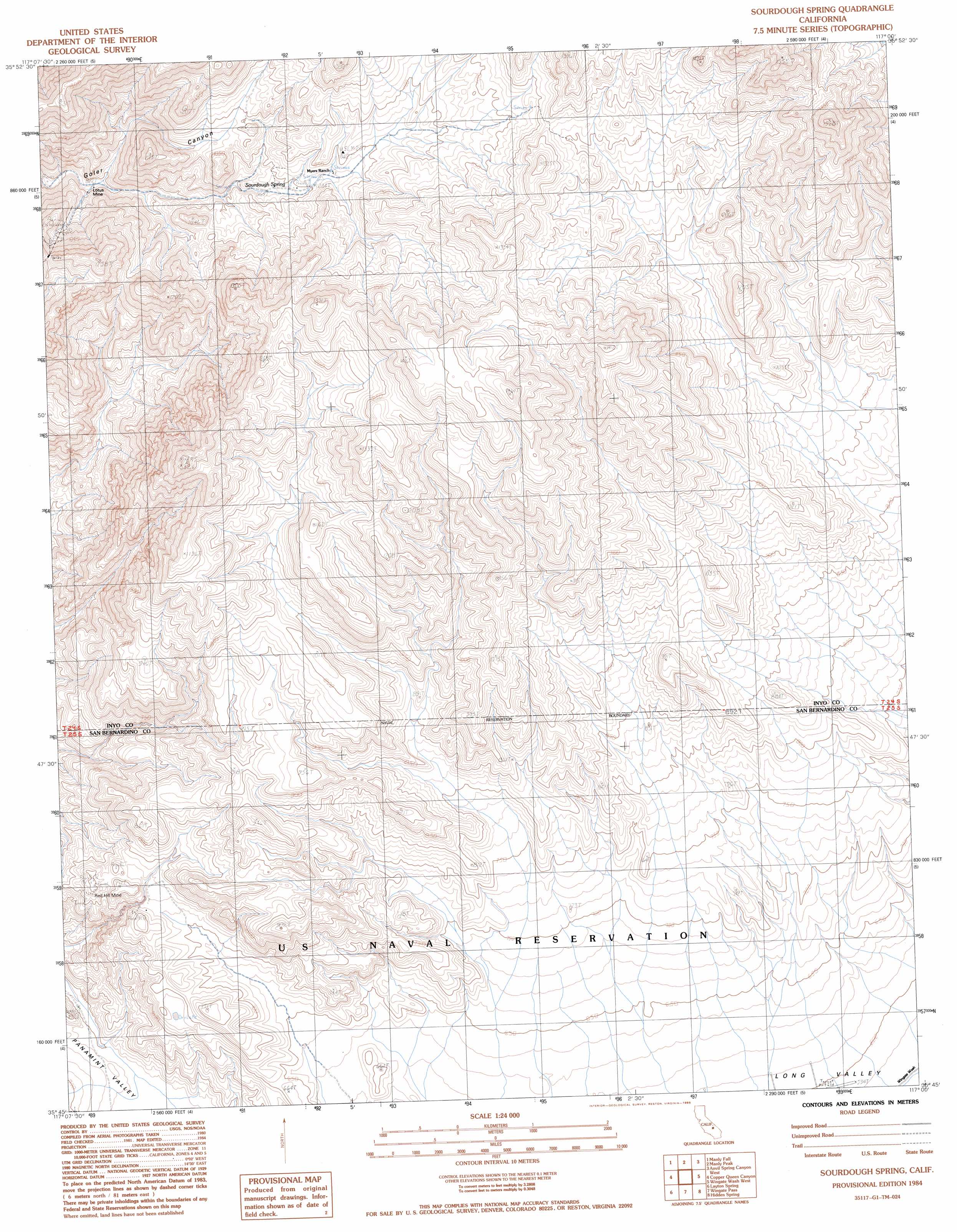
USGS Topo Quad 35117g1 - 1:24,000 scale
| Topo Map Name: | Sourdough Spring |
| USGS Topo Quad ID: | 35117g1 |
| Print Size: | ca. 21 1/4" wide x 27" high |
| Southeast Coordinates: | 35.75° N latitude / 117° W longitude |
| Map Center Coordinates: | 35.8125° N latitude / 117.0625° W longitude |
| U.S. State: | CA |
| Filename: | o35117g1.jpg |
| Download Map JPG Image: | Sourdough Spring topo map 1:24,000 scale |
| Map Type: | Topographic |
| Topo Series: | 7.5´ |
| Map Scale: | 1:24,000 |
| Source of Map Images: | United States Geological Survey (USGS) |
| Alternate Map Versions: |
Sourdough Spring CA 1984, updated 1985 Download PDF Buy paper map Sourdough Spring CA 2012 Download PDF Buy paper map Sourdough Spring CA 2015 Download PDF Buy paper map |
1:24,000 Topo Quads surrounding Sourdough Spring
Maturango Peak Se |
Ballarat |
Panamint |
Galena Canyon |
Mormon Point |
Slate Range Crossing |
Manly Fall |
Manly Peak |
Anvil Spring Canyon West |
Anvil Spring Canyon East |
Trona East |
Copper Queen Canyon |
Sourdough Spring |
Wingate Wash West |
Wingate Wash East |
Searles Lake |
Layton Spring |
Wingate Pass |
Hidden Spring |
Quail Spring |
Christmas Canyon |
Pilot Knob Valley West |
Pilot Knob Valley East |
West Of Leach Spring |
Leach Spring |
> Back to 35117e1 at 1:100,000 scale
> Back to 35116a1 at 1:250,000 scale
> Back to U.S. Topo Maps home
Sourdough Spring topo map: Gazetteer
Sourdough Spring: Mines
Lotus Mine elevation 870m 2854′Red Hill Mine elevation 711m 2332′
Sourdough Spring: Springs
Sourdough Spring elevation 972m 3188′Sourdough Spring digital topo map on disk
Buy this Sourdough Spring topo map showing relief, roads, GPS coordinates and other geographical features, as a high-resolution digital map file on DVD:
Southern Sierra Nevada, California & Southern Nevada
Buy digital topo maps: Southern Sierra Nevada, California & Southern Nevada