Manly Peak Topo Map California
To zoom in, hover over the map of Manly Peak
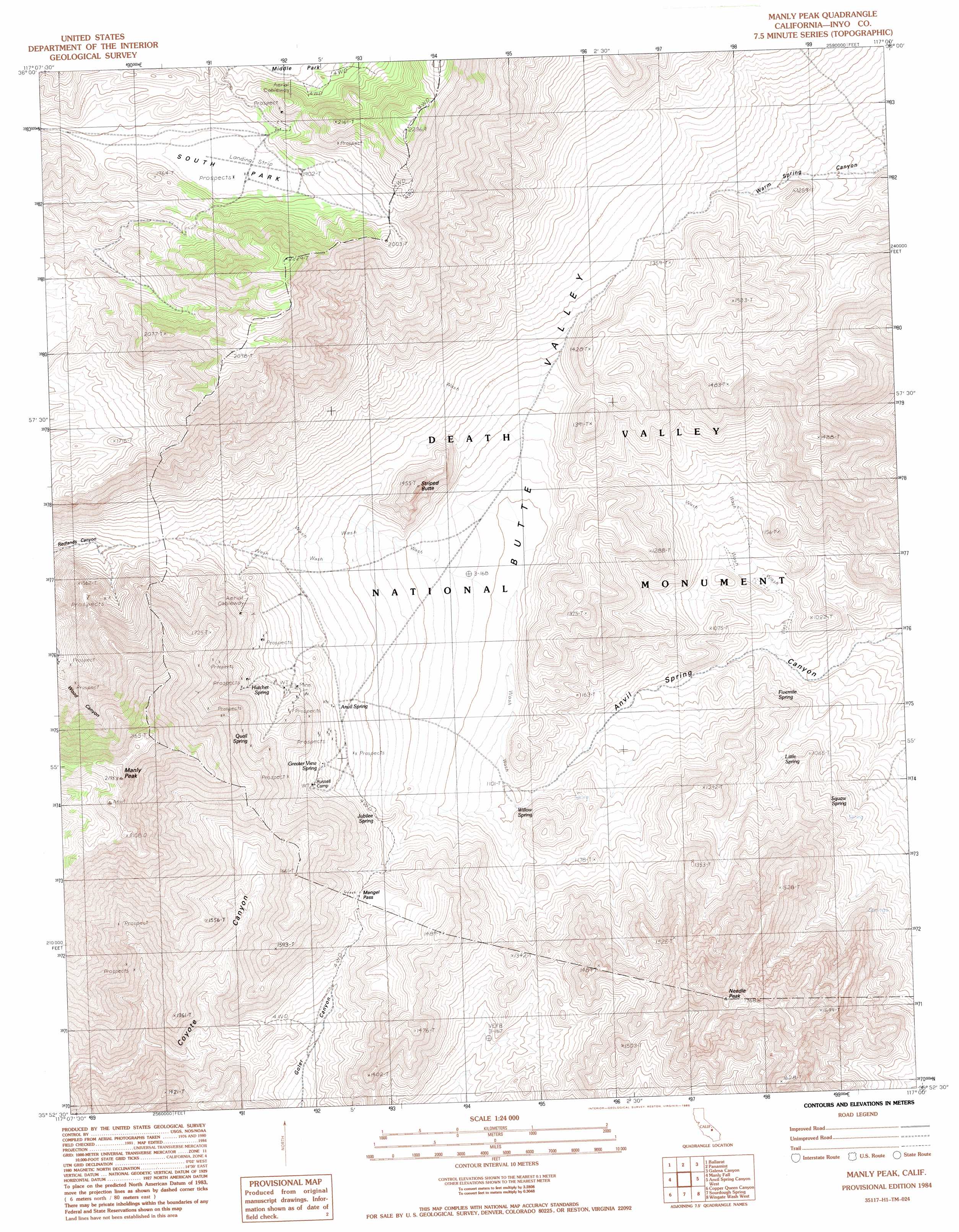
USGS Topo Quad 35117h1 - 1:24,000 scale
| Topo Map Name: | Manly Peak |
| USGS Topo Quad ID: | 35117h1 |
| Print Size: | ca. 21 1/4" wide x 27" high |
| Southeast Coordinates: | 35.875° N latitude / 117° W longitude |
| Map Center Coordinates: | 35.9375° N latitude / 117.0625° W longitude |
| U.S. State: | CA |
| Filename: | o35117h1.jpg |
| Download Map JPG Image: | Manly Peak topo map 1:24,000 scale |
| Map Type: | Topographic |
| Topo Series: | 7.5´ |
| Map Scale: | 1:24,000 |
| Source of Map Images: | United States Geological Survey (USGS) |
| Alternate Map Versions: |
Manly Peak CA 1984, updated 1985 Download PDF Buy paper map Manly Peak CA 2012 Download PDF Buy paper map Manly Peak CA 2015 Download PDF Buy paper map |
1:24,000 Topo Quads surrounding Manly Peak
Maturango Peak Ne |
Jail Canyon |
Telescope Peak |
Hanaupah Canyon |
Badwater |
Maturango Peak Se |
Ballarat |
Panamint |
Galena Canyon |
Mormon Point |
Slate Range Crossing |
Manly Fall |
Manly Peak |
Anvil Spring Canyon West |
Anvil Spring Canyon East |
Trona East |
Copper Queen Canyon |
Sourdough Spring |
Wingate Wash West |
Wingate Wash East |
Searles Lake |
Layton Spring |
Wingate Pass |
Hidden Spring |
Quail Spring |
> Back to 35117e1 at 1:100,000 scale
> Back to 35116a1 at 1:250,000 scale
> Back to U.S. Topo Maps home
Manly Peak topo map: Gazetteer
Manly Peak: Basins
South Park elevation 1872m 6141′Manly Peak: Gaps
Mengel Pass elevation 1311m 4301′Manly Peak: Springs
Anvil Spring elevation 1288m 4225′Fivemile Spring elevation 991m 3251′
Greater View Spring elevation 1351m 4432′
Hatchet Spring elevation 1427m 4681′
Jubilee Spring elevation 1252m 4107′
Little Spring elevation 1029m 3375′
Quail Spring elevation 1540m 5052′
Squaw Spring elevation 1018m 3339′
Willow Spring elevation 1098m 3602′
Manly Peak: Summits
Manly Peak elevation 2133m 6998′Needle Peak elevation 1749m 5738′
Striped Butte elevation 1446m 4744′
Manly Peak: Valleys
Butte Valley elevation 1131m 3710′Manly Peak digital topo map on disk
Buy this Manly Peak topo map showing relief, roads, GPS coordinates and other geographical features, as a high-resolution digital map file on DVD:
Southern Sierra Nevada, California & Southern Nevada
Buy digital topo maps: Southern Sierra Nevada, California & Southern Nevada