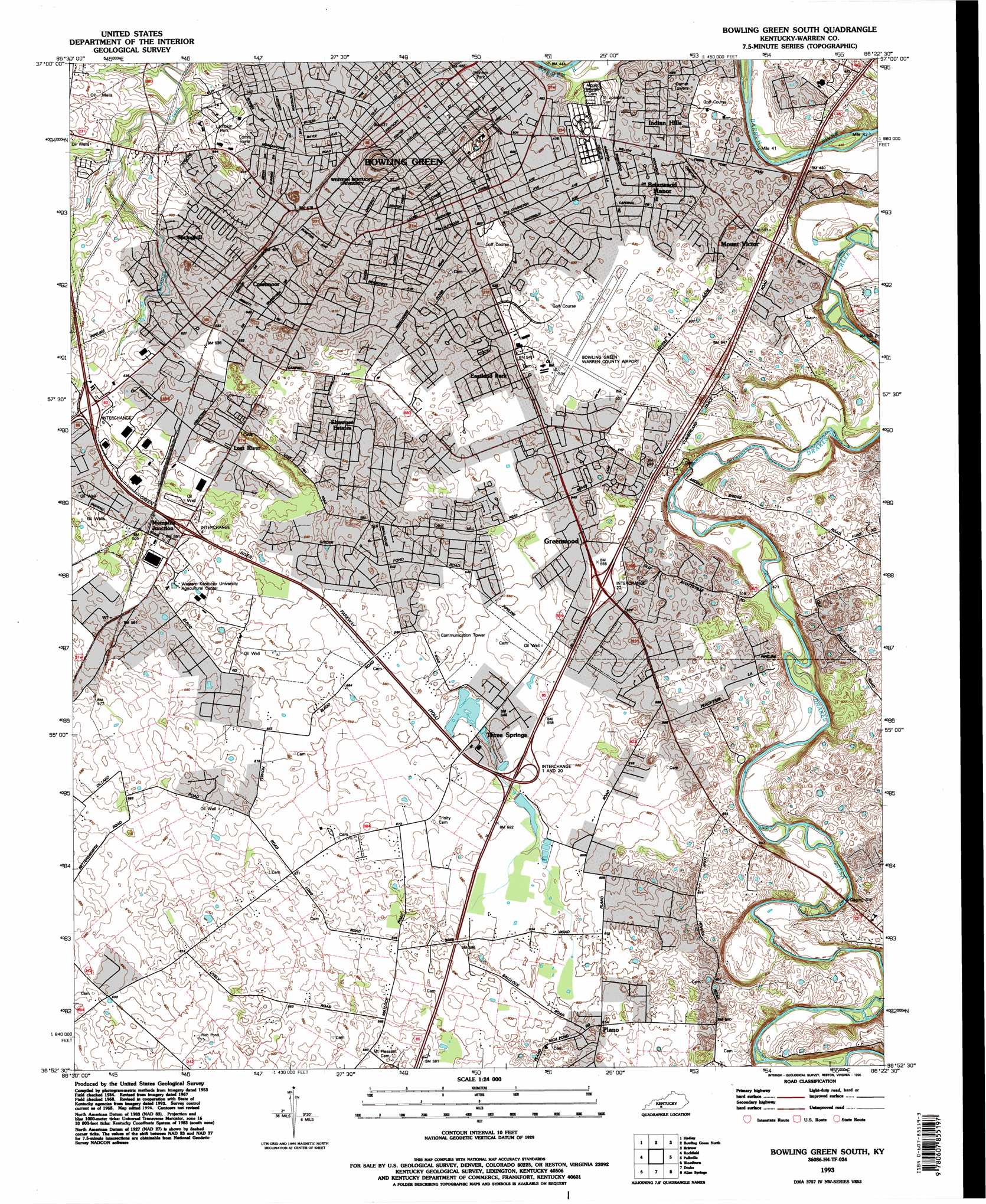
Bowling Green South Topo Map Kentucky
To zoom in, hover over the map of Bowling Green South
USGS Topo Quad 36086h4 - 1:24,000 scale
| Topo Map Name: | Bowling Green South |
| USGS Topo Quad ID: | 36086h4 |
| Print Size: | ca. 21 1/4" wide x 27" high |
| Southeast Coordinates: | 36.875° N latitude / 86.375° W longitude |
| Map Center Coordinates: | 36.9375° N latitude / 86.4375° W longitude |
| U.S. State: | KY |
| Filename: | o36086h4.jpg |
| Download Map JPG Image: | Bowling Green South topo map 1:24,000 scale |
| Map Type: | Topographic |
| Topo Series: | 7.5´ |
| Map Scale: | 1:24,000 |
| Source of Map Images: | United States Geological Survey (USGS) |
| Alternate Map Versions: |
Bowling Green South KY 1954, updated 1956 Download PDF Buy paper map Bowling Green South KY 1959, updated 1960 Download PDF Buy paper map Bowling Green South KY 1968, updated 1970 Download PDF Buy paper map Bowling Green South KY 1968, updated 1983 Download PDF Buy paper map Bowling Green South KY 1993, updated 1996 Download PDF Buy paper map Bowling Green South KY 2010 Download PDF Buy paper map Bowling Green South KY 2013 Download PDF Buy paper map Bowling Green South KY 2016 Download PDF Buy paper map |
1:24,000 Topo Quads surrounding Bowling Green South
Morgantown |
Riverside |
Reedyville |
Brownsville |
Rhoda |
Sugar Grove |
Hadley |
Bowling Green North |
Bristow |
Smiths Grove |
South Union |
Rockfield |
Bowling Green South |
Polkville |
Meador |
Auburn |
Woodburn |
Drake |
Allen Springs |
Scottsville |
Prices Mill |
Franklin |
Hickory Flat |
Adolphus |
Petroleum |
> Back to 36086e1 at 1:100,000 scale
> Back to 36086a1 at 1:250,000 scale
> Back to U.S. Topo Maps home
Bowling Green South topo map: Gazetteer
Bowling Green South: Airports
Bowling Green-Warren County Regional Airport elevation 159m 521′Bowling Green South: Parks
Lampkin Park elevation 150m 492′Pioneer Park elevation 149m 488′
Bowling Green South: Populated Places
Bowling Green elevation 161m 528′Briarwood Manor elevation 151m 495′
Crestmoor elevation 163m 534′
Eastland Park elevation 158m 518′
Greenwood elevation 168m 551′
Indian Hills elevation 149m 488′
Lost River elevation 167m 547′
Memphis Junction elevation 169m 554′
Mount Victor elevation 155m 508′
Plano elevation 186m 610′
Shawnee Estates elevation 165m 541′
Springhill elevation 158m 518′
Three Springs elevation 163m 534′
Bowling Green South: Summits
Reservoir Hill elevation 169m 554′Bowling Green South digital topo map on disk
Buy this Bowling Green South topo map showing relief, roads, GPS coordinates and other geographical features, as a high-resolution digital map file on DVD: