Watts Topo Map Oklahoma
To zoom in, hover over the map of Watts
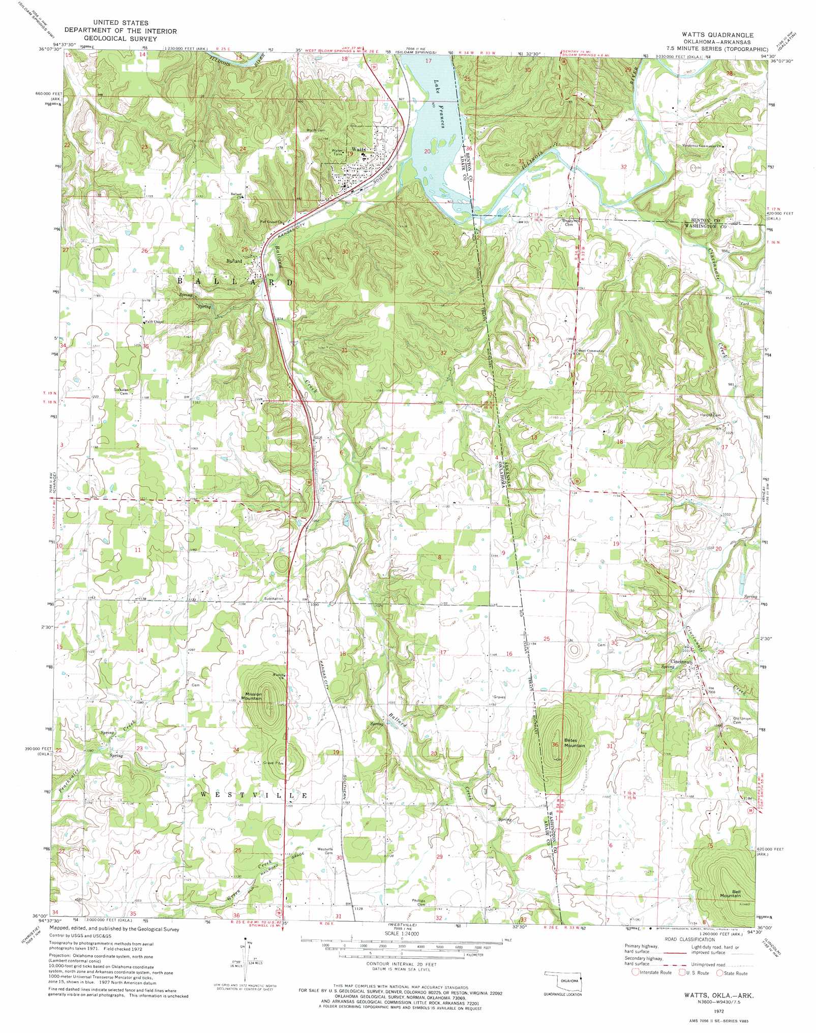
USGS Topo Quad 36094a5 - 1:24,000 scale
| Topo Map Name: | Watts |
| USGS Topo Quad ID: | 36094a5 |
| Print Size: | ca. 21 1/4" wide x 27" high |
| Southeast Coordinates: | 36° N latitude / 94.5° W longitude |
| Map Center Coordinates: | 36.0625° N latitude / 94.5625° W longitude |
| U.S. States: | OK, AR |
| Filename: | o36094a5.jpg |
| Download Map JPG Image: | Watts topo map 1:24,000 scale |
| Map Type: | Topographic |
| Topo Series: | 7.5´ |
| Map Scale: | 1:24,000 |
| Source of Map Images: | United States Geological Survey (USGS) |
| Alternate Map Versions: |
Watts OK 1972, updated 1974 Download PDF Buy paper map Watts OK 2011 Download PDF Buy paper map Watts OK 2012 Download PDF Buy paper map Watts OK 2016 Download PDF Buy paper map |
1:24,000 Topo Quads surrounding Watts
Lake Eucha East |
Colcord |
Cherokee City |
Gentry |
Centerton |
Kansas |
Siloam Springs Nw |
Siloam Springs |
Gallatin |
Robinson |
Chewey |
Chance |
Watts |
Rhea |
Wheeler |
Proctor |
Christie |
Westville |
Lincoln |
Prairie Grove |
Tailholt |
Stilwell West |
Stilwell East |
Evansville |
Strickler |
> Back to 36094a1 at 1:100,000 scale
> Back to 36094a1 at 1:250,000 scale
> Back to U.S. Topo Maps home
Watts topo map: Gazetteer
Watts: Bridges
Goforth Bridge elevation 279m 915′Watts: Crossings
Fishers Ford elevation 282m 925′Goforth Ford elevation 279m 915′
Watts: Populated Places
Ballard elevation 296m 971′Cincinnati elevation 321m 1053′
Watts elevation 300m 984′
Watts: Streams
Ballard Creek elevation 282m 925′Ballard Creek elevation 276m 905′
Cincinnati Creek elevation 279m 915′
Weddington Creek elevation 291m 954′
Watts: Summits
Bates Mountain elevation 430m 1410′Bell Mountain elevation 445m 1459′
Mission Mountain elevation 433m 1420′
Watts digital topo map on disk
Buy this Watts topo map showing relief, roads, GPS coordinates and other geographical features, as a high-resolution digital map file on DVD: