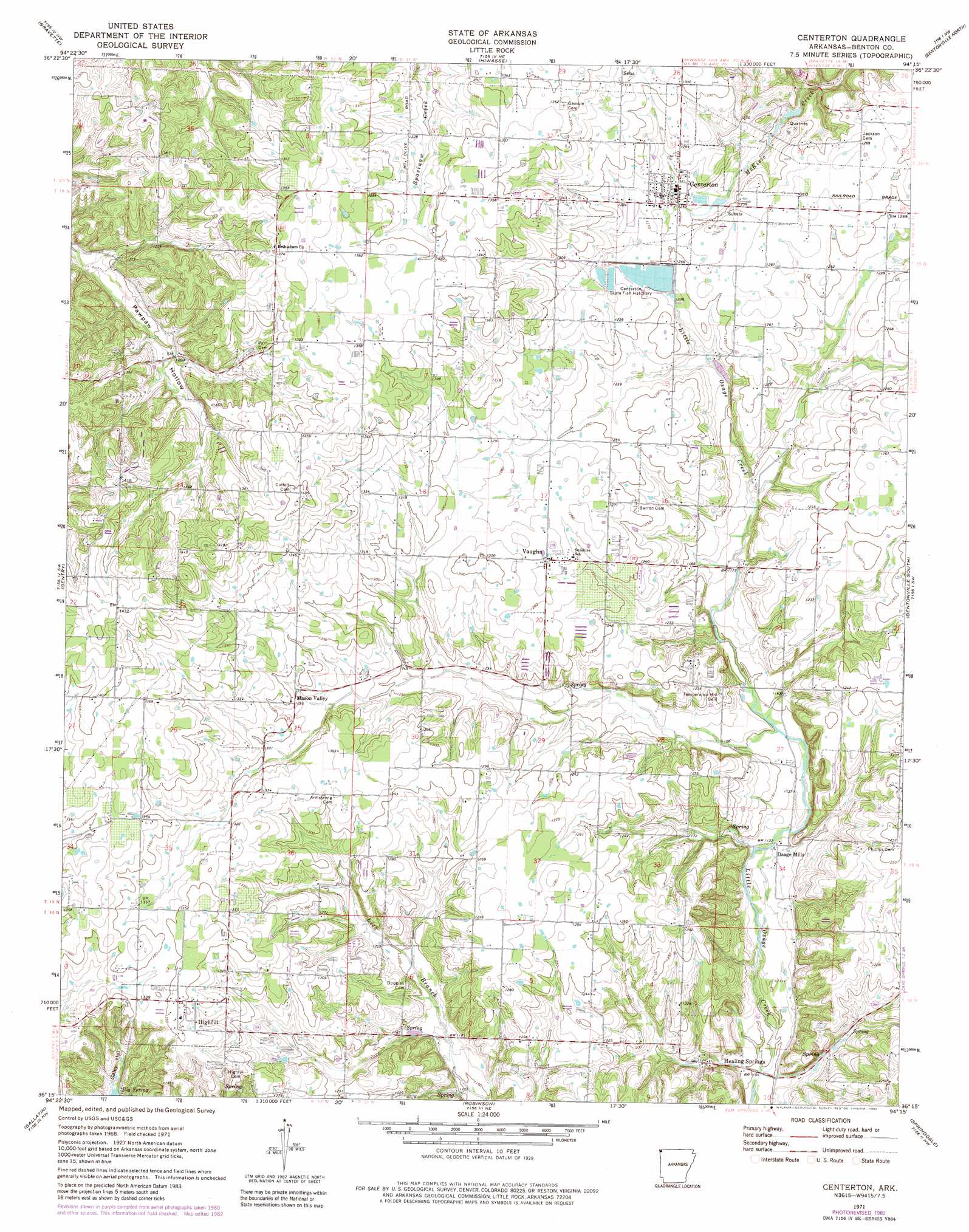
Centerton Topo Map Arkansas
To zoom in, hover over the map of Centerton
USGS Topo Quad 36094c3 - 1:24,000 scale
| Topo Map Name: | Centerton |
| USGS Topo Quad ID: | 36094c3 |
| Print Size: | ca. 21 1/4" wide x 27" high |
| Southeast Coordinates: | 36.25° N latitude / 94.25° W longitude |
| Map Center Coordinates: | 36.3125° N latitude / 94.3125° W longitude |
| U.S. State: | AR |
| Filename: | o36094c3.jpg |
| Download Map JPG Image: | Centerton topo map 1:24,000 scale |
| Map Type: | Topographic |
| Topo Series: | 7.5´ |
| Map Scale: | 1:24,000 |
| Source of Map Images: | United States Geological Survey (USGS) |
| Alternate Map Versions: |
Centerton AR 1971, updated 1973 Download PDF Buy paper map Centerton AR 1971, updated 1982 Download PDF Buy paper map Centerton AR 1971, updated 1982 Download PDF Buy paper map Centerton AR 2011 Download PDF Buy paper map Centerton AR 2014 Download PDF Buy paper map |
1:24,000 Topo Quads surrounding Centerton
South West City |
Noel |
Jane |
Powell |
Jacket |
Colcord Ne |
Gravette |
Hiwasse |
Bentonville North |
Pea Ridge |
Cherokee City |
Gentry |
Centerton |
Bentonville South |
Rogers |
Siloam Springs |
Gallatin |
Robinson |
Springdale |
Sonora |
Watts |
Rhea |
Wheeler |
Fayettville |
Elkins |
> Back to 36094a1 at 1:100,000 scale
> Back to 36094a1 at 1:250,000 scale
> Back to U.S. Topo Maps home
Centerton topo map: Gazetteer
Centerton: Bridges
Healing Springs Bridge elevation 333m 1092′Centerton: Dams
Centerton Hatchery Upper Pond Dam elevation 387m 1269′Osage Mills Dam elevation 347m 1138′
Centerton: Populated Places
Castleville (historical) elevation 377m 1236′Centerton elevation 382m 1253′
Eagle Corner elevation 429m 1407′
Healing Springs elevation 341m 1118′
Highfill elevation 412m 1351′
Hoover (historical) elevation 390m 1279′
Mason Valley elevation 392m 1286′
Osage Mills elevation 345m 1131′
Parn (historical) elevation 415m 1361′
Seba elevation 404m 1325′
Vaughn elevation 391m 1282′
Centerton: Reservoirs
Upper Pond elevation 387m 1269′Centerton: Springs
Anderson Spring elevation 366m 1200′Bluff Spring elevation 349m 1145′
Healing Springs elevation 344m 1128′
Highfill Spring elevation 379m 1243′
McKissick Spring elevation 382m 1253′
Centerton: Streams
Spring Branch elevation 348m 1141′Centerton digital topo map on disk
Buy this Centerton topo map showing relief, roads, GPS coordinates and other geographical features, as a high-resolution digital map file on DVD: