Mills West Topo Map New Mexico
To zoom in, hover over the map of Mills West
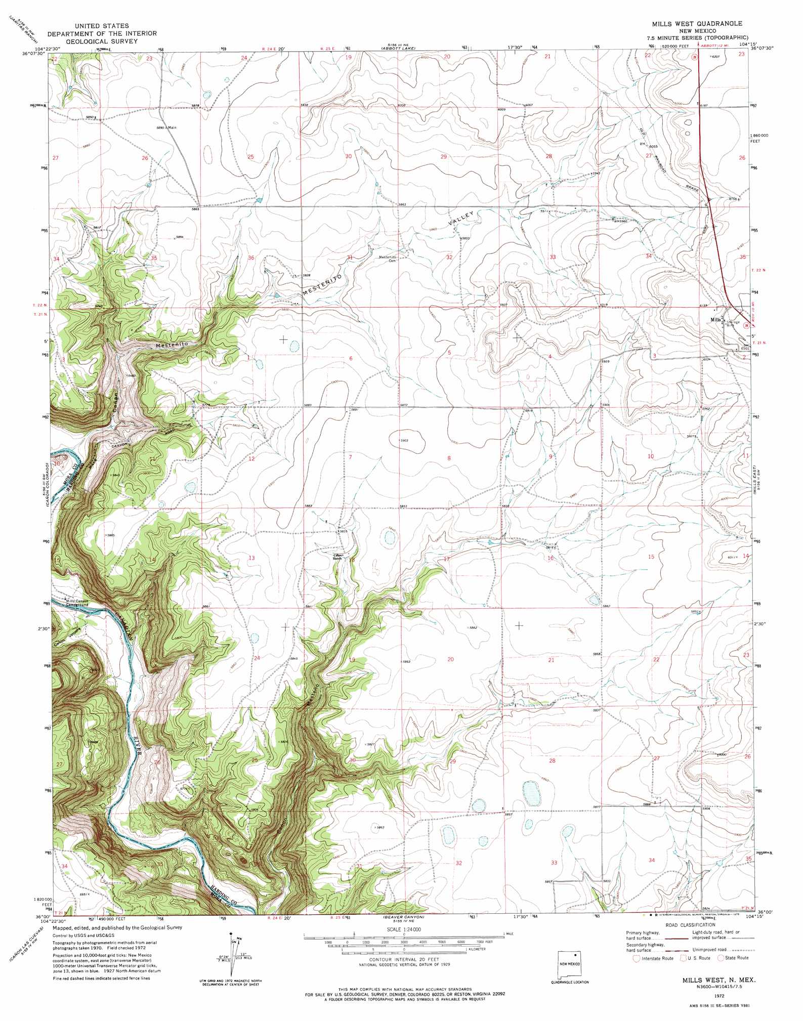
USGS Topo Quad 36104a3 - 1:24,000 scale
| Topo Map Name: | Mills West |
| USGS Topo Quad ID: | 36104a3 |
| Print Size: | ca. 21 1/4" wide x 27" high |
| Southeast Coordinates: | 36° N latitude / 104.25° W longitude |
| Map Center Coordinates: | 36.0625° N latitude / 104.3125° W longitude |
| U.S. State: | NM |
| Filename: | o36104a3.jpg |
| Download Map JPG Image: | Mills West topo map 1:24,000 scale |
| Map Type: | Topographic |
| Topo Series: | 7.5´ |
| Map Scale: | 1:24,000 |
| Source of Map Images: | United States Geological Survey (USGS) |
| Alternate Map Versions: |
Mills West NM 1972, updated 1975 Download PDF Buy paper map Mills West NM 1998, updated 2001 Download PDF Buy paper map Mills West NM 2011 Download PDF Buy paper map Mills West NM 2013 Download PDF Buy paper map |
| FStopo: | US Forest Service topo Mills West is available: Download FStopo PDF Download FStopo TIF |
1:24,000 Topo Quads surrounding Mills West
Springer |
Taylor Springs |
Abbott |
Ingram Lake |
Farley |
Stony Lake |
Jaritas Ranch |
Abbott Lake |
Spear Hills |
Divine Lake |
Alto De Hormiga |
Canon Colorado |
Mills West |
Mills East |
Kansas Valley |
Alamosa Creek |
Canon Las Cuevas |
Beaver Canyon |
Roy |
Kansas Valley Lake |
Canon Ancho |
Alamito |
Canon Encierro |
La Cinta Canyon |
Solano |
> Back to 36104a1 at 1:100,000 scale
> Back to 36104a1 at 1:250,000 scale
> Back to U.S. Topo Maps home
Mills West topo map: Gazetteer
Mills West: Populated Places
Mills elevation 1864m 6115′Mills West: Post Offices
Mills Post Office (historical) elevation 1864m 6115′Mills West: Valleys
Cañon Mestenito elevation 1567m 5141′Cañon Vercere elevation 1558m 5111′
Mestenito Valley elevation 1750m 5741′
Mills West digital topo map on disk
Buy this Mills West topo map showing relief, roads, GPS coordinates and other geographical features, as a high-resolution digital map file on DVD: