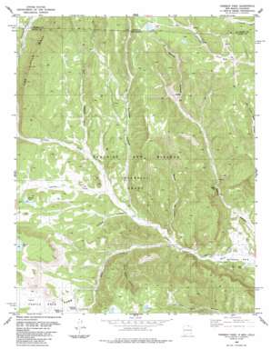
Vermejo Park Topo Map New Mexico
To zoom in, hover over the map of Vermejo Park
USGS Topo Quad 36105h1 - 1:24,000 scale
| Topo Map Name: | Vermejo Park |
| USGS Topo Quad ID: | 36105h1 |
| Print Size: | ca. 21 1/4" wide x 27" high |
| Southeast Coordinates: | 36.875° N latitude / 105° W longitude |
| Map Center Coordinates: | 36.9375° N latitude / 105.0625° W longitude |
| U.S. States: | NM, CO |
| Filename: | o36105h1.jpg |
| Download Map JPG Image: | Vermejo Park topo map 1:24,000 scale |
| Map Type: | Topographic |
| Topo Series: | 7.5´ |
| Map Scale: | 1:24,000 |
| Source of Map Images: | United States Geological Survey (USGS) |
| Alternate Map Versions: |
Vermejo Park NM 1986, updated 1986 Download PDF Buy paper map Vermejo Park NM 2010 Download PDF Buy paper map Vermejo Park NM 2013 Download PDF Buy paper map Vermejo Park NM 2017 Download PDF Buy paper map |
1:24,000 Topo Quads surrounding Vermejo Park
> Back to 36105e1 at 1:100,000 scale
> Back to 36104a1 at 1:250,000 scale
> Back to U.S. Topo Maps home
Vermejo Park topo map: Gazetteer
Vermejo Park: Flats
Castle Rock Park elevation 2489m 8166′Vermejo Park: Gaps
San Francisco Pass elevation 2429m 7969′Vermejo Park: Lakes
Merrick Lake elevation 2515m 8251′Vermejo Park: Mines
Bartlett Mine elevation 2406m 7893′Vermejo Park: Pillars
Castle Rock elevation 2496m 8188′Vermejo Park: Ridges
The Little Wall elevation 2623m 8605′Vermejo Park: Springs
Bubbling Springs elevation 2474m 8116′Vermejo Park: Streams
Bernal Creek elevation 2497m 8192′Leandro Creek elevation 2396m 7860′
Rock Creek elevation 2343m 7687′
Vermejo Park: Valleys
Crazy Woman Canyon elevation 2395m 7857′Gonzales Canyon elevation 2384m 7821′
Gonzales Canyon elevation 2412m 7913′
Mestas Canyon elevation 2356m 7729′
Stinking Canyon elevation 2387m 7831′
Wet Canyon elevation 2442m 8011′
Vermejo Park digital topo map on disk
Buy this Vermejo Park topo map showing relief, roads, GPS coordinates and other geographical features, as a high-resolution digital map file on DVD:


