Shadow Mountain Well Topo Map Arizona
To zoom in, hover over the map of Shadow Mountain Well
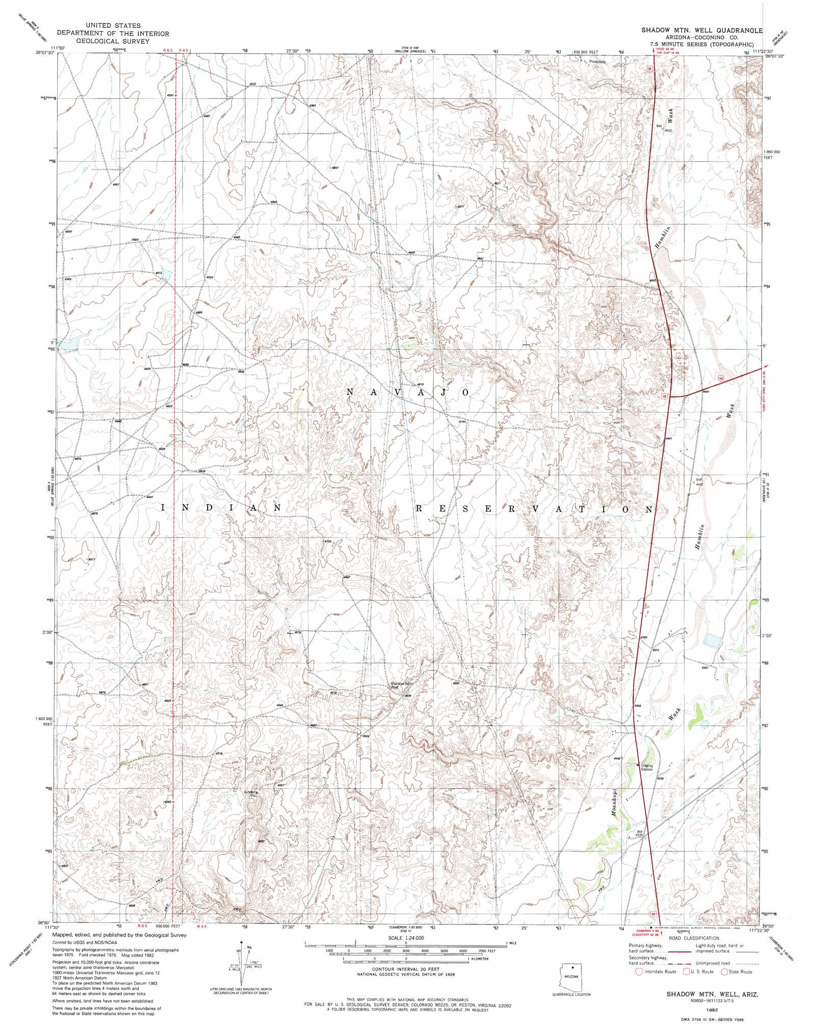
USGS Topo Quad 36111a4 - 1:24,000 scale
| Topo Map Name: | Shadow Mountain Well |
| USGS Topo Quad ID: | 36111a4 |
| Print Size: | ca. 21 1/4" wide x 27" high |
| Southeast Coordinates: | 36° N latitude / 111.375° W longitude |
| Map Center Coordinates: | 36.0625° N latitude / 111.4375° W longitude |
| U.S. State: | AZ |
| Filename: | o36111a4.jpg |
| Download Map JPG Image: | Shadow Mountain Well topo map 1:24,000 scale |
| Map Type: | Topographic |
| Topo Series: | 7.5´ |
| Map Scale: | 1:24,000 |
| Source of Map Images: | United States Geological Survey (USGS) |
| Alternate Map Versions: |
Moa Ave SW AZ 1955, updated 1957 Download PDF Buy paper map Shadow Mtn. Well AZ 1982, updated 1982 Download PDF Buy paper map Shadow Mountain Well AZ 2011 Download PDF Buy paper map Shadow Mountain Well AZ 2014 Download PDF Buy paper map |
1:24,000 Topo Quads surrounding Shadow Mountain Well
Blue Moon Reservoir |
Bodaway Mesa |
The Gap |
Preston Well |
Preston Mesa South |
Salt Trail Canyon |
Pillow Mountain |
Willow Springs |
Moenave |
Tuba City |
Blue Spring |
Blue Spring Se |
Shadow Mountain Well |
Moenave Se |
Moenkopi |
Hellhole Bend |
Coconino Point |
Cameron North |
Cameron Ne |
Goldtooth |
Willows Camp |
Coconino Point Se |
Cameron South |
Cameron Se |
The Landmark |
> Back to 36111a1 at 1:100,000 scale
> Back to 36110a1 at 1:250,000 scale
> Back to U.S. Topo Maps home
Shadow Mountain Well topo map: Gazetteer
Shadow Mountain Well: Airports
Tuba City Airport elevation 1364m 4475′Shadow Mountain Well: Streams
Hamblin Wash elevation 1323m 4340′Shadow Mountain Well: Wells
Shadow Mountain Well elevation 1384m 4540′Shadow Mountain Well digital topo map on disk
Buy this Shadow Mountain Well topo map showing relief, roads, GPS coordinates and other geographical features, as a high-resolution digital map file on DVD: