Mount Trumbull Se Topo Map Arizona
To zoom in, hover over the map of Mount Trumbull Se
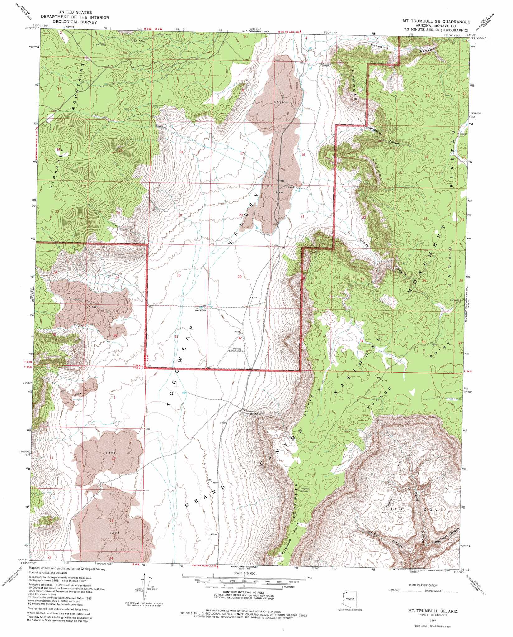
USGS Topo Quad 36113c1 - 1:24,000 scale
| Topo Map Name: | Mount Trumbull Se |
| USGS Topo Quad ID: | 36113c1 |
| Print Size: | ca. 21 1/4" wide x 27" high |
| Southeast Coordinates: | 36.25° N latitude / 113° W longitude |
| Map Center Coordinates: | 36.3125° N latitude / 113.0625° W longitude |
| U.S. State: | AZ |
| Filename: | o36113c1.jpg |
| Download Map JPG Image: | Mount Trumbull Se topo map 1:24,000 scale |
| Map Type: | Topographic |
| Topo Series: | 7.5´ |
| Map Scale: | 1:24,000 |
| Source of Map Images: | United States Geological Survey (USGS) |
| Alternate Map Versions: |
Mt. Trumbull SE AZ 1967, updated 1970 Download PDF Buy paper map Mt. Trumbull SE AZ 1967, updated 1984 Download PDF Buy paper map Mount Trumbull SE AZ 2011 Download PDF Buy paper map Mount Trumbull SE AZ 2014 Download PDF Buy paper map |
1:24,000 Topo Quads surrounding Mount Trumbull Se
Russell Spring |
Moriah Knoll |
Hat Knoll |
Heaton Knolls |
Robinson Canyon |
Jones Hill |
Mount Trumbull |
Mount Trumbull Ne |
Hancock Knolls |
Hitson Tank |
Cold Spring |
Mount Logan |
Mount Trumbull Se |
Fern Glen Canyon |
S B Point |
Whitmore Point |
Whitmore Rapids |
Vulcans Throne |
Gateway Rapids |
Yunosi Point |
Whitmore Point Se |
Vulcans Throne Sw |
Vulcans Throne Se |
National Canyon Sw |
Higgins Tank |
> Back to 36113a1 at 1:100,000 scale
> Back to 36112a1 at 1:250,000 scale
> Back to U.S. Topo Maps home
Mount Trumbull Se topo map: Gazetteer
Mount Trumbull Se: Airports
Toroweap Landing Strip elevation 1421m 4662′Tuweep Airport elevation 1420m 4658′
Mount Trumbull Se: Cliffs
Toroweap Cliffs elevation 1673m 5488′Tuckup Point elevation 1906m 6253′
Mount Trumbull Se: Valleys
Big Cove elevation 884m 2900′Big Point Canyon elevation 828m 2716′
Brady Canyon elevation 1474m 4835′
Burro Canyon elevation 722m 2368′
Cunninghams Canyon elevation 1501m 4924′
Paradise Canyon elevation 1525m 5003′
Mount Trumbull Se digital topo map on disk
Buy this Mount Trumbull Se topo map showing relief, roads, GPS coordinates and other geographical features, as a high-resolution digital map file on DVD: