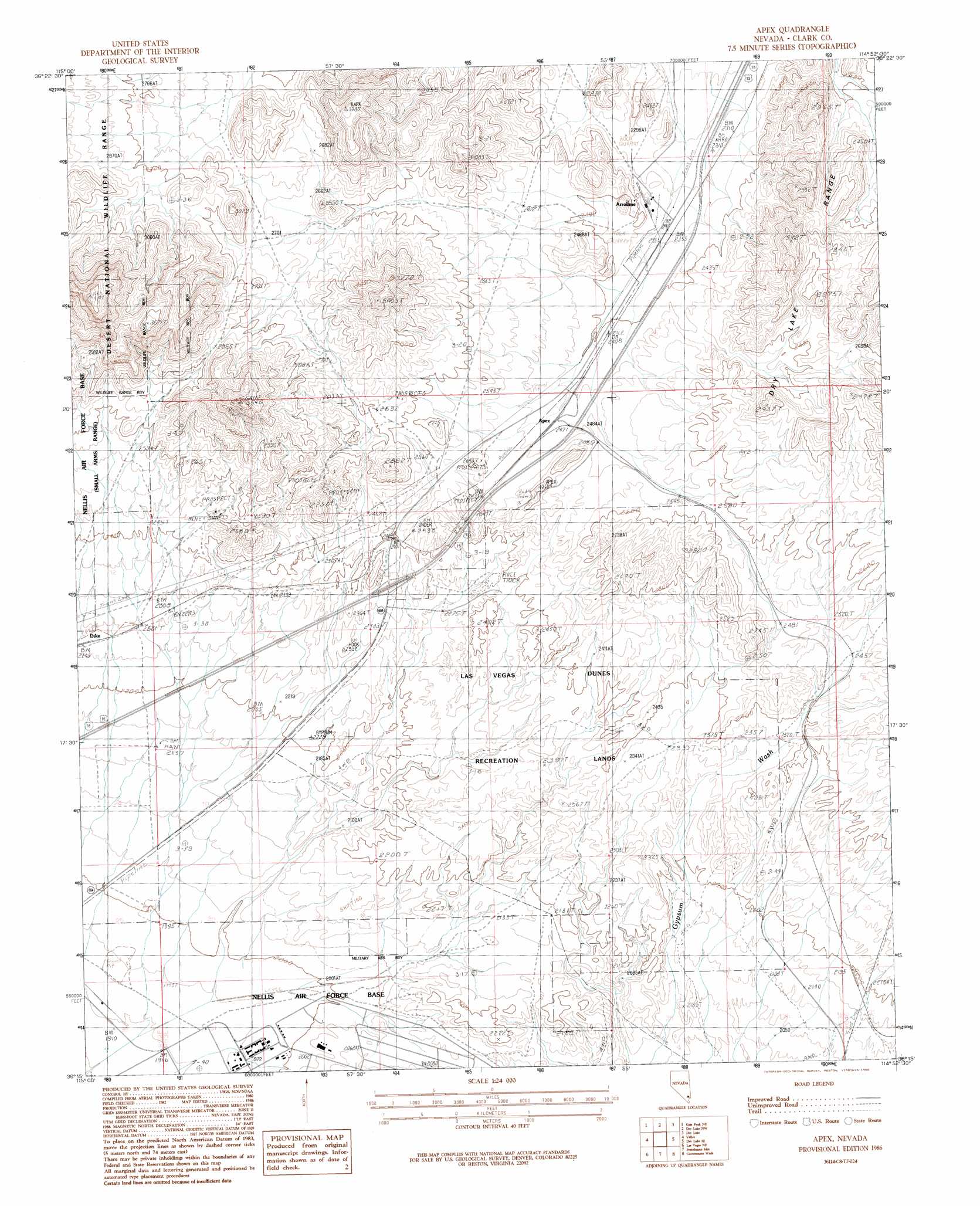
Apex Topo Map Nevada
To zoom in, hover over the map of Apex
USGS Topo Quad 36114c8 - 1:24,000 scale
| Topo Map Name: | Apex |
| USGS Topo Quad ID: | 36114c8 |
| Print Size: | ca. 21 1/4" wide x 27" high |
| Southeast Coordinates: | 36.25° N latitude / 114.875° W longitude |
| Map Center Coordinates: | 36.3125° N latitude / 114.9375° W longitude |
| U.S. State: | NV |
| Filename: | o36114c8.jpg |
| Download Map JPG Image: | Apex topo map 1:24,000 scale |
| Map Type: | Topographic |
| Topo Series: | 7.5´ |
| Map Scale: | 1:24,000 |
| Source of Map Images: | United States Geological Survey (USGS) |
| Alternate Map Versions: |
Apex NV 1986, updated 1986 Download PDF Buy paper map Apex NV 2012 Download PDF Buy paper map Apex NV 2014 Download PDF Buy paper map |
1:24,000 Topo Quads surrounding Apex
Sheep Peak |
Hayford Peak Se |
Arrow Canyon Sw |
Arrow Canyon Se |
Ute |
Gass Peak |
Gass Peak Ne |
Dry Lake Nw |
Dry Lake |
Piute Point |
Gass Peak Sw |
Valley |
Apex |
Dry Lake Se |
Muddy Peak |
Las Vegas Nw |
Las Vegas Ne |
Frenchman Mountain |
Government Wash |
Callville Bay |
Las Vegas Sw |
Las Vegas Se |
Henderson |
Boulder Beach |
Hoover Dam |
> Back to 36114a1 at 1:100,000 scale
> Back to 36114a1 at 1:250,000 scale
> Back to U.S. Topo Maps home
Apex topo map: Gazetteer
Apex: Gaps
Apex Summit elevation 744m 2440′Apex: Mines
Apex Limstone Quarry elevation 722m 2368′Arrolime elevation 764m 2506′
Lead King Mine elevation 767m 2516′
Apex: Parks
Las Vegas Dunes Recreation Lands elevation 724m 2375′Apex: Populated Places
Apex elevation 752m 2467′Arrolime elevation 722m 2368′
Apex: Post Offices
Lake Mead Base Branch Post Office (historical) elevation 601m 1971′Apex digital topo map on disk
Buy this Apex topo map showing relief, roads, GPS coordinates and other geographical features, as a high-resolution digital map file on DVD:
Southern Sierra Nevada, California & Southern Nevada
Buy digital topo maps: Southern Sierra Nevada, California & Southern Nevada